Distance between West Vancouver BC and Ferryland NL
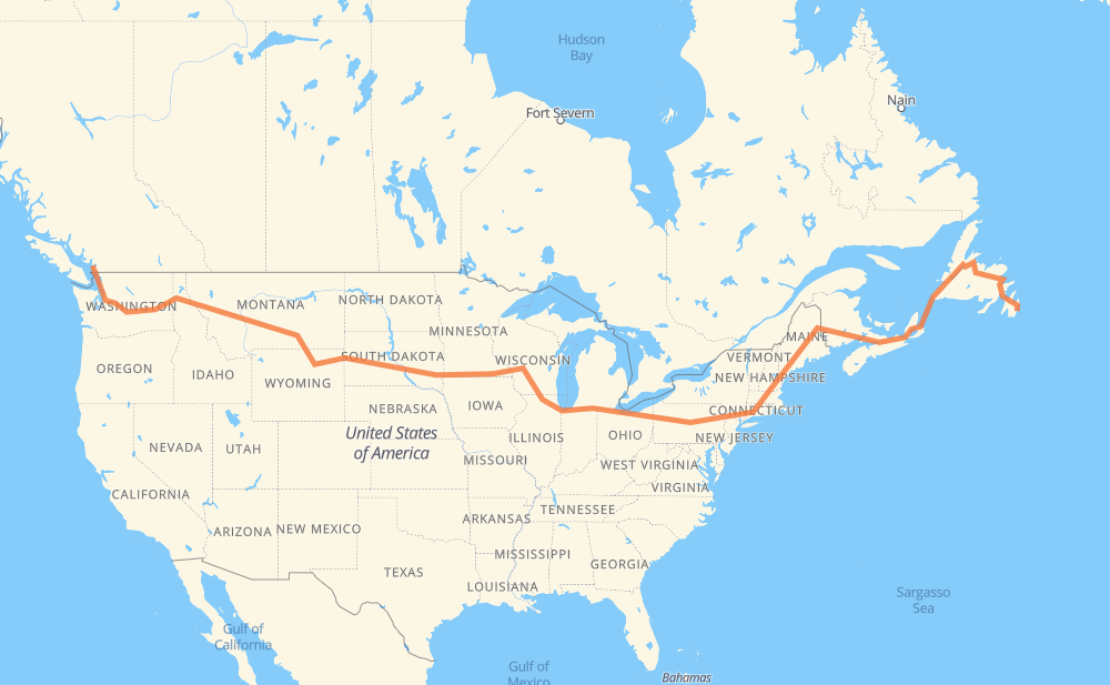
The distance from West Vancouver to Ferryland is 7,616 kilometers by road including 6,418 kilometers on motorways. Road takes approximately 80 hours and 56 minutes and goes through District of North Vancouver, Vancouver, Burnaby, New Westminster, Bellingham, Everett and Bellevue.
| Shortest distance by air | 5,025 km ✈️ |
| Car route length | 7,616 km 🚗 |
| Driving time | 80 h 56 min |
| Fuel amount | 609.3 L |
| Fuel cost | 1,194.2 CAD |
| Point | Distance | Time | Fuel | |
| West Vancouver | 0 km | 00 min | 0.0 L | |
|
1 10 km, 07 min
|
||||
| District of North Vancouver | 10 km | 07 min | 0.4 L | |
|
1 7 km, 05 min
|
||||
| Vancouver | 16 km | 12 min | 1.2 L | |
|
1 7 km, 05 min
|
||||
| Burnaby | 23 km | 18 min | 1.4 L | |
|
1 7 km, 06 min
|
||||
| New Westminster | 30 km | 24 min | 2.3 L | |
|
91A I 5 72 km, 45 min
|
||||
| Bellingham | 102 km | 1 h 09 min | 7.3 L | |
|
I 5 93 km, 53 min
|
||||
| Everett | 196 km | 2 h 03 min | 15.0 L | |
|
I 5 I 405 45 km, 28 min
|
||||
| Bellevue | 241 km | 2 h 32 min | 18.6 L | |
|
I 405 I 90 254 km, 2 h 20 min
|
||||
| Moses Lake | 495 km | 4 h 53 min | 37.7 L | |
|
I 90 182 km, 1 h 39 min
|
||||
| Spokane | 677 km | 6 h 33 min | 53.7 L | |
|
I 90 51 km, 29 min
|
||||
| Coeur d'Alene | 728 km | 7 h 02 min | 57.8 L | |
|
I 90 265 km, 2 h 27 min
|
||||
| Missoula | 994 km | 9 h 29 min | 79.2 L | |
|
I 90 184 km, 1 h 40 min
|
||||
| Butte | 1,177 km | 11 h 10 min | 92.3 L | |
|
I 90 364 km, 3 h 24 min
|
||||
| Billings | 1,542 km | 14 h 34 min | 122.7 L | |
|
I 90 216 km, 2 h 15 min
|
||||
| Sheridan | 1,758 km | 16 h 50 min | 139.7 L | |
|
I 90 160 km, 1 h 27 min
|
||||
| Gillette | 1,918 km | 18 h 17 min | 152.9 L | |
|
I 90 156 km, 1 h 29 min
|
||||
| Spearfish | 2,073 km | 19 h 46 min | 165.0 L | |
|
I 90 68 km, 37 min
|
||||
| Rapid City | 2,141 km | 20 h 24 min | 171.0 L | |
|
I 90 18 km, 10 min
|
||||
| Box Elder | 2,159 km | 20 h 34 min | 172.0 L | |
|
I 90 411 km, 3 h 44 min
|
||||
| Mitchell | 2,571 km | 24 h 18 min | 204.5 L | |
|
I 90 116 km, 1 h 03 min
|
||||
| Sioux Falls | 2,687 km | 25 h 22 min | 214.6 L | |
|
I 90 11 km, 06 min
|
||||
| Brandon | 2,698 km | 25 h 28 min | 215.6 L | |
|
I 90 676 km, 6 h 11 min
|
||||
| Madison | 3,374 km | 31 h 40 min | 269.2 L | |
|
I 39 56 km, 30 min
|
||||
| Janesville | 3,430 km | 32 h 10 min | 274.1 L | |
|
I 39 I 90 173 km, 1 h 39 min
|
||||
| Chicago | 3,604 km | 33 h 50 min | 286.4 L | |
|
I 90 139 km, 1 h 22 min
|
||||
| South Bend | 3,743 km | 35 h 13 min | 298.9 L | |
|
I 80 369 km, 3 h 21 min
|
||||
| Elyria | 4,112 km | 38 h 34 min | 328.5 L | |
|
I 80 618 km, 5 h 42 min
|
||||
| Scranton | 4,729 km | 44 h 16 min | 378.1 L | |
|
I 81 I 84 262 km, 2 h 34 min
|
||||
| Waterbury | 4,991 km | 46 h 51 min | 398.8 L | |
|
I 84 43 km, 27 min
|
||||
| Hartford | 5,034 km | 47 h 18 min | 402.4 L | |
|
I 84 103 km, 1 h 03 min
|
||||
| Worcester | 5,138 km | 48 h 22 min | 410.6 L | |
|
I 290 I 495 65 km, 38 min
|
||||
| Lowell | 5,202 km | 49 h 00 min | 416.1 L | |
|
I 495 I 95 154 km, 1 h 29 min
|
||||
| Portland | 5,357 km | 50 h 30 min | 428.3 L | |
|
I 295 88 km, 52 min
|
||||
| Augusta | 5,445 km | 51 h 23 min | 435.2 L | |
|
I 95 21 km, 11 min
|
||||
| Waterville | 5,465 km | 51 h 34 min | 436.0 L | |
|
I 95 101 km, 55 min
|
||||
| Bangor | 5,566 km | 52 h 30 min | 444.4 L | |
|
I 95 304 km, 2 h 56 min
|
||||
| Fredericton | 5,871 km | 55 h 27 min | 469.3 L | |
|
2 170 km, 1 h 32 min
|
||||
| Moncton | 6,040 km | 56 h 59 min | 482.5 L | |
|
2 TCH 859 km, 15 h 57 min
|
||||
| Corner Brook | 6,900 km | 72 h 56 min | 550.8 L | |
|
1 723 km, 8 h 02 min
|
||||
| Ferryland | 7,622 km | 80 h 59 min | 609.4 L | |
Frequently Asked Questions
How much does it cost to drive from West Vancouver to Ferryland?
Fuel cost: 1,194.2 CAD
This fuel cost is calculated as: (Route length 7,616 km / 100 km) * (Fuel consumption 8 L/100 km) * (Fuel price 1.96 CAD / L)
You can adjust fuel consumption and fuel price here.
How long is a car ride from West Vancouver to Ferryland?
Driving time: 80 h 56 min
This time is calculated for driving at the maximum permitted speed, taking into account traffic rules restrictions.
- 4,751 km with a maximum speed 110 km/h = 43 h 11 min
- 653 km with a maximum speed 105 km/h = 6 h 14 min
- 427 km with a maximum speed 100 km/h = 4 h 16 min
- 192 km with a maximum speed 97 km/h = 1 h 59 min
- 945 km with a maximum speed 90 km/h = 10 h 30 min
- 112 km with a maximum speed 89 km/h = 1 h 15 min
- 17 km with a maximum speed 80 km/h = 12 min
- 304 km with a maximum speed 80 km/h = 3 h 47 min
- 15 km with a maximum speed 72 km/h = 12 min
- 10 km with a maximum speed 70 km/h = 8 min
- 1 km with a maximum speed 64 km/h = 1 min
- 3 km with a maximum speed 60 km/h = 2 min
- 2 km with a maximum speed 56 km/h = 2 min
- 4 km with a maximum speed 50 km/h = 5 min
- 177 km with a maximum speed 20 km/h = 8 h 51 min
The calculated driving time does not take into account intermediate stops and traffic jams.
How far is West Vancouver to Ferryland by land?
The distance between West Vancouver and Ferryland is 7,616 km by road including 6,418 km on motorways.
Precise satellite coordinates of highways were used for this calculation. The start and finish points are the centers of West Vancouver and Ferryland respectively.
How far is West Vancouver to Ferryland by plane?
The shortest distance (air line, as the crow flies) between West Vancouver and Ferryland is 5,025 km.
This distance is calculated using the Haversine formula as a great-circle distance between two points on the surface of a sphere. The start and finish points are the centers of West Vancouver and Ferryland respectively. Actual distance between airports may be different.
How many hours is West Vancouver from Ferryland by plane?
Boeing 737 airliner needs 6 h 16 min to cover the distance of 5,025 km at a cruising speed of 800 km/h.
Small plane "Cessna 172" needs 22 h 50 min to flight this distance at average speed of 220 km/h.
This time is approximate and do not take into account takeoff and landing times, airport location and other real world factors.
How long is a helicopter ride from West Vancouver to Ferryland?
Fast helicopter "Eurocopter AS350" or "Hughes OH-6 Cayuse" need 20 h 56 min to cover the distance of 5,025 km at a cruising speed of 240 km/h.
Popular "Robinson R44" needs 23 h 55 min to flight this distance at average speed of 210 km/h.
This time is approximate and do not take into account takeoff and landing times, aerodrome location and other real world factors.
What city is halfway between West Vancouver and Ferryland?
The halfway point between West Vancouver and Ferryland is Elkhart. It is located about 39 km from the exact midpoint by road.
The distance from Elkhart to West Vancouver is 3,769 km and driving will take about 35 h 24 min. The road between Elkhart and Ferryland has length 3,847 km and will take approximately 45 h 31 min.
The other cities located close to halfway point:
Where is West Vancouver in relation to Ferryland?
West Vancouver is located 5,025 km west of Ferryland.
West Vancouver has geographic coordinates: latitude 49.33228, longitude -123.16223.
Ferryland has geographic coordinates: latitude 47.02412, longitude -52.88648.
Which highway goes from West Vancouver to Ferryland?
The route from West Vancouver to Ferryland follows I 90, I 80, 1, I 95, TCH, I 84, 2, US 14, NS 104, US 87, I 94, I 39, I 5, NS 105, US 212, US 12.
Other minor sections pass along the road:
- US 395: 96 km
- US 191: 92 km
- I 495: 89 km
- I 295: 85 km
- I 81: 56 km
- SD 79: 50 km
- 10: 43 km
- US 16: 40 km
- US 6: 38 km
- I 290: 32 km
- US 51: 32 km
- US 83: 31 km
- I 405: 29 km
- US 220: 28 km
- 13: 21 km
- MT 200: 21 km
- 99: 16 km
- 95: 14 km
- I 15: 12 km
- US 85: 11 km
- NY 52: 11 km
- US 89: 11 km
- 7: 11 km
- SD 63: 11 km
- 91: 10 km
- SD 73: 10 km
- SD 50: 10 km
- SD 34: 9 km
- PA 309: 8 km
- US 93: 8 km
- SD 45: 7 km
- US 61: 7 km
- US 97: 7 km
- SR 11: 6 km
- PA 66: 6 km
- US 1: 6 km
- US 16 Truck: 6 km
- US 7: 6 km
- I 380: 6 km
- US 202: 5 km
- 105: 5 km
- US 2: 4 km
- US 220 Alternate: 4 km
- NS 4: 4 km
- ME 15: 4 km
- 91A: 4 km
- MN 43: 4 km
- US 218: 4 km
- PA 28 Truck: 4 km
- WI 11: 3 km
- SD 37: 2 km
- US 53: 2 km
- 99A: 1 km
- 1A: 1 km