Distance between Neepawa MB and Meaford ON
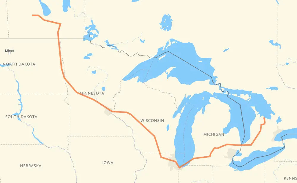
The distance from Neepawa to Meaford is 2,418 kilometers by road including 1,903 kilometers on motorways. Road takes approximately 24 hours and 35 minutes and goes through Portage la Prairie, Winnipeg, Grand Forks, Fargo, Eau Claire, Madison and Janesville.
| Shortest distance by air | 1,546 km ✈️ |
| Car route length | 2,418 km 🚗 |
| Driving time | 24 h 35 min |
| Fuel amount | 193.5 L |
| Fuel cost | 373.4 CAD |
| Point | Distance | Time | Fuel | |
| Neepawa | 0 km | 00 min | 0.0 L | |
|
PTH 16 102 km, 1 h 09 min
|
||||
| Portage la Prairie | 102 km | 1 h 09 min | 7.5 L | |
|
PTH 1 85 km, 58 min
|
||||
| Winnipeg | 187 km | 2 h 08 min | 13.8 L | |
|
PTH 100 I 29 228 km, 2 h 34 min
|
||||
| Grand Forks | 415 km | 4 h 42 min | 32.6 L | |
|
I 29 119 km, 1 h 17 min
|
||||
| Fargo | 534 km | 6 h 00 min | 42.0 L | |
|
I 29 I 94 526 km, 5 h 02 min
|
||||
| Eau Claire | 1,060 km | 11 h 02 min | 83.9 L | |
|
I 94 282 km, 2 h 34 min
|
||||
| Madison | 1,342 km | 13 h 37 min | 106.6 L | |
|
I 39 56 km, 30 min
|
||||
| Janesville | 1,398 km | 14 h 07 min | 111.5 L | |
|
I 39 I 90 173 km, 1 h 39 min
|
||||
| Chicago | 1,571 km | 15 h 47 min | 123.8 L | |
|
I 90 I 94 231 km, 2 h 12 min
|
||||
| Kalamazoo | 1,803 km | 17 h 59 min | 144.1 L | |
|
I 94 I 69 104 km, 56 min
|
||||
| Lansing | 1,907 km | 18 h 56 min | 152.4 L | |
|
I 69 99 km, 54 min
|
||||
| Flint | 2,006 km | 19 h 50 min | 160.1 L | |
|
I 69 122 km, 1 h 14 min
|
||||
| Sarnia | 2,128 km | 21 h 05 min | 169.5 L | |
|
402 23 290 km, 3 h 29 min
|
||||
| Meaford | 2,418 km | 24 h 35 min | 193.2 L | |
Hotels of Meaford
Frequently Asked Questions
How much does it cost to drive from Neepawa to Meaford?
Fuel cost: 373.4 CAD
This fuel cost is calculated as: (Route length 2,418 km / 100 km) * (Fuel consumption 8 L/100 km) * (Fuel price 1.93 CAD / L)
You can adjust fuel consumption and fuel price here.
How long is a car ride from Neepawa to Meaford?
Driving time: 24 h 35 min
This time is calculated for driving at the maximum permitted speed, taking into account traffic rules restrictions.
- 1,299 km with a maximum speed 110 km/h = 11 h 48 min
- 28 km with a maximum speed 105 km/h = 15 min
- 334 km with a maximum speed 100 km/h = 3 h 20 min
- 33 km with a maximum speed 97 km/h = 20 min
- 269 km with a maximum speed 90 km/h = 2 h 59 min
- 40 km with a maximum speed 89 km/h = 27 min
- 372 km with a maximum speed 80 km/h = 4 h 39 min
- 13 km with a maximum speed 72 km/h = 10 min
- 9 km with a maximum speed 70 km/h = 7 min
- 4 km with a maximum speed 60 km/h = 3 min
- 1 km with a maximum speed 56 km/h = 1 min
- 15 km with a maximum speed 50 km/h = 17 min
- 2 km with a maximum speed 40 km/h = 2 min
The calculated driving time does not take into account intermediate stops and traffic jams.
How far is Neepawa to Meaford by land?
The distance between Neepawa and Meaford is 2,418 km by road including 1,903 km on motorways.
Precise satellite coordinates of highways were used for this calculation. The start and finish points are the centers of Neepawa and Meaford respectively.
How far is Neepawa to Meaford by plane?
The shortest distance (air line, as the crow flies) between Neepawa and Meaford is 1,546 km.
This distance is calculated using the Haversine formula as a great-circle distance between two points on the surface of a sphere. The start and finish points are the centers of Neepawa and Meaford respectively. Actual distance between airports may be different.
How many hours is Neepawa from Meaford by plane?
Boeing 737 airliner needs 1 h 55 min to cover the distance of 1,546 km at a cruising speed of 800 km/h.
Small plane "Cessna 172" needs 7 h 1 min to flight this distance at average speed of 220 km/h.
This time is approximate and do not take into account takeoff and landing times, airport location and other real world factors.
How long is a helicopter ride from Neepawa to Meaford?
Fast helicopter "Eurocopter AS350" or "Hughes OH-6 Cayuse" need 6 h 26 min to cover the distance of 1,546 km at a cruising speed of 240 km/h.
Popular "Robinson R44" needs 7 h 21 min to flight this distance at average speed of 210 km/h.
This time is approximate and do not take into account takeoff and landing times, aerodrome location and other real world factors.
What city is halfway between Neepawa and Meaford?
The halfway point between Neepawa and Meaford is Camp Douglas. It is located about 2 km from the exact midpoint by road.
The distance from Camp Douglas to Neepawa is 1,207 km and driving will take about 12 h 22 min. The road between Camp Douglas and Meaford has length 1,211 km and will take approximately 12 h 12 min.
The other cities located close to halfway point:
Where is Neepawa in relation to Meaford?
Neepawa is located 1,546 km north-west of Meaford.
Neepawa has geographic coordinates: latitude 50.23194, longitude -99.46373.
Meaford has geographic coordinates: latitude 44.60866, longitude -80.59146.
Which highway goes from Neepawa to Meaford?
The route from Neepawa to Meaford follows I 94, I 90, I 69, I 29, US 81, I 39.
Other minor sections pass along the road:
- 23: 96 km
- PTH 75: 93 km
- PTH 16: 87 km
- PTH 1: 85 km
- 402: 63 km
- I 694: 46 km
- US 51: 32 km
- PTH 100: 23 km
- CR 7: 23 km
- 6: 22 km
- 4: 19 km
- US 59: 17 km
- 7: 16 km
- 19: 15 km
- 89: 14 km
- CR 13: 12 km
- CR 4: 9 km
- I 96: 7 km
- US 10: 7 km
- MN 95: 6 km
- US 12: 6 km
- 81: 5 km
- MN 210: 5 km
- US 52: 5 km
- US 31: 5 km
- WI 35: 4 km
- WI 11: 3 km
- Route 42: 2 km
- 26: 1 km
- CR 86: 1 km