Distance between Chilliwack BC and Oakville MB
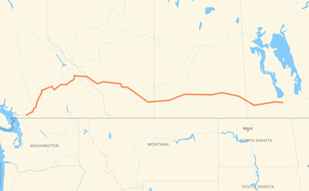
The distance from Chilliwack to Oakville is 2,133 kilometers by road including 562 kilometers on motorways. Road takes approximately 23 hours and 29 minutes and goes through Merritt, Salmon Arm, Revelstoke, Chestermere, Brooks, Medicine Hat and Swift Current.
| Shortest distance by air | 1,723 km ✈️ |
| Car route length | 2,133 km 🚗 |
| Driving time | 23 h 29 min |
| Fuel amount | 170.7 L |
| Fuel cost | 334.5 CAD |
| Point | Distance | Time | Fuel | |
| Chilliwack | 0 km | 00 min | 0.0 L | |
|
1 5 168 km, 1 h 34 min
|
||||
| Merritt | 168 km | 1 h 34 min | 12.7 L | |
|
5 1 198 km, 2 h 02 min
|
||||
| Salmon Arm | 366 km | 3 h 37 min | 28.2 L | |
|
1 102 km, 1 h 10 min
|
||||
| Revelstoke | 468 km | 4 h 47 min | 36.9 L | |
|
1 426 km, 4 h 41 min
|
||||
| Chestermere | 894 km | 9 h 29 min | 70.7 L | |
|
1 163 km, 1 h 48 min
|
||||
| Brooks | 1,056 km | 11 h 17 min | 84.0 L | |
|
1 106 km, 1 h 10 min
|
||||
| Medicine Hat | 1,162 km | 12 h 28 min | 92.5 L | |
|
1 221 km, 2 h 27 min
|
||||
| Swift Current | 1,384 km | 14 h 56 min | 110.2 L | |
|
1 164 km, 1 h 49 min
|
||||
| Moose Jaw | 1,548 km | 16 h 46 min | 123.0 L | |
|
1 77 km, 50 min
|
||||
| Regina | 1,625 km | 17 h 37 min | 129.5 L | |
|
6 1 361 km, 4 h 09 min
|
||||
| Brandon | 1,987 km | 21 h 46 min | 158.6 L | |
|
PTH 1 122 km, 1 h 25 min
|
||||
| Portage la Prairie | 2,109 km | 23 h 11 min | 168.1 L | |
|
PTH 1 25 km, 17 min
|
||||
| Oakville | 2,133 km | 23 h 28 min | 170.3 L | |
Frequently Asked Questions
How much does it cost to drive from Chilliwack to Oakville?
Fuel cost: 334.5 CAD
This fuel cost is calculated as: (Route length 2,133 km / 100 km) * (Fuel consumption 8 L/100 km) * (Fuel price 1.96 CAD / L)
You can adjust fuel consumption and fuel price here.
How long is a car ride from Chilliwack to Oakville?
Driving time: 23 h 29 min
This time is calculated for driving at the maximum permitted speed, taking into account traffic rules restrictions.
- 316 km with a maximum speed 110 km/h = 2 h 52 min
- 129 km with a maximum speed 100 km/h = 1 h 17 min
- 1,420 km with a maximum speed 90 km/h = 15 h 46 min
- 216 km with a maximum speed 80 km/h = 2 h 41 min
- 24 km with a maximum speed 70 km/h = 20 min
- 20 km with a maximum speed 60 km/h = 19 min
- 8 km with a maximum speed 50 km/h = 9 min
The calculated driving time does not take into account intermediate stops and traffic jams.
How far is Chilliwack to Oakville by land?
The distance between Chilliwack and Oakville is 2,133 km by road including 562 km on motorways.
Precise satellite coordinates of highways were used for this calculation. The start and finish points are the centers of Chilliwack and Oakville respectively.
How far is Chilliwack to Oakville by plane?
The shortest distance (air line, as the crow flies) between Chilliwack and Oakville is 1,723 km.
This distance is calculated using the Haversine formula as a great-circle distance between two points on the surface of a sphere. The start and finish points are the centers of Chilliwack and Oakville respectively. Actual distance between airports may be different.
How many hours is Chilliwack from Oakville by plane?
Boeing 737 airliner needs 2 h 9 min to cover the distance of 1,723 km at a cruising speed of 800 km/h.
Small plane "Cessna 172" needs 7 h 49 min to flight this distance at average speed of 220 km/h.
This time is approximate and do not take into account takeoff and landing times, airport location and other real world factors.
How long is a helicopter ride from Chilliwack to Oakville?
Fast helicopter "Eurocopter AS350" or "Hughes OH-6 Cayuse" need 7 h 10 min to cover the distance of 1,723 km at a cruising speed of 240 km/h.
Popular "Robinson R44" needs 8 h 12 min to flight this distance at average speed of 210 km/h.
This time is approximate and do not take into account takeoff and landing times, aerodrome location and other real world factors.
What city is halfway between Chilliwack and Oakville?
The halfway point between Chilliwack and Oakville is Brooks. It is located about 10 km from the exact midpoint by road.
The distance from Brooks to Chilliwack is 1,056 km and driving will take about 11 h 17 min. The road between Brooks and Oakville has length 1,077 km and will take approximately 12 h 11 min.
The other cities located close to halfway point:
Where is Chilliwack in relation to Oakville?
Chilliwack is located 1,723 km west of Oakville.
Chilliwack has geographic coordinates: latitude 49.16734, longitude -121.95099.
Oakville has geographic coordinates: latitude 49.93064, longitude -97.99765.
Which highway goes from Chilliwack to Oakville?
The route from Chilliwack to Oakville follows 1, PTH 1, 5.
Other minor sections pass along the road:
- 97: 37 km
- 93: 27 km
- 19: 25 km
- 41: 16 km
- 47: 8 km
- PTH 83: 7 km
- 6: 7 km
- 3: 6 km
- PR 254: 5 km
- PR 250: 4 km
- PTH 13: 3 km
- PTH 10: 2 km
- 8: 1 km
- 23: 1 km