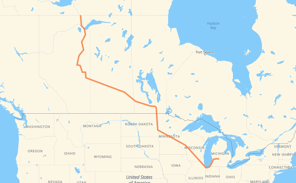
The distance from Fort Smith to Portland is 3,804 kilometers by road including 1,667 kilometers on motorways. Road takes approximately 40 hours and 46 minutes and goes through Lloydminster, North Battleford, Saskatoon, Yorkton, Portage la Prairie, Winnipeg and Grand Forks.
How much does it cost to drive from Fort Smith to Portland?
Fuel cost:
596.4 CAD
This fuel cost is calculated as: (Route length 3,804 km / 100 km) * (Fuel consumption 8 L/100 km) * (Fuel price 1.96 CAD / L)
You can adjust fuel consumption and fuel price here.
How long is a car ride from Fort Smith to Portland?
Driving time:
40 h 46 min
This time is calculated for driving at the maximum permitted speed, taking into account traffic rules restrictions.
1,079 km with a maximum speed 110 km/h = 9 h 48 min
28 km with a maximum speed 105 km/h = 15 min
277 km with a maximum speed 100 km/h = 2 h 45 min
33 km with a maximum speed 97 km/h = 20 min
1,753 km with a maximum speed 90 km/h = 19 h 28 min
39 km with a maximum speed 89 km/h = 26 min
536 km with a maximum speed 80 km/h = 6 h 41 min
13 km with a maximum speed 72 km/h = 10 min
17 km with a maximum speed 70 km/h = 14 min
10 km with a maximum speed 60 km/h = 9 min
1 km with a maximum speed 56 km/h = 1 min
18 km with a maximum speed 50 km/h = 21 min
The calculated driving time does not take into account intermediate stops and traffic jams.
How far is Fort Smith to Portland by land?
The distance between Fort Smith and Portland is 3,804 km by road including 1,667 km on motorways.
Precise satellite coordinates of highways were used for this calculation. The start and finish points are the centers of Fort Smith and Portland respectively.
How far is Fort Smith to Portland by plane?
The shortest distance (air line, as the crow flies) between Fort Smith and Portland is 2,635 km.
This distance is calculated using the Haversine formula as a great-circle distance between two points on the surface of a sphere. The start and finish points are the centers of Fort Smith and Portland respectively. Actual distance between airports may be different.
How many hours is Fort Smith from Portland by plane?
Boeing 737 airliner needs 3 h 17 min to cover the distance of 2,635 km at a cruising speed of 800 km/h.
Small plane "Cessna 172" needs 11 h 58 min to flight this distance at average speed of 220 km/h.
This time is approximate and do not take into account takeoff and landing times, airport location and other real world factors.
How long is a helicopter ride from Fort Smith to Portland?
Fast helicopter "Eurocopter AS350" or "Hughes OH-6 Cayuse" need 10 h 58 min to cover the distance of 2,635 km at a cruising speed of 240 km/h.
Popular "Robinson R44" needs 12 h 32 min to flight this distance at average speed of 210 km/h.
This time is approximate and do not take into account takeoff and landing times, aerodrome location and other real world factors.
What city is halfway between Fort Smith and Portland?
The halfway point between Fort Smith and Portland is Neepawa. It is located about 14 km from the exact midpoint by road.
The distance from Neepawa to Fort Smith is 1,888 km and driving will take about 21 h 38 min. The road between Neepawa and Portland has length 1,916 km and will take approximately 19 h 8 min.
The other cities located close to halfway point:
Gladstone is in 1,924 km from Fort Smith and 1,879 km from Portland
Minnedosa is in 1,856 km from Fort Smith and 1,948 km from Portland
Westbourne is in 1,951 km from Fort Smith and 1,853 km from Portland
Where is Fort Smith in relation to Portland?
Fort Smith is located 2,635 km north-west of Portland.
Fort Smith has geographic coordinates: latitude 60.00585, longitude -111.89026.
Portland has geographic coordinates: latitude 42.8692, longitude -84.90305.
Which highway goes from Fort Smith to Portland?
The route from Fort Smith to Portland follows I 94, 16, I 90, 63, PTH 16, I 29, US 81, I 39.