Distance between Lettonia MB and Chief Lake BC
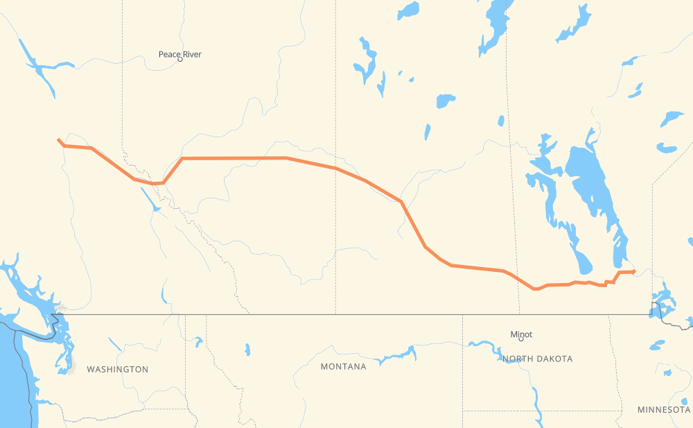
The distance from Lettonia to Chief Lake is 2,244 kilometers by road including 125 kilometers on motorways. Road takes approximately 39 hours and 44 minutes and goes through Winnipeg, Portage la Prairie, Brandon, Regina, Saskatoon, North Battleford and Lloydminster.
| Shortest distance by air | 1,877 km ✈️ |
| Car route length | 2,244 km 🚗 |
| Driving time | 39 h 44 min |
| Fuel amount | 659.8 L |
| Fuel cost | 4,895.6 CAD |
| Point | Distance | Time | Fuel | |
| Lettonia | 0 km | 00 min | 0.0 L | |
|
PR 317 130 km, 2 h 16 min
|
||||
| Winnipeg | 130 km | 2 h 16 min | 34.4 L | |
|
PTH 101 PTH 1 84 km, 1 h 27 min
|
||||
| Portage la Prairie | 214 km | 3 h 43 min | 60.6 L | |
|
PTH 1 123 km, 2 h 11 min
|
||||
| Brandon | 337 km | 5 h 55 min | 98.0 L | |
|
PTH 1 1 362 km, 6 h 26 min
|
||||
| Regina | 698 km | 12 h 21 min | 204.1 L | |
|
46 11 253 km, 4 h 27 min
|
||||
| Saskatoon | 951 km | 16 h 49 min | 277.3 L | |
|
11 16 162 km, 2 h 51 min
|
||||
| North Battleford | 1,113 km | 19 h 41 min | 319.2 L | |
|
16 109 km, 1 h 56 min
|
||||
| Lloydminster | 1,222 km | 21 h 38 min | 351.1 L | |
|
16 254 km, 4 h 29 min
|
||||
| Edmonton | 1,476 km | 26 h 07 min | 430.4 L | |
|
16 27 km, 24 min
|
||||
| Spruce Grove | 1,504 km | 26 h 31 min | 440.0 L | |
|
16 708 km, 12 h 36 min
|
||||
| Prince George | 2,212 km | 39 h 08 min | 646.6 L | |
|
97 32 km, 35 min
|
||||
| Chief Lake | 2,244 km | 39 h 44 min | 658.5 L | |
Frequently Asked Questions
How much does it cost to drive from Lettonia to Chief Lake?
Fuel cost: 4,895.6 CAD
This fuel cost is calculated as: (Route length 2,244 km / 100 km) * (Fuel consumption 29.40 L/100 km) * (Fuel price 7.42 CAD / L)
You can adjust fuel consumption and fuel price here.
How long is a car ride from Lettonia to Chief Lake?
Driving time: 39 h 44 min
This time is calculated for driving at the maximum permitted speed, taking into account traffic rules restrictions.
- 125 km with a maximum speed 68 km/h = 1 h 49 min
- 2,093 km with a maximum speed 56 km/h = 37 h 22 min
- 27 km with a maximum speed 50 km/h = 31 min
The calculated driving time does not take into account intermediate stops and traffic jams.
How far is Lettonia to Chief Lake by land?
The distance between Lettonia and Chief Lake is 2,244 km by road including 125 km on motorways.
Precise satellite coordinates of highways were used for this calculation. The start and finish points are the centers of Lettonia and Chief Lake respectively.
How far is Lettonia to Chief Lake by plane?
The shortest distance (air line, as the crow flies) between Lettonia and Chief Lake is 1,877 km.
This distance is calculated using the Haversine formula as a great-circle distance between two points on the surface of a sphere. The start and finish points are the centers of Lettonia and Chief Lake respectively. Actual distance between airports may be different.
How many hours is Lettonia from Chief Lake by plane?
Boeing 737 airliner needs 2 h 20 min to cover the distance of 1,877 km at a cruising speed of 800 km/h.
Small plane "Cessna 172" needs 8 h 31 min to flight this distance at average speed of 220 km/h.
This time is approximate and do not take into account takeoff and landing times, airport location and other real world factors.
How long is a helicopter ride from Lettonia to Chief Lake?
Fast helicopter "Eurocopter AS350" or "Hughes OH-6 Cayuse" need 7 h 49 min to cover the distance of 1,877 km at a cruising speed of 240 km/h.
Popular "Robinson R44" needs 8 h 56 min to flight this distance at average speed of 210 km/h.
This time is approximate and do not take into account takeoff and landing times, aerodrome location and other real world factors.
What city is halfway between Lettonia and Chief Lake?
The halfway point between Lettonia and Chief Lake is North Battleford. It is located about 9 km from the exact midpoint by road.
The distance from North Battleford to Lettonia is 1,113 km and driving will take about 19 h 40 min. The road between North Battleford and Chief Lake has length 1,131 km and will take approximately 20 h 3 min.
The other cities located close to halfway point:
Where is Lettonia in relation to Chief Lake?
Lettonia is located 1,877 km east of Chief Lake.
Lettonia has geographic coordinates: latitude 50.35, longitude -95.96667.
Chief Lake has geographic coordinates: latitude 54.09842, longitude -123.01788.
Which highway goes from Lettonia to Chief Lake?
The route from Lettonia to Chief Lake follows 16, PTH 1, 11, 1.
Other minor sections pass along the road:
- PR 317: 48 km
- PTH 59: 45 km
- PTH 101: 32 km
- 46: 22 km
- 2: 18 km
- 97: 9 km
- 11A: 9 km
- 47: 8 km
- 22: 8 km
- PTH 83: 7 km
- 40: 7 km
- PR 254: 5 km
- 674: 5 km
- PR 250: 4 km
- PR 313: 3 km
- 6: 3 km
- 21: 3 km
- PR 502: 2 km
- PTH 11: 2 km
- 12: 2 km
- PTH 10: 2 km
- 8: 1 km
- 675: 1 km
- 4: 1 km