Distance between Zhenglan Banner and Ningnan
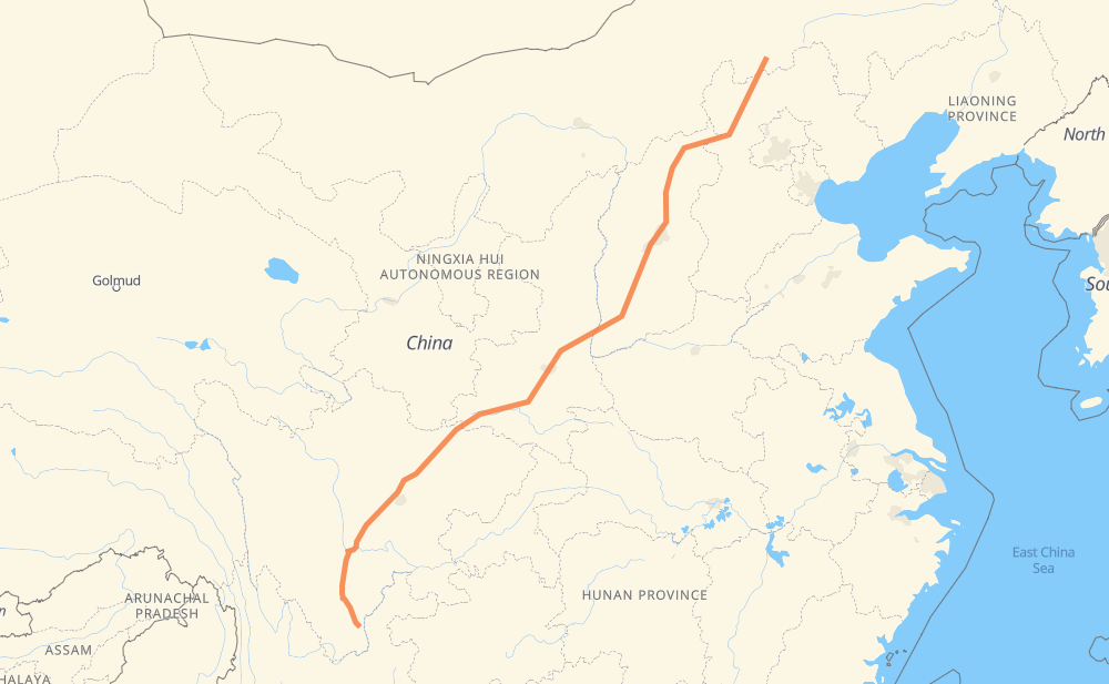
The distance from Zhenglan Banner to Ningnan is 2,579 kilometers by road including 2,412 kilometers on motorways. Road takes approximately 29 hours and 2 minutes and goes through Zhangbei, Datong, Yuanping, Zhaoyu, Gutao, Jiexiu and Hancheng.
| Shortest distance by air | 2,072 km ✈️ |
| Car route length | 2,579 km 🚗 |
| Driving time | 29 h 2 min |
| Fuel amount | 206.3 L |
| Fuel cost | 404.4 CAD |
| Point | Distance | Time | Fuel | |
| Zhenglan Banner | 0 km | 00 min | 0.0 L | |
|
G510 G1013 192 km, 2 h 10 min
|
||||
| Zhangbei | 192 km | 2 h 10 min | 15.1 L | |
|
G1013 G109 208 km, 2 h 08 min
|
||||
| Datong | 400 km | 4 h 19 min | 31.1 L | |
|
G109 G55 194 km, 2 h 08 min
|
||||
| Yuanping | 594 km | 6 h 27 min | 46.9 L | |
|
G55 186 km, 2 h 06 min
|
||||
| Zhaoyu | 781 km | 8 h 34 min | 62.0 L | |
|
G5 22 km, 16 min
|
||||
| Gutao | 803 km | 8 h 50 min | 63.1 L | |
|
G5 30 km, 21 min
|
||||
| Jiexiu | 833 km | 9 h 11 min | 65.9 L | |
|
G5 256 km, 2 h 51 min
|
||||
| Hancheng | 1,089 km | 12 h 03 min | 86.4 L | |
|
G5 42 km, 30 min
|
||||
| Heyang | 1,131 km | 12 h 34 min | 89.9 L | |
|
G5 409 km, 4 h 33 min
|
||||
| Chenggu | 1,539 km | 17 h 07 min | 123.0 L | |
|
G5 127 km, 1 h 25 min
|
||||
| Ningqiang | 1,667 km | 18 h 32 min | 133.2 L | |
|
G5 68 km, 46 min
|
||||
| Guangyuan | 1,735 km | 19 h 19 min | 138.5 L | |
|
G5 232 km, 2 h 41 min
|
||||
| Shifang | 1,967 km | 22 h 01 min | 157.0 L | |
|
S1 20 km, 14 min
|
||||
| Pengzhou | 1,986 km | 22 h 16 min | 158.2 L | |
|
S1 G4202 100 km, 1 h 07 min
|
||||
| Qionglai | 2,086 km | 23 h 23 min | 166.2 L | |
|
S8 G5 158 km, 1 h 48 min
|
||||
| Fulin | 2,245 km | 25 h 11 min | 179.1 L | |
|
G5 334 km, 3 h 49 min
|
||||
| Ningnan | 2,579 km | 29 h 01 min | 205.3 L | |
Frequently Asked Questions
How much does it cost to drive from Zhenglan Banner to Ningnan?
Fuel cost: 404.4 CAD
This fuel cost is calculated as: (Route length 2,579 km / 100 km) * (Fuel consumption 8 L/100 km) * (Fuel price 1.96 CAD / L)
You can adjust fuel consumption and fuel price here.
How long is a car ride from Zhenglan Banner to Ningnan?
Driving time: 29 h 2 min
This time is calculated for driving at the maximum permitted speed, taking into account traffic rules restrictions.
- 1,270 km with a maximum speed 100 km/h = 12 h 41 min
- 26 km with a maximum speed 90 km/h = 17 min
- 1,281 km with a maximum speed 80 km/h = 16 h 1 min
- 1 km with a maximum speed 50 km/h = 1 min
The calculated driving time does not take into account intermediate stops and traffic jams.
How far is Zhenglan Banner to Ningnan by land?
The distance between Zhenglan Banner and Ningnan is 2,579 km by road including 2,412 km on motorways.
Precise satellite coordinates of highways were used for this calculation. The start and finish points are the centers of Zhenglan Banner and Ningnan respectively.
How far is Zhenglan Banner to Ningnan by plane?
The shortest distance (air line, as the crow flies) between Zhenglan Banner and Ningnan is 2,072 km.
This distance is calculated using the Haversine formula as a great-circle distance between two points on the surface of a sphere. The start and finish points are the centers of Zhenglan Banner and Ningnan respectively. Actual distance between airports may be different.
How many hours is Zhenglan Banner from Ningnan by plane?
Boeing 737 airliner needs 2 h 35 min to cover the distance of 2,072 km at a cruising speed of 800 km/h.
Small plane "Cessna 172" needs 9 h 25 min to flight this distance at average speed of 220 km/h.
This time is approximate and do not take into account takeoff and landing times, airport location and other real world factors.
How long is a helicopter ride from Zhenglan Banner to Ningnan?
Fast helicopter "Eurocopter AS350" or "Hughes OH-6 Cayuse" need 8 h 38 min to cover the distance of 2,072 km at a cruising speed of 240 km/h.
Popular "Robinson R44" needs 9 h 52 min to flight this distance at average speed of 210 km/h.
This time is approximate and do not take into account takeoff and landing times, aerodrome location and other real world factors.
What city is halfway between Zhenglan Banner and Ningnan?
The halfway point between Zhenglan Banner and Ningnan is 张卜镇. It is located about 15 km from the exact midpoint by road.
The distance from 张卜镇 to Zhenglan Banner is 1,275 km and driving will take about 14 h 11 min. The road between 张卜镇 and Ningnan has length 1,304 km and will take approximately 14 h 50 min.
The other cities located close to halfway point:
Where is Zhenglan Banner in relation to Ningnan?
Zhenglan Banner is located 2,072 km north-east of Ningnan.
Zhenglan Banner has geographic coordinates: latitude 42.24686, longitude 115.99627.
Ningnan has geographic coordinates: latitude 27.06799, longitude 102.75345.
Which highway goes from Zhenglan Banner to Ningnan?
The route from Zhenglan Banner to Ningnan follows G5, G55, G1013, G109.
Other minor sections pass along the road:
- G248: 89 km
- S1: 86 km
- S8: 65 km
- G2001: 43 km
- G3001: 35 km
- G5 G20: 32 km
- G510: 30 km
- S212: 29 km
- G4202: 21 km
- SA2: 19 km
- G95: 14 km
- G108: 13 km
- S32: 5 km
- G239: 2 km
- S10: 2 km
- G348: 2 km
- G3011: 1 km