Distance between Wiarton ON and Milk River AB
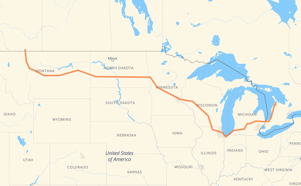
The distance from Wiarton to Milk River is 3,244 kilometers by road including 2,398 kilometers on motorways. Road takes approximately 32 hours and 21 minutes and goes through Sarnia, Flint, Lansing, Kalamazoo, Chicago, Janesville and Madison.
| Shortest distance by air | 2,383 km ✈️ |
| Car route length | 3,244 km 🚗 |
| Driving time | 32 h 21 min |
| Fuel amount | 259.5 L |
| Fuel cost | 508.6 CAD |
| Point | Distance | Time | Fuel | |
| Wiarton | 0 km | 00 min | 0.0 L | |
|
6 21 262 km, 3 h 05 min
|
||||
| Sarnia | 262 km | 3 h 05 min | 20.2 L | |
|
402 I 69 122 km, 1 h 12 min
|
||||
| Flint | 384 km | 4 h 18 min | 30.3 L | |
|
I 69 99 km, 53 min
|
||||
| Lansing | 482 km | 5 h 11 min | 38.4 L | |
|
I 69 102 km, 55 min
|
||||
| Kalamazoo | 584 km | 6 h 07 min | 46.5 L | |
|
I 94 I 90 409 km, 3 h 53 min
|
||||
| Janesville | 993 km | 10 h 01 min | 79.2 L | |
|
I 39 56 km, 30 min
|
||||
| Madison | 1,050 km | 10 h 31 min | 83.2 L | |
|
I 39 I 94 282 km, 2 h 34 min
|
||||
| Eau Claire | 1,332 km | 13 h 06 min | 105.6 L | |
|
I 94 519 km, 4 h 48 min
|
||||
| Fargo | 1,851 km | 17 h 55 min | 147.9 L | |
|
I 94 7 km, 04 min
|
||||
| West Fargo | 1,859 km | 17 h 59 min | 148.3 L | |
|
I 94 296 km, 2 h 41 min
|
||||
| Bismarck | 2,155 km | 20 h 41 min | 171.6 L | |
|
I 94 29 km, 16 min
|
||||
| Mandan | 2,183 km | 20 h 57 min | 173.1 L | |
|
I 94 127 km, 1 h 12 min
|
||||
| Dickinson | 2,310 km | 22 h 10 min | 184.1 L | |
|
I 94 MT 200 724 km, 7 h 48 min
|
||||
| Great Falls | 3,034 km | 29 h 58 min | 242.5 L | |
|
I 15 Business I 15 212 km, 2 h 24 min
|
||||
| Milk River | 3,246 km | 32 h 22 min | 259.3 L | |
Hotels of Milk River
Frequently Asked Questions
How much does it cost to drive from Wiarton to Milk River?
Fuel cost: 508.6 CAD
This fuel cost is calculated as: (Route length 3,244 km / 100 km) * (Fuel consumption 8 L/100 km) * (Fuel price 1.96 CAD / L)
You can adjust fuel consumption and fuel price here.
How long is a car ride from Wiarton to Milk River?
Driving time: 32 h 21 min
This time is calculated for driving at the maximum permitted speed, taking into account traffic rules restrictions.
- 1,959 km with a maximum speed 110 km/h = 17 h 48 min
- 35 km with a maximum speed 105 km/h = 20 min
- 178 km with a maximum speed 100 km/h = 1 h 46 min
- 63 km with a maximum speed 97 km/h = 38 min
- 670 km with a maximum speed 90 km/h = 7 h 26 min
- 31 km with a maximum speed 89 km/h = 20 min
- 282 km with a maximum speed 80 km/h = 3 h 31 min
- 7 km with a maximum speed 72 km/h = 5 min
- 2 km with a maximum speed 70 km/h = 1 min
- 2 km with a maximum speed 60 km/h = 1 min
- 2 km with a maximum speed 56 km/h = 2 min
- 9 km with a maximum speed 50 km/h = 10 min
- 3 km with a maximum speed 40 km/h = 4 min
The calculated driving time does not take into account intermediate stops and traffic jams.
How far is Wiarton to Milk River by land?
The distance between Wiarton and Milk River is 3,244 km by road including 2,398 km on motorways.
Precise satellite coordinates of highways were used for this calculation. The start and finish points are the centers of Wiarton and Milk River respectively.
How far is Wiarton to Milk River by plane?
The shortest distance (air line, as the crow flies) between Wiarton and Milk River is 2,383 km.
This distance is calculated using the Haversine formula as a great-circle distance between two points on the surface of a sphere. The start and finish points are the centers of Wiarton and Milk River respectively. Actual distance between airports may be different.
How many hours is Wiarton from Milk River by plane?
Boeing 737 airliner needs 2 h 58 min to cover the distance of 2,383 km at a cruising speed of 800 km/h.
Small plane "Cessna 172" needs 10 h 49 min to flight this distance at average speed of 220 km/h.
This time is approximate and do not take into account takeoff and landing times, airport location and other real world factors.
How long is a helicopter ride from Wiarton to Milk River?
Fast helicopter "Eurocopter AS350" or "Hughes OH-6 Cayuse" need 9 h 55 min to cover the distance of 2,383 km at a cruising speed of 240 km/h.
Popular "Robinson R44" needs 11 h 20 min to flight this distance at average speed of 210 km/h.
This time is approximate and do not take into account takeoff and landing times, aerodrome location and other real world factors.
What city is halfway between Wiarton and Milk River?
The halfway point between Wiarton and Milk River is Freeport. It is located about 2 km from the exact midpoint by road.
The distance from Freeport to Wiarton is 1,620 km and driving will take about 15 h 46 min. The road between Freeport and Milk River has length 1,623 km and will take approximately 16 h 34 min.
The other cities located close to halfway point:
Where is Wiarton in relation to Milk River?
Wiarton is located 2,383 km east of Milk River.
Wiarton has geographic coordinates: latitude 44.74074, longitude -81.13324.
Milk River has geographic coordinates: latitude 49.15141, longitude -112.08335.
Which highway goes from Wiarton to Milk River?
The route from Wiarton to Milk River follows I 94, MT 200, I 90, I 69, US 87, I 15, I 39, US 52, MT 3, 21.
Other minor sections pass along the road:
- MT 200 S: 71 km
- CR 1: 67 km
- I 694: 46 km
- US 89: 46 km
- US 83: 36 km
- 402: 34 km
- US 51: 30 km
- US 191: 24 km
- US 41: 22 km
- 4: 19 km
- US 59: 17 km
- CR 3: 15 km
- CR 17: 15 km
- ND 3: 12 km
- 6: 11 km
- CR 10: 10 km
- US 12: 9 km
- ND 1: 8 km
- I 96: 8 km
- MN 95: 7 km
- 25: 6 km
- MN 210: 5 km
- US 31: 5 km
- US 10: 5 km
- 501: 4 km
- WI 35: 4 km
- I 15 Business: 4 km
- ND 22 Bypass: 4 km
- US 20: 3 km
- WI 11: 3 km
- US 52 Truck: 3 km
- US 281 Truck: 2 km
- US 87 Bypass: 2 km