Distance between Villa Hidalgo and Gilberto Tapia (Bloque Quinientos Catorce)
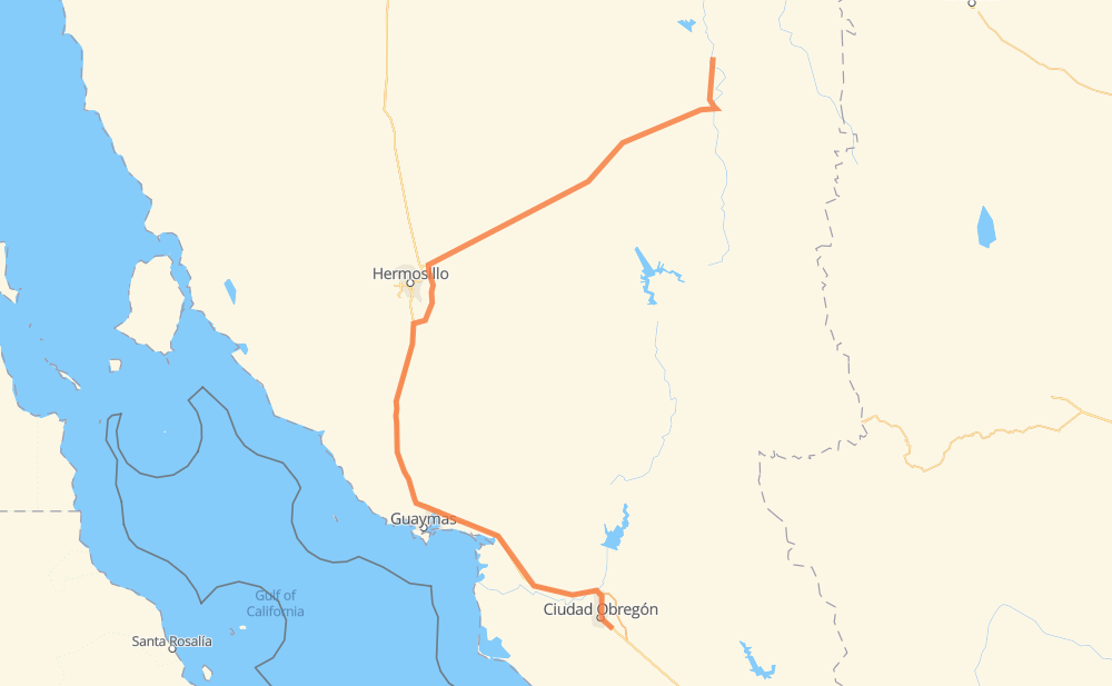
The distance from Villa Hidalgo to Gilberto Tapia (Bloque Quinientos Catorce) is 513 kilometers by road including 207 kilometers on motorways. Road takes approximately 6 hours and 7 minutes and goes through Heroica Ciudad de Ures, Ciudad Obregon, Moctezuma, Fraccionamiento Campestre Buena Vista and Vicam.
| Shortest distance by air | 308 km ✈️ |
| Car route length | 513 km 🚗 |
| Driving time | 6 h 7 min |
| Fuel amount | 41.1 L |
| Fuel cost | 80.5 CAD |
| Toll roads cost | 241 MXN |
| Point | Distance | Time | Fuel | |
| Villa Hidalgo | 0 km | 00 min | 0.0 L | |
|
23 km, 18 min
|
||||
| La Puente | 23 km | 18 min | 1.3 L | |
|
SON 131 SON 69 44 km, 34 min
|
||||
| Moctezuma | 67 km | 53 min | 4.1 L | |
|
SON 69 MEX 14 22 km, 16 min
|
||||
| Bacachi | 88 km | 1 h 10 min | 6.5 L | |
|
MEX 14 8 km, 06 min
|
||||
| La Majada | 97 km | 1 h 16 min | 7.6 L | |
|
MEX 14 82 km, 1 h 06 min
|
||||
| Heroica Ciudad de Ures | 179 km | 2 h 22 min | 13.9 L | |
|
MEX 14 53 km, 40 min
|
||||
| Fraccionamiento Campestre Buena Vista | 231 km | 3 h 03 min | 18.3 L | |
|
MEX 14 MEX 15D 223 km, 2 h 16 min
|
||||
| Vicam | 454 km | 5 h 20 min | 36.1 L | |
|
MEX 15D 53 km, 41 min
|
||||
| Ciudad Obregon | 507 km | 6 h 01 min | 40.1 L | |
|
MEX 15 6 km, 05 min
|
||||
| El Rodeo | 513 km | 6 h 07 min | 41.0 L | |
Frequently Asked Questions
How many toll booths are there from Villa Hidalgo to Gilberto Tapia (Bloque Quinientos Catorce)?
There are 3 toll booths between Villa Hidalgo and Gilberto Tapia (Bloque Quinientos Catorce): Guaymas, Esperanza 150 and Libramiento Hermosillo.
How much does the toll booths cost from Villa Hidalgo to Gilberto Tapia (Bloque Quinientos Catorce)?
Toll roads cost: Libramiento Hermosillo (113 MXN) + Guaymas (38 MXN) + Esperanza 150 (90 MXN) = 241 MXN
How much does it cost to drive from Villa Hidalgo to Gilberto Tapia (Bloque Quinientos Catorce)?
Fuel cost: 80.5 CAD
This fuel cost is calculated as: (Route length 513 km / 100 km) * (Fuel consumption 8 L/100 km) * (Fuel price 1.96 CAD / L)
You can adjust fuel consumption and fuel price here.
Toll roads cost: 241 MXN
How long is a car ride from Villa Hidalgo to Gilberto Tapia (Bloque Quinientos Catorce)?
Driving time: 6 h 7 min
This time is calculated for driving at the maximum permitted speed, taking into account traffic rules restrictions.
- 138 km with a maximum speed 110 km/h = 1 h 15 min
- 28 km with a maximum speed 100 km/h = 16 min
- 45 km with a maximum speed 90 km/h = 29 min
- 262 km with a maximum speed 80 km/h = 3 h 16 min
- 35 km with a maximum speed 60 km/h = 35 min
- 2 km with a maximum speed 50 km/h = 2 min
- 1 km with a maximum speed 40 km/h = 2 min
- 1 km with a maximum speed 30 km/h = 1 min
- 1 km with a maximum speed 20 km/h = 2 min
- 1 km with a maximum speed 10 km/h = 6 min
The calculated driving time does not take into account intermediate stops and traffic jams.
How far is Villa Hidalgo to Gilberto Tapia (Bloque Quinientos Catorce) by land?
The distance between Villa Hidalgo and Gilberto Tapia (Bloque Quinientos Catorce) is 513 km by road including 207 km on motorways.
Precise satellite coordinates of highways were used for this calculation. The start and finish points are the centers of Villa Hidalgo and Gilberto Tapia (Bloque Quinientos Catorce) respectively.
How far is Villa Hidalgo to Gilberto Tapia (Bloque Quinientos Catorce) by plane?
The shortest distance (air line, as the crow flies) between Villa Hidalgo and Gilberto Tapia (Bloque Quinientos Catorce) is 308 km.
This distance is calculated using the Haversine formula as a great-circle distance between two points on the surface of a sphere. The start and finish points are the centers of Villa Hidalgo and Gilberto Tapia (Bloque Quinientos Catorce) respectively. Actual distance between airports may be different.
How many hours is Villa Hidalgo from Gilberto Tapia (Bloque Quinientos Catorce) by plane?
Boeing 737 airliner needs 23 min to cover the distance of 308 km at a cruising speed of 800 km/h.
Small plane "Cessna 172" needs 1 h 24 min to flight this distance at average speed of 220 km/h.
This time is approximate and do not take into account takeoff and landing times, airport location and other real world factors.
How long is a helicopter ride from Villa Hidalgo to Gilberto Tapia (Bloque Quinientos Catorce)?
Fast helicopter "Eurocopter AS350" or "Hughes OH-6 Cayuse" need 1 h 17 min to cover the distance of 308 km at a cruising speed of 240 km/h.
Popular "Robinson R44" needs 1 h 28 min to flight this distance at average speed of 210 km/h.
This time is approximate and do not take into account takeoff and landing times, aerodrome location and other real world factors.
What city is halfway between Villa Hidalgo and Gilberto Tapia (Bloque Quinientos Catorce)?
The halfway point between Villa Hidalgo and Gilberto Tapia (Bloque Quinientos Catorce) is La Mision. It is located about 4 km from the exact midpoint by road.
The distance from La Mision to Villa Hidalgo is 260 km and driving will take about 3 h 24 min. The road between La Mision and Gilberto Tapia (Bloque Quinientos Catorce) has length 253 km and will take approximately 2 h 43 min.
The other cities located close to halfway point:
- San Eduardo Uno is in 252 km from Villa Hidalgo and 261 km from Gilberto Tapia (Bloque Quinientos Catorce)
- Campo Nuevo 3 is in 249 km from Villa Hidalgo and 264 km from Gilberto Tapia (Bloque Quinientos Catorce)
- Los Chinos is in 267 km from Villa Hidalgo and 246 km from Gilberto Tapia (Bloque Quinientos Catorce)
Where is Villa Hidalgo in relation to Gilberto Tapia (Bloque Quinientos Catorce)?
Villa Hidalgo is located 308 km north of Gilberto Tapia (Bloque Quinientos Catorce).
Villa Hidalgo has geographic coordinates: latitude 30.16127, longitude -109.32126.
Gilberto Tapia (Bloque Quinientos Catorce) has geographic coordinates: latitude 27.43383, longitude -109.867.
Which highway goes from Villa Hidalgo to Gilberto Tapia (Bloque Quinientos Catorce)?
The route from Villa Hidalgo to Gilberto Tapia (Bloque Quinientos Catorce) follows MEX 15D, MEX 14.
Other minor sections pass along the road:
- SON 69: 47 km
- SON 131: 13 km
- MEX 15: 7 km