Distance between Vancouver BC and Boston MA
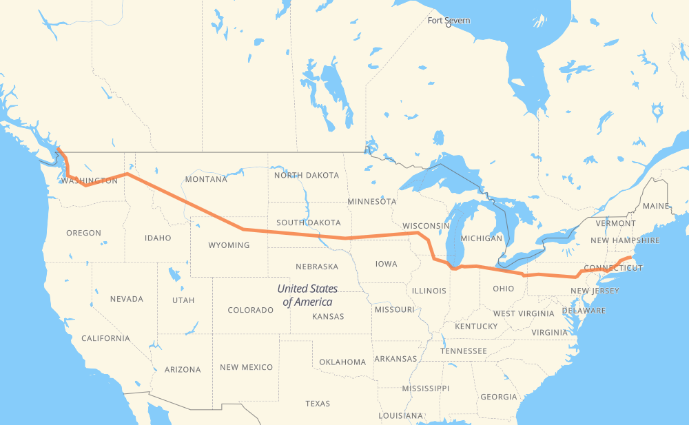
The distance from Vancouver to Boston is 5,186 kilometers by road including 5,176 kilometers on motorways. Road takes approximately 48 hours and 51 minutes and goes through Bellingham, Everett, Bellevue, Moses Lake, Spokane, Coeur d'Alene and Missoula.
| Shortest distance by air | 4,025 km ✈️ |
| Car route length | 5,186 km 🚗 |
| Driving time | 48 h 51 min |
| Fuel amount | 414.9 L |
| Fuel cost | 817.3 CAD |
| Point | Distance | Time | Fuel | |
| Vancouver | 0 km | 00 min | 0.0 L | |
|
99 90 km, 1 h 00 min
|
||||
| Bellingham | 90 km | 1 h 00 min | 6.3 L | |
|
I 5 93 km, 53 min
|
||||
| Everett | 183 km | 1 h 54 min | 13.9 L | |
|
I 5 I 405 45 km, 28 min
|
||||
| Bellevue | 228 km | 2 h 23 min | 17.6 L | |
|
I 405 I 90 254 km, 2 h 20 min
|
||||
| Moses Lake | 482 km | 4 h 43 min | 36.6 L | |
|
I 90 182 km, 1 h 39 min
|
||||
| Spokane | 664 km | 6 h 23 min | 52.7 L | |
|
I 90 51 km, 29 min
|
||||
| Coeur d'Alene | 715 km | 6 h 53 min | 56.8 L | |
|
I 90 265 km, 2 h 27 min
|
||||
| Missoula | 981 km | 9 h 20 min | 78.2 L | |
|
I 90 184 km, 1 h 40 min
|
||||
| Butte | 1,164 km | 11 h 01 min | 91.3 L | |
|
I 90 364 km, 3 h 24 min
|
||||
| Billings | 1,529 km | 14 h 25 min | 121.6 L | |
|
I 90 216 km, 2 h 15 min
|
||||
| Sheridan | 1,745 km | 16 h 41 min | 138.7 L | |
|
I 90 160 km, 1 h 27 min
|
||||
| Gillette | 1,905 km | 18 h 08 min | 151.9 L | |
|
I 90 156 km, 1 h 29 min
|
||||
| Spearfish | 2,060 km | 19 h 37 min | 163.9 L | |
|
I 90 68 km, 37 min
|
||||
| Rapid City | 2,128 km | 20 h 14 min | 170.0 L | |
|
I 90 18 km, 10 min
|
||||
| Box Elder | 2,146 km | 20 h 25 min | 170.9 L | |
|
I 90 411 km, 3 h 44 min
|
||||
| Mitchell | 2,558 km | 24 h 09 min | 203.5 L | |
|
I 90 116 km, 1 h 03 min
|
||||
| Sioux Falls | 2,674 km | 25 h 13 min | 213.6 L | |
|
I 90 11 km, 06 min
|
||||
| Brandon | 2,685 km | 25 h 19 min | 214.5 L | |
|
I 90 676 km, 6 h 11 min
|
||||
| Madison | 3,361 km | 31 h 31 min | 268.2 L | |
|
I 39 56 km, 30 min
|
||||
| Janesville | 3,417 km | 32 h 01 min | 273.0 L | |
|
I 39 I 90 173 km, 1 h 39 min
|
||||
| Chicago | 3,591 km | 33 h 40 min | 285.4 L | |
|
I 90 139 km, 1 h 22 min
|
||||
| South Bend | 3,730 km | 35 h 03 min | 297.9 L | |
|
I 80 369 km, 3 h 21 min
|
||||
| Elyria | 4,099 km | 38 h 25 min | 327.5 L | |
|
I 80 618 km, 5 h 42 min
|
||||
| Scranton | 4,716 km | 44 h 07 min | 377.0 L | |
|
I 81 I 84 262 km, 2 h 34 min
|
||||
| Waterbury | 4,978 km | 46 h 42 min | 397.8 L | |
|
I 84 43 km, 27 min
|
||||
| Hartford | 5,021 km | 47 h 09 min | 401.4 L | |
|
I 84 I 90 165 km, 1 h 41 min
|
||||
| Boston | 5,186 km | 48 h 50 min | 413.9 L | |
Hotels of Boston
Frequently Asked Questions
How much does it cost to drive from Vancouver to Boston?
Fuel cost: 817.3 CAD
This fuel cost is calculated as: (Route length 5,186 km / 100 km) * (Fuel consumption 8 L/100 km) * (Fuel price 1.97 CAD / L)
You can adjust fuel consumption and fuel price here.
How long is a car ride from Vancouver to Boston?
Driving time: 48 h 51 min
This time is calculated for driving at the maximum permitted speed, taking into account traffic rules restrictions.
- 3,886 km with a maximum speed 110 km/h = 35 h 19 min
- 560 km with a maximum speed 105 km/h = 5 h 21 min
- 271 km with a maximum speed 100 km/h = 2 h 42 min
- 182 km with a maximum speed 97 km/h = 1 h 53 min
- 6 km with a maximum speed 90 km/h = 4 min
- 110 km with a maximum speed 89 km/h = 1 h 14 min
- 9 km with a maximum speed 80 km/h = 6 min
- 131 km with a maximum speed 80 km/h = 1 h 38 min
- 15 km with a maximum speed 72 km/h = 12 min
- 1 km with a maximum speed 64 km/h = 1 min
- 3 km with a maximum speed 60 km/h = 2 min
- 1 km with a maximum speed 56 km/h = 1 min
- 7 km with a maximum speed 50 km/h = 8 min
- 1 km with a maximum speed 40 km/h = 1 min
- 1 km with a maximum speed 30 km/h = 1 min
The calculated driving time does not take into account intermediate stops and traffic jams.
How far is Vancouver to Boston by land?
The distance between Vancouver and Boston is 5,186 km by road including 5,176 km on motorways.
Precise satellite coordinates of highways were used for this calculation. The start and finish points are the centers of Vancouver and Boston respectively.
How far is Vancouver to Boston by plane?
The shortest distance (air line, as the crow flies) between Vancouver and Boston is 4,025 km.
This distance is calculated using the Haversine formula as a great-circle distance between two points on the surface of a sphere. The start and finish points are the centers of Vancouver and Boston respectively. Actual distance between airports may be different.
How many hours is Vancouver from Boston by plane?
Boeing 737 airliner needs 5 h 1 min to cover the distance of 4,025 km at a cruising speed of 800 km/h.
Small plane "Cessna 172" needs 18 h 17 min to flight this distance at average speed of 220 km/h.
This time is approximate and do not take into account takeoff and landing times, airport location and other real world factors.
How long is a helicopter ride from Vancouver to Boston?
Fast helicopter "Eurocopter AS350" or "Hughes OH-6 Cayuse" need 16 h 46 min to cover the distance of 4,025 km at a cruising speed of 240 km/h.
Popular "Robinson R44" needs 19 h 10 min to flight this distance at average speed of 210 km/h.
This time is approximate and do not take into account takeoff and landing times, aerodrome location and other real world factors.
What city is halfway between Vancouver and Boston?
The halfway point between Vancouver and Boston is Mitchell. It is located about 35 km from the exact midpoint by road.
The distance from Mitchell to Vancouver is 2,558 km and driving will take about 24 h 7 min. The road between Mitchell and Boston has length 2,628 km and will take approximately 24 h 43 min.
The other cities located close to halfway point:
Where is Vancouver in relation to Boston?
Vancouver is located 4,025 km west of Boston.
Vancouver has geographic coordinates: latitude 49.26243, longitude -123.11554.
Boston has geographic coordinates: latitude 42.36048, longitude -71.05957.
Which highway goes from Vancouver to Boston?
The route from Vancouver to Boston follows I 90, I 80, I 84, US 14, US 87, I 94, I 39, I 5, US 212, US 12.
Other minor sections pass along the road:
- US 395: 96 km
- US 191: 92 km
- I 81: 56 km
- SD 79: 50 km
- 99: 41 km
- US 16: 40 km
- US 6: 38 km
- US 51: 32 km
- US 83: 31 km
- I 405: 29 km
- US 220: 28 km
- MT 200: 21 km
- I 15: 12 km
- US 85: 11 km
- NY 52: 11 km
- US 89: 11 km
- SD 63: 11 km
- SD 73: 10 km
- SD 50: 10 km
- SD 34: 9 km
- PA 309: 8 km
- US 93: 8 km
- SD 45: 7 km
- US 61: 7 km
- US 97: 7 km
- SR 11: 6 km
- PA 66: 6 km
- US 16 Truck: 6 km
- US 7: 6 km
- I 380: 6 km
- US 202: 5 km
- US 220 Alternate: 4 km
- US 2: 4 km
- MN 43: 4 km
- US 218: 4 km
- PA 28 Truck: 4 km
- WI 11: 3 km
- SD 37: 2 km
- US 53: 2 km