Distance between Turbaco and Altos del Rosario
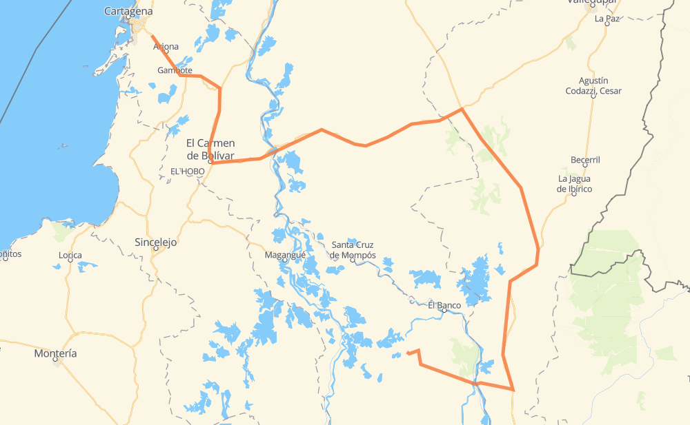
The distance from Turbaco to Altos del Rosario is 511 kilometers by road. Road takes approximately 6 hours and 22 minutes and goes through Arjona, San Juan Nepomuceno, San Jacinto, El Carmen de Bolívar, Nueva Granada, El Difícil and Bosconia.
| Shortest distance by air | 219 km ✈️ |
| Car route length | 511 km 🚗 |
| Driving time | 6 h 22 min |
| Fuel amount | 40.9 L |
| Fuel cost | 80.5 CAD |
| Point | Distance | Time | Fuel | |
| Turbaco | 0 km | 00 min | 0.0 L | |
|
90 15 km, 11 min
|
||||
| Arjona | 15 km | 11 min | 0.7 L | |
|
90 55 km, 39 min
|
||||
| San Juan Nepomuceno | 70 km | 51 min | 5.0 L | |
|
25 14 km, 10 min
|
||||
| San Jacinto | 84 km | 1 h 01 min | 6.2 L | |
|
25 29 km, 21 min
|
||||
| El Carmen de Bolívar | 113 km | 1 h 23 min | 7.4 L | |
|
80 155 km, 1 h 50 min
|
||||
| Bosconia | 268 km | 3 h 14 min | 20.1 L | |
|
45 39 km, 28 min
|
||||
| La Loma de Calenturas | 307 km | 3 h 42 min | 24.3 L | |
|
45 38 km, 26 min
|
||||
| San Roque | 344 km | 4 h 09 min | 26.7 L | |
|
45 45 km, 30 min
|
||||
| Pailitas | 389 km | 4 h 40 min | 31.0 L | |
|
45 129 km, 1 h 42 min
|
||||
| Altos del Rosario | 518 km | 6 h 22 min | 40.8 L | |
Frequently Asked Questions
How much does it cost to drive from Turbaco to Altos del Rosario?
Fuel cost: 80.5 CAD
This fuel cost is calculated as: (Route length 511 km / 100 km) * (Fuel consumption 8 L/100 km) * (Fuel price 1.97 CAD / L)
You can adjust fuel consumption and fuel price here.
How long is a car ride from Turbaco to Altos del Rosario?
Driving time: 6 h 22 min
This time is calculated for driving at the maximum permitted speed, taking into account traffic rules restrictions.
- 166 km with a maximum speed 90 km/h = 1 h 50 min
- 337 km with a maximum speed 80 km/h = 4 h 12 min
- 15 km with a maximum speed 50 km/h = 17 min
- 1 km with a maximum speed 20 km/h = 1 min
The calculated driving time does not take into account intermediate stops and traffic jams.
How far is Turbaco to Altos del Rosario by land?
The distance between Turbaco and Altos del Rosario is 511 km by road.
Precise satellite coordinates of highways were used for this calculation. The start and finish points are the centers of Turbaco and Altos del Rosario respectively.
How far is Turbaco to Altos del Rosario by plane?
The shortest distance (air line, as the crow flies) between Turbaco and Altos del Rosario is 219 km.
This distance is calculated using the Haversine formula as a great-circle distance between two points on the surface of a sphere. The start and finish points are the centers of Turbaco and Altos del Rosario respectively. Actual distance between airports may be different.
How many hours is Turbaco from Altos del Rosario by plane?
Boeing 737 airliner needs 16 min to cover the distance of 219 km at a cruising speed of 800 km/h.
Small plane "Cessna 172" needs 59 min to flight this distance at average speed of 220 km/h.
This time is approximate and do not take into account takeoff and landing times, airport location and other real world factors.
How long is a helicopter ride from Turbaco to Altos del Rosario?
Fast helicopter "Eurocopter AS350" or "Hughes OH-6 Cayuse" need 54 min to cover the distance of 219 km at a cruising speed of 240 km/h.
Popular "Robinson R44" needs 1 h 2 min to flight this distance at average speed of 210 km/h.
This time is approximate and do not take into account takeoff and landing times, aerodrome location and other real world factors.
What city is halfway between Turbaco and Altos del Rosario?
The halfway point between Turbaco and Altos del Rosario is Bosconia. It is located about 12 km from the exact midpoint by road.
The distance from Bosconia to Turbaco is 268 km and driving will take about 3 h 14 min. The road between Bosconia and Altos del Rosario has length 243 km and will take approximately 3 h 8 min.
The other cities located close to halfway point:
Where is Turbaco in relation to Altos del Rosario?
Turbaco is located 219 km north-west of Altos del Rosario.
Turbaco has geographic coordinates: latitude 10.33059, longitude -75.41273.
Altos del Rosario has geographic coordinates: latitude 8.79214, longitude -74.16389.
Which highway goes from Turbaco to Altos del Rosario?
The route from Turbaco to Altos del Rosario follows 45, 80.
Other minor sections pass along the road:
- 25: 44 km
- 90: 32 km