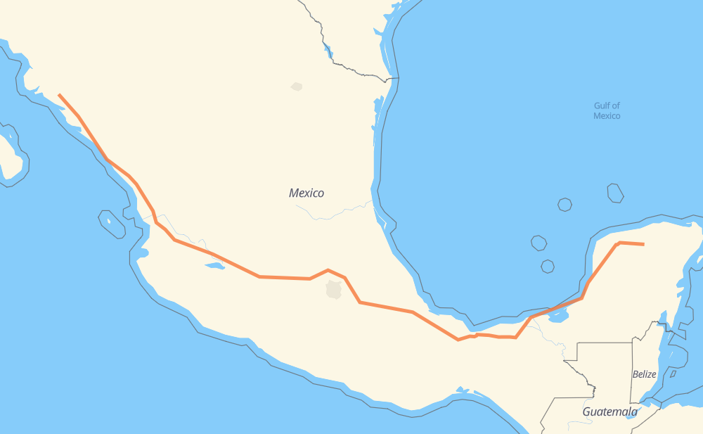
The distance from Tunkás to Las Brisas is 2,734 kilometers by road including 2,046 kilometers on motorways. Road takes approximately 29 hours and 52 minutes and goes through Izamal, Kanasín, Mérida, Orizaba, Tonalá, Tepic and Dimas (Estación Dimas).
How much does it cost to drive from Tunkás to Las Brisas?
Fuel cost:
428.7 CAD
This fuel cost is calculated as: (Route length 2,734 km / 100 km) * (Fuel consumption 8 L/100 km) * (Fuel price 1.96 CAD / L)
You can adjust fuel consumption and fuel price here.
Toll roads cost:
2,957 + ? MXN
How long is a car ride from Tunkás to Las Brisas?
Driving time:
29 h 52 min
This time is calculated for driving at the maximum permitted speed, taking into account traffic rules restrictions.
365 km with a maximum speed 110 km/h = 3 h 19 min
1,103 km with a maximum speed 100 km/h = 11 h 2 min
304 km with a maximum speed 90 km/h = 3 h 22 min
924 km with a maximum speed 80 km/h = 11 h 32 min
29 km with a maximum speed 70 km/h = 25 min
4 km with a maximum speed 60 km/h = 4 min
4 km with a maximum speed 40 km/h = 6 min
The calculated driving time does not take into account intermediate stops and traffic jams.
How far is Tunkás to Las Brisas by land?
The distance between Tunkás and Las Brisas is 2,734 km by road including 2,046 km on motorways.
Precise satellite coordinates of highways were used for this calculation. The start and finish points are the centers of Tunkás and Las Brisas respectively.
How far is Tunkás to Las Brisas by plane?
The shortest distance (air line, as the crow flies) between Tunkás and Las Brisas is 2,055 km.
This distance is calculated using the Haversine formula as a great-circle distance between two points on the surface of a sphere. The start and finish points are the centers of Tunkás and Las Brisas respectively. Actual distance between airports may be different.
How many hours is Tunkás from Las Brisas by plane?
Boeing 737 airliner needs 2 h 34 min to cover the distance of 2,055 km at a cruising speed of 800 km/h.
Small plane "Cessna 172" needs 9 h 20 min to flight this distance at average speed of 220 km/h.
This time is approximate and do not take into account takeoff and landing times, airport location and other real world factors.
How long is a helicopter ride from Tunkás to Las Brisas?
Fast helicopter "Eurocopter AS350" or "Hughes OH-6 Cayuse" need 8 h 33 min to cover the distance of 2,055 km at a cruising speed of 240 km/h.
Popular "Robinson R44" needs 9 h 47 min to flight this distance at average speed of 210 km/h.
This time is approximate and do not take into account takeoff and landing times, aerodrome location and other real world factors.
What city is halfway between Tunkás and Las Brisas?
The halfway point between Tunkás and Las Brisas is José María Morelos (San José). It is located about 3 km from the exact midpoint by road.
The distance from José María Morelos (San José) to Tunkás is 1,370 km and driving will take about 15 h 23 min. The road between José María Morelos (San José) and Las Brisas has length 1,364 km and will take approximately 14 h 29 min.
The other cities located close to halfway point:
Unidad Petrolera (Unidad Habitacional PEMEX) is in 1,319 km from Tunkás and 1,415 km from Las Brisas
Santa María Moyotzingo is in 1,316 km from Tunkás and 1,419 km from Las Brisas
San Miguel Xoxtla is in 1,304 km from Tunkás and 1,430 km from Las Brisas
Where is Tunkás in relation to Las Brisas?
Tunkás is located 2,055 km east of Las Brisas.
Tunkás has geographic coordinates: latitude 20.90233, longitude -88.75119.
Las Brisas has geographic coordinates: latitude 25.49033, longitude -108.24512.
Which highway goes from Tunkás to Las Brisas?
The route from Tunkás to Las Brisas follows MEX 15D, MEX 180, MEX 150D, MEX 145D, MEX M40D, MEX 180D.