Distance between Trenton ON and Seven Sisters Falls MB
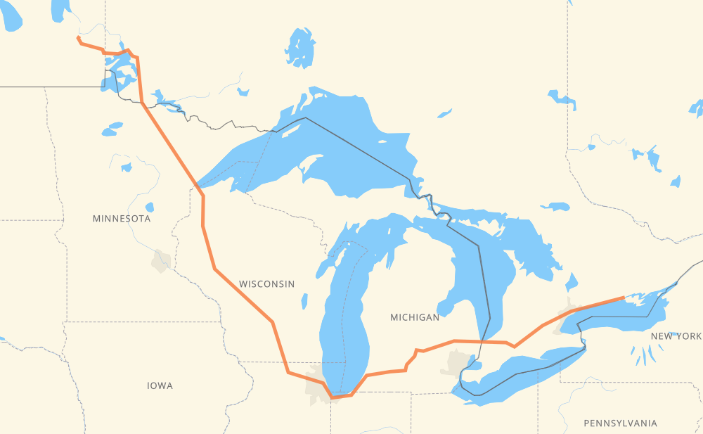
The distance from Trenton to Seven Sisters Falls is 2,373 kilometers by road including 1,586 kilometers on motorways. Road takes approximately 24 hours and 1 minute and goes through Oshawa, Ajax, Toronto, Mississauga, Kitchener, Woodstock and Sarnia.
| Shortest distance by air | 1,543 km ✈️ |
| Car route length | 2,373 km 🚗 |
| Driving time | 24 h 1 min |
| Fuel amount | 189.8 L |
| Fuel cost | 372.1 CAD |
| Point | Distance | Time | Fuel | |
| Trenton | 0 km | 00 min | 0.0 L | |
|
33 401 111 km, 1 h 07 min
|
||||
| Oshawa | 111 km | 1 h 07 min | 8.5 L | |
|
401 15 km, 08 min
|
||||
| Ajax | 126 km | 1 h 16 min | 9.8 L | |
|
401 32 km, 19 min
|
||||
| Toronto | 158 km | 1 h 35 min | 10.9 L | |
|
401 31 km, 18 min
|
||||
| Mississauga | 188 km | 1 h 53 min | 14.3 L | |
|
401 66 km, 39 min
|
||||
| Kitchener | 254 km | 2 h 33 min | 20.1 L | |
|
401 42 km, 25 min
|
||||
| Woodstock | 296 km | 2 h 58 min | 23.3 L | |
|
401 402 140 km, 1 h 19 min
|
||||
| Sarnia | 437 km | 4 h 18 min | 34.2 L | |
|
402 I 69 122 km, 1 h 12 min
|
||||
| Flint | 558 km | 5 h 30 min | 44.3 L | |
|
I 69 99 km, 53 min
|
||||
| Lansing | 657 km | 6 h 24 min | 52.4 L | |
|
I 69 102 km, 55 min
|
||||
| Kalamazoo | 758 km | 7 h 20 min | 60.5 L | |
|
I 94 I 90 409 km, 3 h 53 min
|
||||
| Janesville | 1,168 km | 11 h 13 min | 93.1 L | |
|
I 39 56 km, 30 min
|
||||
| Madison | 1,224 km | 11 h 44 min | 97.2 L | |
|
I 39 I 94 279 km, 2 h 33 min
|
||||
| Eau Claire | 1,504 km | 14 h 17 min | 119.6 L | |
|
US 53 247 km, 2 h 37 min
|
||||
| Duluth | 1,750 km | 16 h 55 min | 139.2 L | |
|
US 53 262 km, 2 h 59 min
|
||||
| International Falls | 2,012 km | 19 h 54 min | 160.4 L | |
|
US 53 71 226 km, 2 h 33 min
|
||||
| Kenora | 2,238 km | 22 h 28 min | 178.7 L | |
|
17A PTH 44 147 km, 1 h 40 min
|
||||
| Seven Sisters Falls | 2,385 km | 24 h 09 min | 190.2 L | |
Frequently Asked Questions
How much does it cost to drive from Trenton to Seven Sisters Falls?
Fuel cost: 372.1 CAD
This fuel cost is calculated as: (Route length 2,373 km / 100 km) * (Fuel consumption 8 L/100 km) * (Fuel price 1.96 CAD / L)
You can adjust fuel consumption and fuel price here.
How long is a car ride from Trenton to Seven Sisters Falls?
Driving time: 24 h 1 min
This time is calculated for driving at the maximum permitted speed, taking into account traffic rules restrictions.
- 1,006 km with a maximum speed 110 km/h = 9 h 8 min
- 106 km with a maximum speed 105 km/h = 1 h
- 431 km with a maximum speed 100 km/h = 4 h 18 min
- 645 km with a maximum speed 90 km/h = 7 h 10 min
- 31 km with a maximum speed 89 km/h = 21 min
- 3 km with a maximum speed 80 km/h = 2 min
- 120 km with a maximum speed 80 km/h = 1 h 30 min
- 10 km with a maximum speed 72 km/h = 8 min
- 2 km with a maximum speed 70 km/h = 1 min
- 1 km with a maximum speed 64 km/h = 1 min
- 3 km with a maximum speed 60 km/h = 3 min
- 7 km with a maximum speed 56 km/h = 7 min
- 2 km with a maximum speed 50 km/h = 2 min
- 3 km with a maximum speed 48 km/h = 3 min
The calculated driving time does not take into account intermediate stops and traffic jams.
How far is Trenton to Seven Sisters Falls by land?
The distance between Trenton and Seven Sisters Falls is 2,373 km by road including 1,586 km on motorways.
Precise satellite coordinates of highways were used for this calculation. The start and finish points are the centers of Trenton and Seven Sisters Falls respectively.
How far is Trenton to Seven Sisters Falls by plane?
The shortest distance (air line, as the crow flies) between Trenton and Seven Sisters Falls is 1,543 km.
This distance is calculated using the Haversine formula as a great-circle distance between two points on the surface of a sphere. The start and finish points are the centers of Trenton and Seven Sisters Falls respectively. Actual distance between airports may be different.
How many hours is Trenton from Seven Sisters Falls by plane?
Boeing 737 airliner needs 1 h 55 min to cover the distance of 1,543 km at a cruising speed of 800 km/h.
Small plane "Cessna 172" needs 7 h to flight this distance at average speed of 220 km/h.
This time is approximate and do not take into account takeoff and landing times, airport location and other real world factors.
How long is a helicopter ride from Trenton to Seven Sisters Falls?
Fast helicopter "Eurocopter AS350" or "Hughes OH-6 Cayuse" need 6 h 25 min to cover the distance of 1,543 km at a cruising speed of 240 km/h.
Popular "Robinson R44" needs 7 h 20 min to flight this distance at average speed of 210 km/h.
This time is approximate and do not take into account takeoff and landing times, aerodrome location and other real world factors.
What city is halfway between Trenton and Seven Sisters Falls?
The halfway point between Trenton and Seven Sisters Falls is Albion. It is located about 4 km from the exact midpoint by road.
The distance from Albion to Trenton is 1,190 km and driving will take about 11 h 25 min. The road between Albion and Seven Sisters Falls has length 1,183 km and will take approximately 12 h 35 min.
The other cities located close to halfway point:
Where is Trenton in relation to Seven Sisters Falls?
Trenton is located 1,543 km south-east of Seven Sisters Falls.
Trenton has geographic coordinates: latitude 44.10331, longitude -77.57589.
Seven Sisters Falls has geographic coordinates: latitude 50.1043, longitude -96.02582.
Which highway goes from Trenton to Seven Sisters Falls?
The route from Trenton to Seven Sisters Falls follows US 53, I 94, I 90, 401, I 69, 71, I 39, 402.
Other minor sections pass along the road:
- PTH 44: 83 km
- 17: 43 km
- 11: 40 km
- 17A: 33 km
- US 51: 30 km
- PTH 11: 25 km
- US 41: 22 km
- US 2: 18 km
- MN 194: 10 km
- I 96: 8 km
- US 53-MN 1: 7 km
- MN 37: 6 km
- US 63: 6 km
- US 31: 5 km
- MN 1: 4 km
- I 535: 4 km
- PTH 1: 4 km
- 33: 4 km
- US 12: 3 km
- US 20: 3 km
- WI 11: 3 km
- PR 307: 3 km
- 611: 2 km