Distance between Tapachula and Ejido Nuevo Sacramento
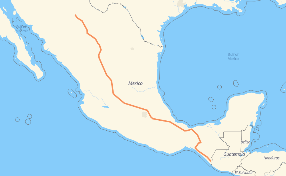
The distance from Tapachula to Ejido Nuevo Sacramento is 2,614 kilometers by road including 1,506 kilometers on motorways. Road takes approximately 27 hours and 56 minutes and goes through Orizaba, Celaya, Salamanca, Aguascalientes, Fresnillo, Jiménez and Camargo.
| Shortest distance by air | 2,108 km ✈️ |
| Car route length | 2,614 km 🚗 |
| Driving time | 27 h 56 min |
| Fuel amount | 209.1 L |
| Fuel cost | 411.9 CAD |
| Toll roads cost | 2,317 + ? MXN |
| Point | Distance | Time | Fuel | |
| Tapachula | 0 km | 00 min | 0.0 L | |
|
MEX 200 885 km, 9 h 39 min
|
||||
| Orizaba | 885 km | 9 h 39 min | 70.5 L | |
|
MEX 150D 514 km, 5 h 24 min
|
||||
| Celaya | 1,400 km | 15 h 03 min | 111.8 L | |
|
MEX 45D 34 km, 20 min
|
||||
| Salamanca | 1,434 km | 15 h 24 min | 114.7 L | |
|
MEX 45D 208 km, 2 h 03 min
|
||||
| Aguascalientes | 1,642 km | 17 h 27 min | 130.9 L | |
|
MEX 45 MEX 45D 172 km, 1 h 56 min
|
||||
| Fresnillo | 1,814 km | 19 h 24 min | 144.3 L | |
|
MEX 45D MEX 49D 577 km, 6 h 03 min
|
||||
| Jiménez | 2,391 km | 25 h 27 min | 188.7 L | |
|
MEX 45D 44 km, 28 min
|
||||
| Camargo | 2,434 km | 25 h 56 min | 194.3 L | |
|
MEX 45 MEX 45D 68 km, 42 min
|
||||
| Delicias | 2,503 km | 26 h 38 min | 199.8 L | |
|
MEX 45 115 km, 1 h 17 min
|
||||
| Ejido Nuevo Sacramento | 2,618 km | 27 h 56 min | 209.1 L | |
Frequently Asked Questions
How many toll booths are there from Tapachula to Ejido Nuevo Sacramento?
There are 38 toll booths between Tapachula and Ejido Nuevo Sacramento: Libramiento Oriente de Chihuahua - Sacramento, Libramiento Oriente de Chihuahua - Jimenez, Saucillo, Camargo, Jimenez, Savalza, León Guzmán, Fortín, Cuitláhuac, Cosamaloapan, Acayucan, Antonio Dovali, Las Choapas, Ceballos, Bermejillo, Cuencame, Morfín Chávez, Calera, Veta Grande, Zacatecas, Encarnacion De Diaz, León - Aguascalientes, Puerto Interior, Mendoza, Cerro Gordo, Apaseo el Grande, Queretaro, Palmillas, San Martin Texmelucan, San Martín, Amozoc 2, Amozoc, Esperanza 27, Arriaga, Jiquipilas, Ocozocoautla, Ocozocoautla 182 and Malpasito.
How much does the toll booths cost from Tapachula to Ejido Nuevo Sacramento?
Toll roads cost: Arriaga (37 MXN) + Jiquipilas (15-60 MXN) + Ocozocoautla (38 MXN) + Ocozocoautla 182 (82 MXN) + Malpasito (82 MXN) + Las Choapas (82 MXN) + Antonio Dovali (20 MXN) + Acayucan (?) + Cosamaloapan (229 MXN) + Cuitláhuac (114 MXN) + Fortín (33 MXN) + Esperanza 27 (140 MXN) + Amozoc (72 MXN) + Amozoc 2 (81 MXN) + San Martín (42 MXN) + San Martin Texmelucan (?) + Queretaro (?) + Palmillas (89 MXN) + Apaseo el Grande (?) + Cerro Gordo (?) + Mendoza (53 MXN) + Puerto Interior (?) + León - Aguascalientes (153 MXN) + Encarnacion De Diaz (150 MXN) + Zacatecas (41 MXN) + Veta Grande (48 MXN) + Calera (23 MXN) + Morfín Chávez (40 MXN) + Cuencame (?) + León Guzmán (?) + Bermejillo (127 MXN) + Ceballos (145 MXN) + Savalza (71 MXN) + Jimenez (97 MXN) + Camargo (71 MXN) + Saucillo (71 MXN) + Libramiento Oriente de Chihuahua - Jimenez (35 MXN) + Libramiento Oriente de Chihuahua - Sacramento (36 MXN) = 2,317 + ? MXN
How much does it cost to drive from Tapachula to Ejido Nuevo Sacramento?
Fuel cost: 411.9 CAD
This fuel cost is calculated as: (Route length 2,614 km / 100 km) * (Fuel consumption 8 L/100 km) * (Fuel price 1.97 CAD / L)
You can adjust fuel consumption and fuel price here.
Toll roads cost: 2,317 + ? MXN
How long is a car ride from Tapachula to Ejido Nuevo Sacramento?
Driving time: 27 h 56 min
This time is calculated for driving at the maximum permitted speed, taking into account traffic rules restrictions.
- 512 km with a maximum speed 110 km/h = 4 h 39 min
- 772 km with a maximum speed 100 km/h = 7 h 43 min
- 949 km with a maximum speed 90 km/h = 10 h 32 min
- 344 km with a maximum speed 80 km/h = 4 h 18 min
- 11 km with a maximum speed 70 km/h = 9 min
- 23 km with a maximum speed 60 km/h = 22 min
- 2 km with a maximum speed 50 km/h = 2 min
- 4 km with a maximum speed 40 km/h = 5 min
- 2 km with a maximum speed 30 km/h = 3 min
The calculated driving time does not take into account intermediate stops and traffic jams.
How far is Tapachula to Ejido Nuevo Sacramento by land?
The distance between Tapachula and Ejido Nuevo Sacramento is 2,614 km by road including 1,506 km on motorways.
Precise satellite coordinates of highways were used for this calculation. The start and finish points are the centers of Tapachula and Ejido Nuevo Sacramento respectively.
How far is Tapachula to Ejido Nuevo Sacramento by plane?
The shortest distance (air line, as the crow flies) between Tapachula and Ejido Nuevo Sacramento is 2,108 km.
This distance is calculated using the Haversine formula as a great-circle distance between two points on the surface of a sphere. The start and finish points are the centers of Tapachula and Ejido Nuevo Sacramento respectively. Actual distance between airports may be different.
How many hours is Tapachula from Ejido Nuevo Sacramento by plane?
Boeing 737 airliner needs 2 h 38 min to cover the distance of 2,108 km at a cruising speed of 800 km/h.
Small plane "Cessna 172" needs 9 h 34 min to flight this distance at average speed of 220 km/h.
This time is approximate and do not take into account takeoff and landing times, airport location and other real world factors.
How long is a helicopter ride from Tapachula to Ejido Nuevo Sacramento?
Fast helicopter "Eurocopter AS350" or "Hughes OH-6 Cayuse" need 8 h 47 min to cover the distance of 2,108 km at a cruising speed of 240 km/h.
Popular "Robinson R44" needs 10 h 2 min to flight this distance at average speed of 210 km/h.
This time is approximate and do not take into account takeoff and landing times, aerodrome location and other real world factors.
What city is halfway between Tapachula and Ejido Nuevo Sacramento?
The halfway point between Tapachula and Ejido Nuevo Sacramento is Santa Bárbara de la Cueva. It is located about 6 km from the exact midpoint by road.
The distance from Santa Bárbara de la Cueva to Tapachula is 1,301 km and driving will take about 14 h 8 min. The road between Santa Bárbara de la Cueva and Ejido Nuevo Sacramento has length 1,313 km and will take approximately 13 h 47 min.
The other cities located close to halfway point:
Where is Tapachula in relation to Ejido Nuevo Sacramento?
Tapachula is located 2,108 km south-east of Ejido Nuevo Sacramento.
Tapachula has geographic coordinates: latitude 14.90994, longitude -92.26497.
Ejido Nuevo Sacramento has geographic coordinates: latitude 28.82753, longitude -106.18119.
Which highway goes from Tapachula to Ejido Nuevo Sacramento?
The route from Tapachula to Ejido Nuevo Sacramento follows MEX 45D, MEX 49D, MEX 150D, MEX 49, MEX 200, MEX 180D, MEX 145D, MEX 45, MEX M40D.
Other minor sections pass along the road:
- MEX 40D: 89 km
- MEX 47D: 84 km
- MEX 43D: 77 km
- MEX 195D: 70 km
- MEX 57D: 56 km
- MEX 70: 50 km
- MEX 190D: 23 km
- MEX 40: 9 km
- MEX 190: 7 km
- MEX 180: 7 km
- Tapachula Arriaga: 2 km
- MEX 140D: 2 km