Distance between Stazione and El Velerín
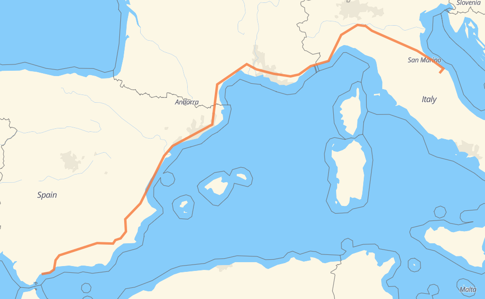
The distance from Stazione to El Velerín is 2,375 kilometers by road including 2,266 kilometers on motorways. Road takes approximately 22 hours and 50 minutes and goes through Pesaro, Rimini, Forlì, Bolonia, Módena, Reggio Emilia and Parme.
| Shortest distance by air | 1,736 km ✈️ |
| Car route length | 2,375 km 🚗 |
| Driving time | 22 h 50 min |
| Fuel amount | 190 L |
| Fuel cost | 372.3 CAD |
| Point | Distance | Time | Fuel | |
| Stazione | 0 km | 00 min | 0.0 L | |
|
SP11 A14 79 km, 47 min
|
||||
| Pesaro | 79 km | 47 min | 5.5 L | |
|
A14 37 km, 20 min
|
||||
| Rimini | 116 km | 1 h 07 min | 8.6 L | |
|
A14 44 km, 23 min
|
||||
| Forlì | 159 km | 1 h 31 min | 12.1 L | |
|
A14 68 km, 38 min
|
||||
| Bolonia | 227 km | 2 h 10 min | 17.5 L | |
|
A14 A1 38 km, 21 min
|
||||
| Módena | 265 km | 2 h 32 min | 20.6 L | |
|
A1 22 km, 11 min
|
||||
| Reggio Emilia | 287 km | 2 h 44 min | 21.8 L | |
|
A1 31 km, 16 min
|
||||
| Parme | 318 km | 3 h 00 min | 24.8 L | |
|
A1 56 km, 32 min
|
||||
| Plasencia | 374 km | 3 h 33 min | 29.3 L | |
|
A21 147 km, 1 h 24 min
|
||||
| Genoa | 521 km | 4 h 57 min | 41.3 L | |
|
A26 A 10 30 km, 16 min
|
||||
| Savone | 551 km | 5 h 14 min | 43.8 L | |
|
A10 147 km, 1 h 23 min
|
||||
| Niza | 699 km | 6 h 37 min | 55.3 L | |
|
A 8 177 km, 1 h 39 min
|
||||
| Aix-en-Provence | 875 km | 8 h 16 min | 69.5 L | |
|
A 8 A 54 99 km, 58 min
|
||||
| Nîmes | 975 km | 9 h 15 min | 77.7 L | |
|
A 54 A 9 45 km, 24 min
|
||||
| Montpellier | 1,020 km | 9 h 39 min | 81.2 L | |
|
A 9 151 km, 1 h 22 min
|
||||
| Perpiñán | 1,170 km | 11 h 02 min | 93.1 L | |
|
A 9 AP-7 1,185 km, 11 h 33 min
|
||||
| Marbella | 2,356 km | 22 h 35 min | 188.3 L | |
|
A-7 21 km, 16 min
|
||||
| El Velerín | 2,377 km | 22 h 51 min | 189.9 L | |
Frequently Asked Questions
How much does it cost to drive from Stazione to El Velerín?
Fuel cost: 372.3 CAD
This fuel cost is calculated as: (Route length 2,375 km / 100 km) * (Fuel consumption 8 L/100 km) * (Fuel price 1.96 CAD / L)
You can adjust fuel consumption and fuel price here.
How long is a car ride from Stazione to El Velerín?
Driving time: 22 h 50 min
This time is calculated for driving at the maximum permitted speed, taking into account traffic rules restrictions.
- 1,785 km with a maximum speed 110 km/h = 16 h 13 min
- 283 km with a maximum speed 100 km/h = 2 h 49 min
- 133 km with a maximum speed 90 km/h = 1 h 28 min
- 155 km with a maximum speed 80 km/h = 1 h 56 min
- 4 km with a maximum speed 70 km/h = 3 min
- 5 km with a maximum speed 60 km/h = 4 min
- 3 km with a maximum speed 50 km/h = 4 min
- 6 km with a maximum speed 40 km/h = 9 min
The calculated driving time does not take into account intermediate stops and traffic jams.
How far is Stazione to El Velerín by land?
The distance between Stazione and El Velerín is 2,375 km by road including 2,266 km on motorways.
Precise satellite coordinates of highways were used for this calculation. The start and finish points are the centers of Stazione and El Velerín respectively.
How far is Stazione to El Velerín by plane?
The shortest distance (air line, as the crow flies) between Stazione and El Velerín is 1,736 km.
This distance is calculated using the Haversine formula as a great-circle distance between two points on the surface of a sphere. The start and finish points are the centers of Stazione and El Velerín respectively. Actual distance between airports may be different.
How many hours is Stazione from El Velerín by plane?
Boeing 737 airliner needs 2 h 10 min to cover the distance of 1,736 km at a cruising speed of 800 km/h.
Small plane "Cessna 172" needs 7 h 53 min to flight this distance at average speed of 220 km/h.
This time is approximate and do not take into account takeoff and landing times, airport location and other real world factors.
How long is a helicopter ride from Stazione to El Velerín?
Fast helicopter "Eurocopter AS350" or "Hughes OH-6 Cayuse" need 7 h 14 min to cover the distance of 1,736 km at a cruising speed of 240 km/h.
Popular "Robinson R44" needs 8 h 16 min to flight this distance at average speed of 210 km/h.
This time is approximate and do not take into account takeoff and landing times, aerodrome location and other real world factors.
What city is halfway between Stazione and El Velerín?
The halfway point between Stazione and El Velerín is Le Boulou. It is located about 2 km from the exact midpoint by road.
The distance from Le Boulou to Stazione is 1,189 km and driving will take about 11 h 10 min. The road between Le Boulou and El Velerín has length 1,185 km and will take approximately 11 h 40 min.
The other cities located close to halfway point:
Where is Stazione in relation to El Velerín?
Stazione is located 1,736 km north-east of El Velerín.
Stazione has geographic coordinates: latitude 43.50141, longitude 13.14941.
El Velerín has geographic coordinates: latitude 36.45073, longitude -5.08674.
Which highway goes from Stazione to El Velerín?
The route from Stazione to El Velerín follows AP-7, A 9, A 8, A14, A-7, A1, A-92N, A-92, A10.
Other minor sections pass along the road:
- A21: 76 km
- A-33: 66 km
- A 54: 48 km
- A26: 44 km
- A-35: 32 km
- N-344: 31 km
- A-92M: 26 km
- AP-46: 26 km
- SS76: 22 km
- N 113: 20 km
- V-21: 18 km
- A-91: 17 km
- A26/A7: 16 km
- V-31: 14 km
- A-30: 11 km
- A 10: 11 km
- A 7: 11 km
- A7: 8 km
- N 572: 4 km
- RM-424: 4 km
- MA-30: 3 km
- A-45: 2 km