Distance between Santarém and Altamira
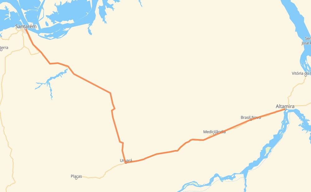
The distance from Santarém to Altamira is 403 kilometers by road. Road takes approximately 5 hours and 19 minutes and goes through Jacamin, Tipizal, Curuá-Una, Cicero Mendes, São Marcos, Carlos Pena Filho and Agrovila União.
| Shortest distance by air | 289 km ✈️ |
| Car route length | 403 km 🚗 |
| Driving time | 5 h 19 min |
| Fuel amount | 32.2 L |
| Fuel cost | 63.2 CAD |
| Point | Distance | Time | Fuel | |
| -2.43849, -54.69961 | 0 km | 00 min | 0.0 L | |
|
PA-370 19 km, 13 min
|
||||
| Jacamin | 19 km | 13 min | 2.1 L | |
|
PA-370 11 km, 08 min
|
||||
| Santa Rosa | 30 km | 21 min | 3.1 L | |
|
PA-370 21 km, 15 min
|
||||
| Sagrado Coração de Jesus | 51 km | 37 min | 3.9 L | |
|
PA-370 51 km, 52 min
|
||||
| Curuá-Una | 102 km | 1 h 30 min | 6.6 L | |
|
PA-370 145 km, 2 h 01 min
|
||||
| São Marcos | 247 km | 3 h 31 min | 19.9 L | |
|
BR-230 120 km, 1 h 21 min
|
||||
| Carlos Pena Filho | 367 km | 4 h 52 min | 30.2 L | |
|
BR-230 16 km, 11 min
|
||||
| Agrovila União | 382 km | 5 h 04 min | 30.6 L | |
|
BR-230 21 km, 15 min
|
||||
| -3.20407, -52.20996 | 403 km | 5 h 19 min | 33.3 L | |
Hotels of Altamira
Frequently Asked Questions
How much does it cost to drive from Santarém to Altamira?
Fuel cost: 63.2 CAD
This fuel cost is calculated as: (Route length 403 km / 100 km) * (Fuel consumption 8 L/100 km) * (Fuel price 1.96 CAD / L)
You can adjust fuel consumption and fuel price here.
How long is a car ride from Santarém to Altamira?
Driving time: 5 h 19 min
This time is calculated for driving at the maximum permitted speed, taking into account traffic rules restrictions.
- 146 km with a maximum speed 90 km/h = 1 h 37 min
- 192 km with a maximum speed 80 km/h = 2 h 23 min
- 65 km with a maximum speed 50 km/h = 1 h 18 min
The calculated driving time does not take into account intermediate stops and traffic jams.
How far is Santarém to Altamira by land?
The distance between Santarém and Altamira is 403 km by road.
Precise satellite coordinates of highways were used for this calculation. The start and finish points are the centers of Santarém and Altamira respectively.
How far is Santarém to Altamira by plane?
The shortest distance (air line, as the crow flies) between Santarém and Altamira is 289 km.
This distance is calculated using the Haversine formula as a great-circle distance between two points on the surface of a sphere. The start and finish points are the centers of Santarém and Altamira respectively. Actual distance between airports may be different.
How many hours is Santarém from Altamira by plane?
Boeing 737 airliner needs 21 min to cover the distance of 289 km at a cruising speed of 800 km/h.
Small plane "Cessna 172" needs 1 h 18 min to flight this distance at average speed of 220 km/h.
This time is approximate and do not take into account takeoff and landing times, airport location and other real world factors.
How long is a helicopter ride from Santarém to Altamira?
Fast helicopter "Eurocopter AS350" or "Hughes OH-6 Cayuse" need 1 h 12 min to cover the distance of 289 km at a cruising speed of 240 km/h.
Popular "Robinson R44" needs 1 h 22 min to flight this distance at average speed of 210 km/h.
This time is approximate and do not take into account takeoff and landing times, aerodrome location and other real world factors.
What city is halfway between Santarém and Altamira?
The halfway point between Santarém and Altamira is São Marcos. It is located about 45 km from the exact midpoint by road.
The distance from São Marcos to Santarém is 247 km and driving will take about 3 h 31 min. The road between São Marcos and Altamira has length 156 km and will take approximately 1 h 48 min.
Where is Santarém in relation to Altamira?
Santarém is located 289 km north-west of Altamira.
Santarém has geographic coordinates: latitude -2.43849, longitude -54.69961.
Altamira has geographic coordinates: latitude -3.20407, longitude -52.20996.
Which highway goes from Santarém to Altamira?
The route from Santarém to Altamira follows PA-370, BR-230.