Distance between Santa Cruz and 22
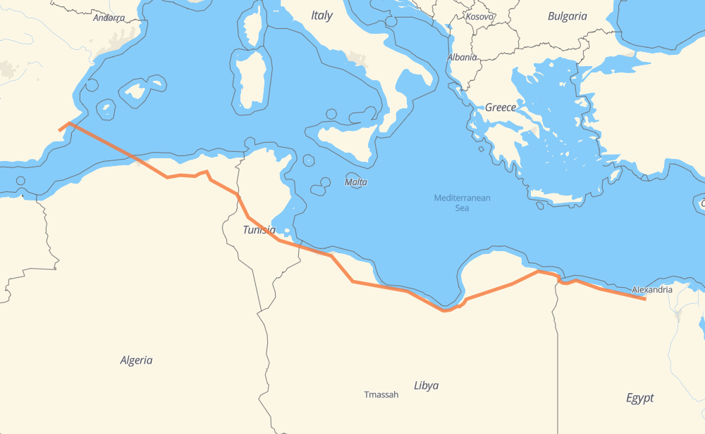
The distance from Santa Cruz to 22 is 3,531 kilometers by road including 524 kilometers on motorways. Road takes approximately 54 hours and 35 minutes and goes through Algiers, Bordj Bou Arreridjj, Setif, El Eulma, Constantine, Tebessa and Zuwarah.
| Shortest distance by air | 2,913 km ✈️ |
| Car route length | 3,531 km 🚗 |
| Driving time | 54 h 35 min |
| Fuel amount | 282.5 L |
| Fuel cost | 553.6 CAD |
| Point | Distance | Time | Fuel | |
| Santa Cruz | 0 km | 00 min | 0.0 L | |
|
RM-F2 A1 639 km, 21 h 01 min
|
||||
| Bordj Bou Arreridjj | 639 km | 21 h 01 min | 50.5 L | |
|
A1 65 km, 35 min
|
||||
| Setif | 704 km | 21 h 36 min | 55.9 L | |
|
A1 26 km, 14 min
|
||||
| El Eulma | 731 km | 21 h 50 min | 57.8 L | |
|
A1 98 km, 55 min
|
||||
| Constantine | 828 km | 22 h 46 min | 65.5 L | |
|
A1 RN 10 194 km, 2 h 22 min
|
||||
| Tebessa | 1,022 km | 25 h 08 min | 80.8 L | |
|
RN 16 RN 15 ط و 558 km, 6 h 40 min
|
||||
| Zuwarah | 1,580 km | 31 h 48 min | 125.2 L | |
|
1 37 km, 27 min
|
||||
| Sabrata | 1,617 km | 32 h 15 min | 128.5 L | |
|
1 23 km, 17 min
|
||||
| Al Zawiyah | 1,641 km | 32 h 33 min | 130.9 L | |
|
1 15 km, 10 min
|
||||
| Al-Zahra الزهراء | 1,655 km | 32 h 44 min | 131.6 L | |
|
3 173 km, 1 h 57 min
|
||||
| Bani Walid | 1,828 km | 34 h 41 min | 146.0 L | |
|
1 702 km, 8 h 19 min
|
||||
| Ajdabiya | 2,530 km | 43 h 01 min | 202.2 L | |
|
5 633 km, 7 h 13 min
|
||||
| Al Sellum | 3,163 km | 50 h 15 min | 244.6 L | |
|
10 371 km, 4 h 21 min
|
||||
| 22 | 3,534 km | 54 h 36 min | 282.6 L | |
Frequently Asked Questions
How much does it cost to drive from Santa Cruz to 22?
Fuel cost: 553.6 CAD
This fuel cost is calculated as: (Route length 3,531 km / 100 km) * (Fuel consumption 8 L/100 km) * (Fuel price 1.96 CAD / L)
You can adjust fuel consumption and fuel price here.
How long is a car ride from Santa Cruz to 22?
Driving time: 54 h 35 min
This time is calculated for driving at the maximum permitted speed, taking into account traffic rules restrictions.
- 378 km with a maximum speed 110 km/h = 3 h 26 min
- 108 km with a maximum speed 100 km/h = 1 h 4 min
- 1,710 km with a maximum speed 90 km/h = 19 h
- 881 km with a maximum speed 80 km/h = 11 h
- 11 km with a maximum speed 60 km/h = 11 min
- 73 km with a maximum speed 50 km/h = 1 h 28 min
- 3 km with a maximum speed 40 km/h = 4 min
- 2 km with a maximum speed 30 km/h = 3 min
- 365 km with a maximum speed 20 km/h = 18 h 15 min
The calculated driving time does not take into account intermediate stops and traffic jams.
How far is Santa Cruz to 22 by land?
The distance between Santa Cruz and 22 is 3,531 km by road including 524 km on motorways.
Precise satellite coordinates of highways were used for this calculation. The start and finish points are the centers of Santa Cruz and 22 respectively.
How far is Santa Cruz to 22 by plane?
The shortest distance (air line, as the crow flies) between Santa Cruz and 22 is 2,913 km.
This distance is calculated using the Haversine formula as a great-circle distance between two points on the surface of a sphere. The start and finish points are the centers of Santa Cruz and 22 respectively. Actual distance between airports may be different.
How many hours is Santa Cruz from 22 by plane?
Boeing 737 airliner needs 3 h 38 min to cover the distance of 2,913 km at a cruising speed of 800 km/h.
Small plane "Cessna 172" needs 13 h 14 min to flight this distance at average speed of 220 km/h.
This time is approximate and do not take into account takeoff and landing times, airport location and other real world factors.
How long is a helicopter ride from Santa Cruz to 22?
Fast helicopter "Eurocopter AS350" or "Hughes OH-6 Cayuse" need 12 h 8 min to cover the distance of 2,913 km at a cruising speed of 240 km/h.
Popular "Robinson R44" needs 13 h 52 min to flight this distance at average speed of 210 km/h.
This time is approximate and do not take into account takeoff and landing times, aerodrome location and other real world factors.
What city is halfway between Santa Cruz and 22?
The halfway point between Santa Cruz and 22 is Musayyah مسياه. It is located about 31 km from the exact midpoint by road.
The distance from Musayyah مسياه to Santa Cruz is 1,735 km and driving will take about 33 h 37 min. The road between Musayyah مسياه and 22 has length 1,796 km and will take approximately 20 h 57 min.
The other cities located close to halfway point:
Where is Santa Cruz in relation to 22?
Santa Cruz is located 2,913 km west of 22.
Santa Cruz has geographic coordinates: latitude 38.01413, longitude -1.05355.
22 has geographic coordinates: latitude 30.75456, longitude 29.60502.
Which highway goes from Santa Cruz to 22?
The route from Santa Cruz to 22 follows 1, 10, A1, 5, RN 15 ط و, RN 10, 3, RN 1 ط و.
Other minor sections pass along the road:
- A 1 طس: 73 km
- A-7: 41 km
- RN 11: 20 km
- RN 3: 17 km
- A-70: 14 km
- RN 16: 11 km
- RM-414: 4 km
- 2: 4 km
- A-31: 4 km
- RM-303: 4 km
- RM-F2: 2 km
- RN 16 ط و: 2 km
- RR 124 ط ج: 1 km