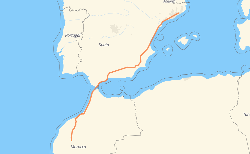
The distance from Sant Celoni to Marrakesh is 1,763 kilometers by road including 1,623 kilometers on motorways. Road takes approximately 18 hours and 38 minutes and goes through Castellón de la Plana, Marbella, Algeciras, Tangier, Arcila, Larache and Mohammedia.
How much does it cost to drive from Sant Celoni to Marrakesh?
Fuel cost:
276.4 CAD
This fuel cost is calculated as: (Route length 1,763 km / 100 km) * (Fuel consumption 8 L/100 km) * (Fuel price 1.96 CAD / L)
You can adjust fuel consumption and fuel price here.
How long is a car ride from Sant Celoni to Marrakesh?
Driving time:
18 h 38 min
This time is calculated for driving at the maximum permitted speed, taking into account traffic rules restrictions.
1,131 km with a maximum speed 110 km/h = 10 h 16 min
353 km with a maximum speed 100 km/h = 3 h 31 min
49 km with a maximum speed 90 km/h = 32 min
164 km with a maximum speed 80 km/h = 2 h 3 min
25 km with a maximum speed 60 km/h = 25 min
4 km with a maximum speed 50 km/h = 4 min
3 km with a maximum speed 40 km/h = 5 min
1 km with a maximum speed 30 km/h = 1 min
32 km with a maximum speed 20 km/h = 1 h 37 min
The calculated driving time does not take into account intermediate stops and traffic jams.
How far is Sant Celoni to Marrakesh by land?
The distance between Sant Celoni and Marrakesh is 1,763 km by road including 1,623 km on motorways.
Precise satellite coordinates of highways were used for this calculation. The start and finish points are the centers of Sant Celoni and Marrakesh respectively.
How far is Sant Celoni to Marrakesh by plane?
The shortest distance (air line, as the crow flies) between Sant Celoni and Marrakesh is 1,456 km.
This distance is calculated using the Haversine formula as a great-circle distance between two points on the surface of a sphere. The start and finish points are the centers of Sant Celoni and Marrakesh respectively. Actual distance between airports may be different.
How many hours is Sant Celoni from Marrakesh by plane?
Boeing 737 airliner needs 1 h 49 min to cover the distance of 1,456 km at a cruising speed of 800 km/h.
Small plane "Cessna 172" needs 6 h 37 min to flight this distance at average speed of 220 km/h.
This time is approximate and do not take into account takeoff and landing times, airport location and other real world factors.
How long is a helicopter ride from Sant Celoni to Marrakesh?
Fast helicopter "Eurocopter AS350" or "Hughes OH-6 Cayuse" need 6 h 4 min to cover the distance of 1,456 km at a cruising speed of 240 km/h.
Popular "Robinson R44" needs 6 h 56 min to flight this distance at average speed of 210 km/h.
This time is approximate and do not take into account takeoff and landing times, aerodrome location and other real world factors.
What city is halfway between Sant Celoni and Marrakesh?
The halfway point between Sant Celoni and Marrakesh is Atarfe. It is located about 4 km from the exact midpoint by road.
The distance from Atarfe to Sant Celoni is 877 km and driving will take about 8 h 33 min. The road between Atarfe and Marrakesh has length 886 km and will take approximately 10 h 4 min.
The other cities located close to halfway point:
Chauchina is in 886 km from Sant Celoni and 876 km from Marrakesh
Cijuela is in 889 km from Sant Celoni and 874 km from Marrakesh
Peligros is in 871 km from Sant Celoni and 892 km from Marrakesh
Where is Sant Celoni in relation to Marrakesh?
Sant Celoni is located 1,456 km north-east of Marrakesh.
Sant Celoni has geographic coordinates: latitude 41.69014, longitude 2.49167.
Marrakesh has geographic coordinates: latitude 31.62599, longitude -7.98861.
Which highway goes from Sant Celoni to Marrakesh?
The route from Sant Celoni to Marrakesh follows AP-7, A5, A3, A-7, A-92N, A-92.