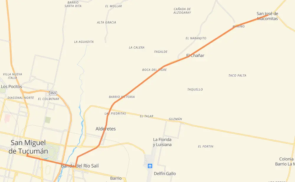
Distance between San Miguel de Tucumán and San José de Macomitas
The distance from San Miguel de Tucumán to San José de Macomitas is 25 kilometers by road. Road takes approximately 18 minutes and goes through Banda del Río Salí, El Chañar and La Ramada.
| Shortest distance by air | 22 km ✈️ |
| Car route length | 25 km 🚗 |
| Driving time | 18 min |
| Fuel amount | 2 L |
| Fuel cost | 3.9 CAD |
| Point | Distance | Time | Fuel | |
| San Miguel de Tucumán | 0 km | 00 min | 0.0 L | |
|
5 km, 04 min
|
||||
| Banda del Río Salí | 5 km | 04 min | 0.3 L | |
|
RP304 11 km, 08 min
|
||||
| El Chañar | 16 km | 12 min | 0.9 L | |
|
RP304 9 km, 06 min
|
||||
| San José de Macomitas | 25 km | 18 min | 1.8 L | |
Frequently Asked Questions
How much does it cost to drive from San Miguel de Tucumán to San José de Macomitas?
Fuel cost: 3.9 CAD
This fuel cost is calculated as: (Route length 25 km / 100 km) * (Fuel consumption 8 L/100 km) * (Fuel price 1.96 CAD / L)
You can adjust fuel consumption and fuel price here.
How long is a car ride from San Miguel de Tucumán to San José de Macomitas?
Driving time: 18 min
This time is calculated for driving at the maximum permitted speed, taking into account traffic rules restrictions.
- 5 km with a maximum speed 90 km/h = 3 min
- 19 km with a maximum speed 80 km/h = 14 min
- 1 km with a maximum speed 60 km/h = 1 min
The calculated driving time does not take into account intermediate stops and traffic jams.
How far is San Miguel de Tucumán to San José de Macomitas by land?
The distance between San Miguel de Tucumán and San José de Macomitas is 25 km by road.
Precise satellite coordinates of highways were used for this calculation. The start and finish points are the centers of San Miguel de Tucumán and San José de Macomitas respectively.
What city is halfway between San Miguel de Tucumán and San José de Macomitas?
The halfway point between San Miguel de Tucumán and San José de Macomitas is El Chañar. It is located about 4 km from the exact midpoint by road.
The distance from El Chañar to San Miguel de Tucumán is 16 km and driving will take about 12 min. The road between El Chañar and San José de Macomitas has length 9 km and will take approximately 6 min.
Where is San Miguel de Tucumán in relation to San José de Macomitas?
San Miguel de Tucumán is located 22 km south-west of San José de Macomitas.
San Miguel de Tucumán has geographic coordinates: latitude -26.83037, longitude -65.20381.
San José de Macomitas has geographic coordinates: latitude -26.72978, longitude -65.01028.
Which highway goes from San Miguel de Tucumán to San José de Macomitas?
The route from San Miguel de Tucumán to San José de Macomitas follows RP304.