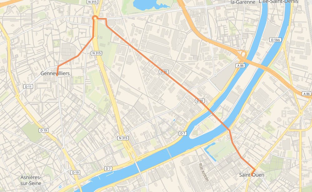
Distance between Saint-Ouen and Gennevilliers
The distance from Saint-Ouen to Gennevilliers is 5 kilometers by road. Road takes approximately 5 minutes.
| Shortest distance by air | 3 km ✈️ |
| Car route length | 5 km 🚗 |
| Driving time | 5 min |
| Fuel amount | 0.4 L |
| Fuel cost | 0.7 CAD |
| Point | Distance | Time | Fuel | |
| Saint-Ouen | 0 km | 00 min | 0.0 L | |
|
D 22 D 20 5 km, 05 min
|
||||
| Gennevilliers | 5 km | 05 min | 0.1 L | |
Hotels of Gennevilliers
Frequently Asked Questions
How much does it cost to drive from Saint-Ouen to Gennevilliers?
Fuel cost: 0.7 CAD
This fuel cost is calculated as: (Route length 5 km / 100 km) * (Fuel consumption 8 L/100 km) * (Fuel price 1.96 CAD / L)
You can adjust fuel consumption and fuel price here.
How long is a car ride from Saint-Ouen to Gennevilliers?
Driving time: 5 min
This time is calculated for driving at the maximum permitted speed, taking into account traffic rules restrictions.
- 1 km with a maximum speed 80 km/h = 1 min
- 3 km with a maximum speed 50 km/h = 3 min
The calculated driving time does not take into account intermediate stops and traffic jams.
How far is Saint-Ouen to Gennevilliers by land?
The distance between Saint-Ouen and Gennevilliers is 5 km by road.
Precise satellite coordinates of highways were used for this calculation. The start and finish points are the centers of Saint-Ouen and Gennevilliers respectively.
Where is Saint-Ouen in relation to Gennevilliers?
Saint-Ouen is located 3 km south-east of Gennevilliers.
Saint-Ouen has geographic coordinates: latitude 48.91173, longitude 2.33427.
Gennevilliers has geographic coordinates: latitude 48.92542, longitude 2.29401.
Which highway goes from Saint-Ouen to Gennevilliers?
The route from Saint-Ouen to Gennevilliers follows D 20.