Distance between Saint-Joseph-de-la-Rive QC and La Malbaie QC
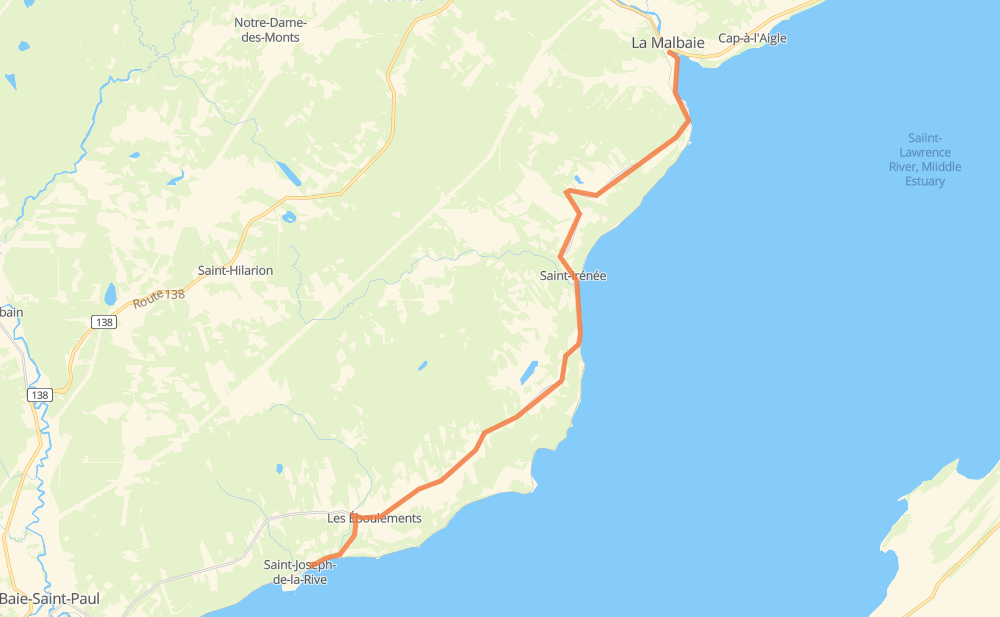
The distance from Saint-Joseph-de-la-Rive to La Malbaie is 34 kilometers by road. Road takes approximately 23 minutes and goes through Les Éboulements, Saint-Irénée and Pointe-au-Pic.
| Shortest distance by air | 27 km ✈️ |
| Car route length | 34 km 🚗 |
| Driving time | 23 min |
| Fuel amount | 2.7 L |
| Fuel cost | 5.3 CAD |
| Point | Distance | Time | Fuel | |
| Saint-Joseph-de-la-Rive | 0 km | 00 min | 0.0 L | |
|
4 km, 02 min
|
||||
| Les Éboulements | 4 km | 02 min | 0.2 L | |
|
362 14 km, 09 min
|
||||
| Saint-Irénée | 18 km | 12 min | 1.3 L | |
|
362 14 km, 09 min
|
||||
| Pointe-au-Pic | 32 km | 22 min | 2.4 L | |
|
362 2 km, 01 min
|
||||
| La Malbaie | 34 km | 23 min | 2.7 L | |
Hotels of La Malbaie
Frequently Asked Questions
How much does it cost to drive from Saint-Joseph-de-la-Rive to La Malbaie?
Fuel cost: 5.3 CAD
This fuel cost is calculated as: (Route length 34 km / 100 km) * (Fuel consumption 8 L/100 km) * (Fuel price 1.97 CAD / L)
You can adjust fuel consumption and fuel price here.
How long is a car ride from Saint-Joseph-de-la-Rive to La Malbaie?
Driving time: 23 min
This time is calculated for driving at the maximum permitted speed, taking into account traffic rules restrictions.
- 21 km with a maximum speed 90 km/h = 13 min
- 13 km with a maximum speed 80 km/h = 9 min
The calculated driving time does not take into account intermediate stops and traffic jams.
How far is Saint-Joseph-de-la-Rive to La Malbaie by land?
The distance between Saint-Joseph-de-la-Rive and La Malbaie is 34 km by road.
Precise satellite coordinates of highways were used for this calculation. The start and finish points are the centers of Saint-Joseph-de-la-Rive and La Malbaie respectively.
What city is halfway between Saint-Joseph-de-la-Rive and La Malbaie?
The halfway point between Saint-Joseph-de-la-Rive and La Malbaie is Saint-Irénée. It is located about 1 km from the exact midpoint by road.
The distance from Saint-Irénée to Saint-Joseph-de-la-Rive is 18 km and driving will take about 12 min. The road between Saint-Irénée and La Malbaie has length 16 km and will take approximately 11 min.
Where is Saint-Joseph-de-la-Rive in relation to La Malbaie?
Saint-Joseph-de-la-Rive is located 27 km south-west of La Malbaie.
Saint-Joseph-de-la-Rive has geographic coordinates: latitude 47.46167, longitude -70.35672.
La Malbaie has geographic coordinates: latitude 47.65753, longitude -70.15389.
Which highway goes from Saint-Joseph-de-la-Rive to La Malbaie?
The route from Saint-Joseph-de-la-Rive to La Malbaie follows 362.