Distance between São Joaquim da Barra and Guarapari
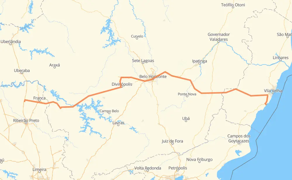
The distance from São Joaquim da Barra to Guarapari is 1,064 kilometers by road including 157 kilometers on motorways. Road takes approximately 12 hours and 32 minutes and goes through Betim, São José, Itaú de Minas, Cancã, Piumhi, Córrego Fundo de Baixo and Pará de Minas.
| Shortest distance by air | 766 km ✈️ |
| Car route length | 1,064 km 🚗 |
| Driving time | 12 h 32 min |
| Fuel amount | 85.2 L |
| Fuel cost | 166.9 CAD |
| Point | Distance | Time | Fuel | |
| São Joaquim da Barra | 0 km | 00 min | 0.0 L | |
|
SP-330 SP-345 110 km, 1 h 12 min
|
||||
| São José | 110 km | 1 h 12 min | 8.5 L | |
|
MG-444 MG-344 32 km, 22 min
|
||||
| Itaú de Minas | 143 km | 1 h 35 min | 10.6 L | |
|
MG-050 47 km, 32 min
|
||||
| Cancã | 189 km | 2 h 08 min | 14.8 L | |
|
MG-050 58 km, 39 min
|
||||
| Piumhi | 247 km | 2 h 47 min | 19.4 L | |
|
MG-050 56 km, 38 min
|
||||
| Córrego Fundo de Baixo | 304 km | 3 h 25 min | 24.1 L | |
|
MG-050 151 km, 1 h 36 min
|
||||
| Pará de Minas | 454 km | 5 h 02 min | 36.0 L | |
|
BR-262 47 km, 29 min
|
||||
| Betim | 501 km | 5 h 32 min | 39.6 L | |
|
BR-262 8 km, 04 min
|
||||
| PTB | 509 km | 5 h 36 min | 40.6 L | |
|
BR-381 BR-262 556 km, 6 h 55 min
|
||||
| Guarapari | 1,065 km | 12 h 32 min | 85.2 L | |
Hotels of Guarapari
Frequently Asked Questions
How much does it cost to drive from São Joaquim da Barra to Guarapari?
Fuel cost: 166.9 CAD
This fuel cost is calculated as: (Route length 1,064 km / 100 km) * (Fuel consumption 8 L/100 km) * (Fuel price 1.96 CAD / L)
You can adjust fuel consumption and fuel price here.
How long is a car ride from São Joaquim da Barra to Guarapari?
Driving time: 12 h 32 min
This time is calculated for driving at the maximum permitted speed, taking into account traffic rules restrictions.
- 76 km with a maximum speed 110 km/h = 41 min
- 48 km with a maximum speed 100 km/h = 28 min
- 555 km with a maximum speed 90 km/h = 6 h 10 min
- 306 km with a maximum speed 80 km/h = 3 h 49 min
- 5 km with a maximum speed 70 km/h = 4 min
- 66 km with a maximum speed 60 km/h = 1 h 5 min
- 2 km with a maximum speed 50 km/h = 2 min
- 6 km with a maximum speed 40 km/h = 9 min
- 1 km with a maximum speed 30 km/h = 1 min
The calculated driving time does not take into account intermediate stops and traffic jams.
How far is São Joaquim da Barra to Guarapari by land?
The distance between São Joaquim da Barra and Guarapari is 1,064 km by road including 157 km on motorways.
Precise satellite coordinates of highways were used for this calculation. The start and finish points are the centers of São Joaquim da Barra and Guarapari respectively.
How far is São Joaquim da Barra to Guarapari by plane?
The shortest distance (air line, as the crow flies) between São Joaquim da Barra and Guarapari is 766 km.
This distance is calculated using the Haversine formula as a great-circle distance between two points on the surface of a sphere. The start and finish points are the centers of São Joaquim da Barra and Guarapari respectively. Actual distance between airports may be different.
How many hours is São Joaquim da Barra from Guarapari by plane?
Boeing 737 airliner needs 57 min to cover the distance of 766 km at a cruising speed of 800 km/h.
Small plane "Cessna 172" needs 3 h 28 min to flight this distance at average speed of 220 km/h.
This time is approximate and do not take into account takeoff and landing times, airport location and other real world factors.
How long is a helicopter ride from São Joaquim da Barra to Guarapari?
Fast helicopter "Eurocopter AS350" or "Hughes OH-6 Cayuse" need 3 h 11 min to cover the distance of 766 km at a cruising speed of 240 km/h.
Popular "Robinson R44" needs 3 h 38 min to flight this distance at average speed of 210 km/h.
This time is approximate and do not take into account takeoff and landing times, aerodrome location and other real world factors.
What city is halfway between São Joaquim da Barra and Guarapari?
The halfway point between São Joaquim da Barra and Guarapari is Vila Jardim Montanhês. It is located about 1 km from the exact midpoint by road.
The distance from Vila Jardim Montanhês to São Joaquim da Barra is 532 km and driving will take about 5 h 52 min. The road between Vila Jardim Montanhês and Guarapari has length 533 km and will take approximately 6 h 39 min.
The other cities located close to halfway point:
Where is São Joaquim da Barra in relation to Guarapari?
São Joaquim da Barra is located 766 km west of Guarapari.
São Joaquim da Barra has geographic coordinates: latitude -20.5818, longitude -47.86064.
Guarapari has geographic coordinates: latitude -20.67189, longitude -40.49846.
Which highway goes from São Joaquim da Barra to Guarapari?
The route from São Joaquim da Barra to Guarapari follows BR-262, MG-050, BR-381.
Other minor sections pass along the road:
- SP-345: 82 km
- BR-494: 34 km
- BR-101: 29 km
- MG-344: 26 km
- MG-444: 24 km
- ES-165: 11 km
- BR-050: 6 km
- SP-330: 6 km
- ES-480: 5 km
- MG-108: 5 km
- MG-111: 5 km
- MG-329: 5 km
- MG-170: 3 km
- BR-040: 3 km
- ES-185: 3 km
- MG-129: 1 km