Distance between São João do Sabugi and São Francisco de Itabapoana
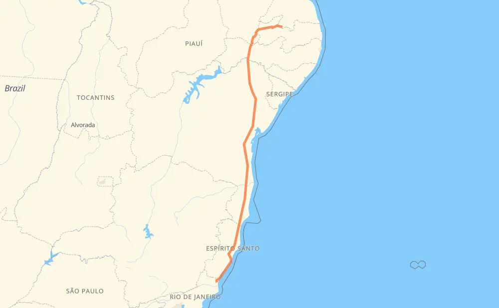
The distance from São João do Sabugi to São Francisco de Itabapoana is 2,120 kilometers by road. Road takes approximately 25 hours and 44 minutes and goes through Teixeira de Freitas, Serra, Cajazeiras, Teofilândia, Parque Panorama, Ubaitaba and Aurelino Leal.
| Shortest distance by air | 1,694 km ✈️ |
| Car route length | 2,120 km 🚗 |
| Driving time | 25 h 44 min |
| Fuel amount | 169.6 L |
| Fuel cost | 332.4 CAD |
| Point | Distance | Time | Fuel | |
| São João do Sabugi | 0 km | 00 min | 0.0 L | |
|
RN-118 BR-230 180 km, 2 h 20 min
|
||||
| Cajazeiras | 180 km | 2 h 20 min | 13.9 L | |
|
BR-230 BR-116 575 km, 6 h 38 min
|
||||
| Teofilândia | 755 km | 8 h 58 min | 59.8 L | |
|
BR-116 101 km, 1 h 11 min
|
||||
| Parque Panorama | 856 km | 10 h 10 min | 68.4 L | |
|
BA-502 BR-101 282 km, 3 h 21 min
|
||||
| Ubaitaba | 1,138 km | 13 h 31 min | 91.0 L | |
|
BR-101 9 km, 06 min
|
||||
| Aurelino Leal | 1,147 km | 13 h 38 min | 91.1 L | |
|
BR-101 353 km, 4 h 01 min
|
||||
| Itamaraju | 1,500 km | 17 h 39 min | 119.6 L | |
|
BR-101 71 km, 49 min
|
||||
| Teixeira de Freitas | 1,571 km | 18 h 28 min | 125.3 L | |
|
BR-101 90 km, 1 h 01 min
|
||||
| Vista Alegre | 1,661 km | 19 h 30 min | 132.5 L | |
|
BR-101 246 km, 2 h 49 min
|
||||
| Serra | 1,907 km | 22 h 20 min | 152.5 L | |
|
BR-101 ES-060 219 km, 3 h 24 min
|
||||
| -21.47434, -41.11184 | 2,125 km | 25 h 44 min | 170.0 L | |
Frequently Asked Questions
How much does it cost to drive from São João do Sabugi to São Francisco de Itabapoana?
Fuel cost: 332.4 CAD
This fuel cost is calculated as: (Route length 2,120 km / 100 km) * (Fuel consumption 8 L/100 km) * (Fuel price 1.96 CAD / L)
You can adjust fuel consumption and fuel price here.
How long is a car ride from São João do Sabugi to São Francisco de Itabapoana?
Driving time: 25 h 44 min
This time is calculated for driving at the maximum permitted speed, taking into account traffic rules restrictions.
- 1,352 km with a maximum speed 90 km/h = 15 h 1 min
- 602 km with a maximum speed 80 km/h = 7 h 31 min
- 117 km with a maximum speed 60 km/h = 1 h 57 min
- 26 km with a maximum speed 50 km/h = 31 min
- 25 km with a maximum speed 40 km/h = 37 min
- 3 km with a maximum speed 30 km/h = 5 min
The calculated driving time does not take into account intermediate stops and traffic jams.
How far is São João do Sabugi to São Francisco de Itabapoana by land?
The distance between São João do Sabugi and São Francisco de Itabapoana is 2,120 km by road.
Precise satellite coordinates of highways were used for this calculation. The start and finish points are the centers of São João do Sabugi and São Francisco de Itabapoana respectively.
How far is São João do Sabugi to São Francisco de Itabapoana by plane?
The shortest distance (air line, as the crow flies) between São João do Sabugi and São Francisco de Itabapoana is 1,694 km.
This distance is calculated using the Haversine formula as a great-circle distance between two points on the surface of a sphere. The start and finish points are the centers of São João do Sabugi and São Francisco de Itabapoana respectively. Actual distance between airports may be different.
How many hours is São João do Sabugi from São Francisco de Itabapoana by plane?
Boeing 737 airliner needs 2 h 7 min to cover the distance of 1,694 km at a cruising speed of 800 km/h.
Small plane "Cessna 172" needs 7 h 42 min to flight this distance at average speed of 220 km/h.
This time is approximate and do not take into account takeoff and landing times, airport location and other real world factors.
How long is a helicopter ride from São João do Sabugi to São Francisco de Itabapoana?
Fast helicopter "Eurocopter AS350" or "Hughes OH-6 Cayuse" need 7 h 3 min to cover the distance of 1,694 km at a cruising speed of 240 km/h.
Popular "Robinson R44" needs 8 h 4 min to flight this distance at average speed of 210 km/h.
This time is approximate and do not take into account takeoff and landing times, aerodrome location and other real world factors.
What city is halfway between São João do Sabugi and São Francisco de Itabapoana?
The halfway point between São João do Sabugi and São Francisco de Itabapoana is Itamarati. It is located about 43 km from the exact midpoint by road.
The distance from Itamarati to São João do Sabugi is 1,103 km and driving will take about 13 h 5 min. The road between Itamarati and São Francisco de Itabapoana has length 1,017 km and will take approximately 12 h 38 min.
The other cities located close to halfway point:
Where is São João do Sabugi in relation to São Francisco de Itabapoana?
São João do Sabugi is located 1,694 km north of São Francisco de Itabapoana.
São João do Sabugi has geographic coordinates: latitude -6.71882, longitude -37.19979.
São Francisco de Itabapoana has geographic coordinates: latitude -21.47434, longitude -41.11184.
Which highway goes from São João do Sabugi to São Francisco de Itabapoana?
The route from São João do Sabugi to São Francisco de Itabapoana follows BR-101, BR-116, ES-060, BR-230.
Other minor sections pass along the road:
- BR-427: 52 km
- RJ-196: 34 km
- BA-502: 30 km
- PB-420: 12 km
- RJ-224: 8 km
- PB-293: 2 km
- BR-101 Norte: 2 km
- ES-146: 1 km