Distance between Rio Verde de Mato Grosso and Rio Claro
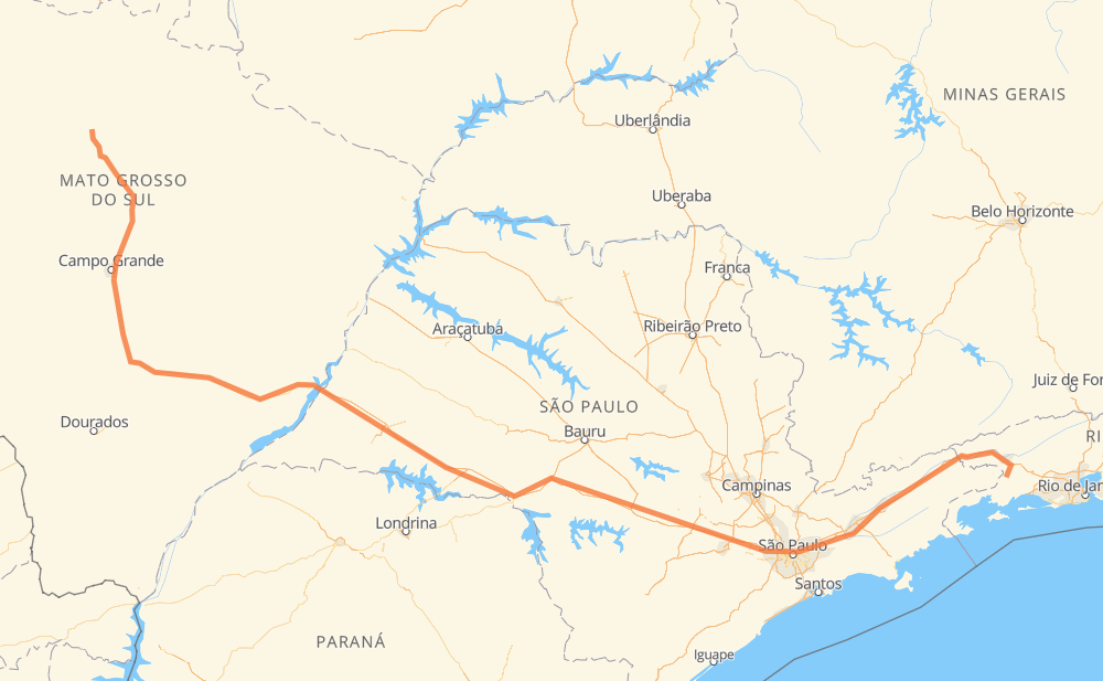
The distance from Rio Verde de Mato Grosso to Rio Claro is 1,549 kilometers by road including 959 kilometers on motorways. Road takes approximately 16 hours and 12 minutes and goes through Assis, Barueri, Jacareí and Guaratinguetá.
| Shortest distance by air | 1,190 km ✈️ |
| Car route length | 1,549 km 🚗 |
| Driving time | 16 h 12 min |
| Fuel amount | 123.9 L |
| Fuel cost | 242.9 CAD |
| Point | Distance | Time | Fuel | |
| Rio Verde de Mato Grosso | 0 km | 00 min | 0.0 L | |
|
BR-163 67 km, 45 min
|
||||
| São Gabriel do Oeste | 67 km | 45 min | 5.0 L | |
|
BR-163 125 km, 1 h 27 min
|
||||
| Nova Lima | 192 km | 2 h 13 min | 15.2 L | |
|
BR-163 24 km, 18 min
|
||||
| Moradia do Sol | 216 km | 2 h 32 min | 16.9 L | |
|
BR-163 19 km, 14 min
|
||||
| Chácara das Mansões | 235 km | 2 h 47 min | 17.7 L | |
|
BR-163 85 km, 58 min
|
||||
| Nova Alvorada do Sul | 320 km | 3 h 45 min | 25.1 L | |
|
BR-267 455 km, 4 h 47 min
|
||||
| Assis | 775 km | 8 h 32 min | 60.8 L | |
|
SP-270 BR-374 405 km, 3 h 48 min
|
||||
| Barueri | 1,180 km | 12 h 21 min | 93.9 L | |
|
SP-280 SP-070 104 km, 1 h 03 min
|
||||
| Jacareí | 1,284 km | 13 h 25 min | 102.5 L | |
|
SP-070 SP-060 103 km, 1 h 00 min
|
||||
| Guaratinguetá | 1,388 km | 14 h 26 min | 110.8 L | |
|
SP-060 BR-116 161 km, 1 h 46 min
|
||||
| -22.72300, -44.13600 | 1,549 km | 16 h 12 min | 123.9 L | |
Frequently Asked Questions
How much does it cost to drive from Rio Verde de Mato Grosso to Rio Claro?
Fuel cost: 242.9 CAD
This fuel cost is calculated as: (Route length 1,549 km / 100 km) * (Fuel consumption 8 L/100 km) * (Fuel price 1.96 CAD / L)
You can adjust fuel consumption and fuel price here.
How long is a car ride from Rio Verde de Mato Grosso to Rio Claro?
Driving time: 16 h 12 min
This time is calculated for driving at the maximum permitted speed, taking into account traffic rules restrictions.
- 693 km with a maximum speed 110 km/h = 6 h 18 min
- 169 km with a maximum speed 100 km/h = 1 h 41 min
- 488 km with a maximum speed 90 km/h = 5 h 25 min
- 149 km with a maximum speed 80 km/h = 1 h 52 min
- 11 km with a maximum speed 70 km/h = 9 min
- 15 km with a maximum speed 60 km/h = 14 min
- 9 km with a maximum speed 50 km/h = 10 min
- 13 km with a maximum speed 40 km/h = 19 min
The calculated driving time does not take into account intermediate stops and traffic jams.
How far is Rio Verde de Mato Grosso to Rio Claro by land?
The distance between Rio Verde de Mato Grosso and Rio Claro is 1,549 km by road including 959 km on motorways.
Precise satellite coordinates of highways were used for this calculation. The start and finish points are the centers of Rio Verde de Mato Grosso and Rio Claro respectively.
How far is Rio Verde de Mato Grosso to Rio Claro by plane?
The shortest distance (air line, as the crow flies) between Rio Verde de Mato Grosso and Rio Claro is 1,190 km.
This distance is calculated using the Haversine formula as a great-circle distance between two points on the surface of a sphere. The start and finish points are the centers of Rio Verde de Mato Grosso and Rio Claro respectively. Actual distance between airports may be different.
How many hours is Rio Verde de Mato Grosso from Rio Claro by plane?
Boeing 737 airliner needs 1 h 29 min to cover the distance of 1,190 km at a cruising speed of 800 km/h.
Small plane "Cessna 172" needs 5 h 24 min to flight this distance at average speed of 220 km/h.
This time is approximate and do not take into account takeoff and landing times, airport location and other real world factors.
How long is a helicopter ride from Rio Verde de Mato Grosso to Rio Claro?
Fast helicopter "Eurocopter AS350" or "Hughes OH-6 Cayuse" need 4 h 57 min to cover the distance of 1,190 km at a cruising speed of 240 km/h.
Popular "Robinson R44" needs 5 h 40 min to flight this distance at average speed of 210 km/h.
This time is approximate and do not take into account takeoff and landing times, aerodrome location and other real world factors.
What city is halfway between Rio Verde de Mato Grosso and Rio Claro?
The halfway point between Rio Verde de Mato Grosso and Rio Claro is Assis. It is located about 1 km from the exact midpoint by road.
The distance from Assis to Rio Verde de Mato Grosso is 775 km and driving will take about 8 h 32 min. The road between Assis and Rio Claro has length 774 km and will take approximately 7 h 39 min.
The other cities located close to halfway point:
Where is Rio Verde de Mato Grosso in relation to Rio Claro?
Rio Verde de Mato Grosso is located 1,190 km north-west of Rio Claro.
Rio Verde de Mato Grosso has geographic coordinates: latitude -18.91692, longitude -54.84107.
Rio Claro has geographic coordinates: latitude -22.723, longitude -44.136.
Which highway goes from Rio Verde de Mato Grosso to Rio Claro?
The route from Rio Verde de Mato Grosso to Rio Claro follows BR-374, BR-267, BR-163, SP-280, SP-270, BR-116, SP-060, SP-070, BR-060.
Other minor sections pass along the road:
- BR-369: 52 km
- SP-327: 33 km
- SP-015: 22 km
- SP-225: 19 km
- BR-262: 15 km
- BR-459: 14 km
- BR-494: 12 km
- RJ-155: 12 km
- BR-383: 11 km
- VRD-001: 9 km
- BR-050: 7 km
- SPM-280 E: 6 km
- SPI 117/070: 3 km
- KM-272: 3 km
- RJ-139: 2 km