Distance between Ridgecrest CA and Emmett ID
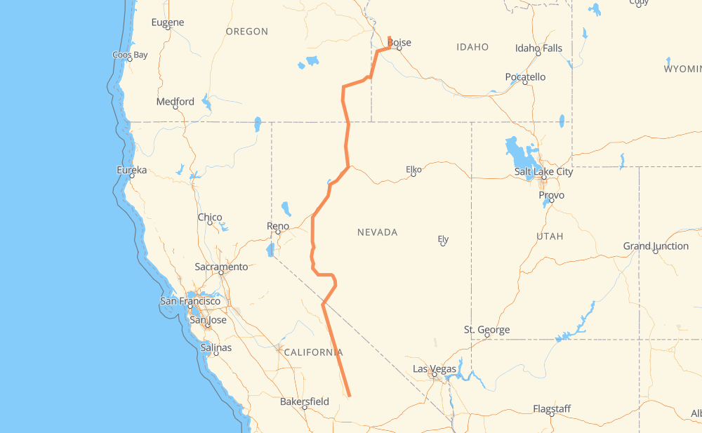
The distance from Ridgecrest to Emmett is 1,156 kilometers by road including 161 kilometers on motorways. Road takes approximately 12 hours and 58 minutes and goes through Bishop, Hawthorne, Fallon, Lovelock, Winnemucca and Nampa.
| Shortest distance by air | 923 km ✈️ |
| Car route length | 1,156 km 🚗 |
| Driving time | 12 h 58 min |
| Fuel amount | 92.5 L |
| Fuel cost | 181.2 CAD |
| Point | Distance | Time | Fuel | |
| Ridgecrest | 0 km | 00 min | 0.0 L | |
|
CA 178 US 395 195 km, 2 h 13 min
|
||||
| Big Pine | 195 km | 2 h 13 min | 15.5 L | |
|
US 395 25 km, 18 min
|
||||
| Bishop | 220 km | 2 h 32 min | 17.6 L | |
|
US 395 US 6 24 km, 17 min
|
||||
| Chalfant Valley | 244 km | 2 h 49 min | 19.0 L | |
|
US 6 US 95 166 km, 1 h 57 min
|
||||
| Hawthorne | 411 km | 4 h 47 min | 32.8 L | |
|
US 95 Truck US 95 115 km, 1 h 19 min
|
||||
| Fallon | 525 km | 6 h 07 min | 41.9 L | |
|
US 95 89 km, 55 min
|
||||
| Lovelock | 615 km | 7 h 03 min | 49.1 L | |
|
I 80 117 km, 1 h 04 min
|
||||
| Winnemucca | 731 km | 8 h 07 min | 58.2 L | |
|
I 80 US 95 383 km, 4 h 21 min
|
||||
| Nampa | 1,115 km | 12 h 29 min | 89.1 L | |
|
I 84 ID 16 41 km, 28 min
|
||||
| Emmett | 1,156 km | 12 h 58 min | 91.6 L | |
Frequently Asked Questions
How much does it cost to drive from Ridgecrest to Emmett?
Fuel cost: 181.2 CAD
This fuel cost is calculated as: (Route length 1,156 km / 100 km) * (Fuel consumption 8 L/100 km) * (Fuel price 1.96 CAD / L)
You can adjust fuel consumption and fuel price here.
How long is a car ride from Ridgecrest to Emmett?
Driving time: 12 h 58 min
This time is calculated for driving at the maximum permitted speed, taking into account traffic rules restrictions.
- 153 km with a maximum speed 110 km/h = 1 h 23 min
- 4 km with a maximum speed 105 km/h = 2 min
- 3 km with a maximum speed 100 km/h = 1 min
- 807 km with a maximum speed 90 km/h = 8 h 58 min
- 37 km with a maximum speed 89 km/h = 25 min
- 7 km with a maximum speed 80 km/h = 4 min
- 101 km with a maximum speed 80 km/h = 1 h 16 min
- 17 km with a maximum speed 72 km/h = 13 min
- 6 km with a maximum speed 64 km/h = 5 min
- 7 km with a maximum speed 56 km/h = 7 min
- 2 km with a maximum speed 50 km/h = 2 min
- 2 km with a maximum speed 48 km/h = 2 min
- 10 km with a maximum speed 40 km/h = 14 min
The calculated driving time does not take into account intermediate stops and traffic jams.
How far is Ridgecrest to Emmett by land?
The distance between Ridgecrest and Emmett is 1,156 km by road including 161 km on motorways.
Precise satellite coordinates of highways were used for this calculation. The start and finish points are the centers of Ridgecrest and Emmett respectively.
How far is Ridgecrest to Emmett by plane?
The shortest distance (air line, as the crow flies) between Ridgecrest and Emmett is 923 km.
This distance is calculated using the Haversine formula as a great-circle distance between two points on the surface of a sphere. The start and finish points are the centers of Ridgecrest and Emmett respectively. Actual distance between airports may be different.
How many hours is Ridgecrest from Emmett by plane?
Boeing 737 airliner needs 1 h 9 min to cover the distance of 923 km at a cruising speed of 800 km/h.
Small plane "Cessna 172" needs 4 h 11 min to flight this distance at average speed of 220 km/h.
This time is approximate and do not take into account takeoff and landing times, airport location and other real world factors.
How long is a helicopter ride from Ridgecrest to Emmett?
Fast helicopter "Eurocopter AS350" or "Hughes OH-6 Cayuse" need 3 h 50 min to cover the distance of 923 km at a cruising speed of 240 km/h.
Popular "Robinson R44" needs 4 h 23 min to flight this distance at average speed of 210 km/h.
This time is approximate and do not take into account takeoff and landing times, aerodrome location and other real world factors.
What city is halfway between Ridgecrest and Emmett?
The halfway point between Ridgecrest and Emmett is Trinity. It is located about 9 km from the exact midpoint by road.
The distance from Trinity to Ridgecrest is 586 km and driving will take about 6 h 47 min. The road between Trinity and Emmett has length 569 km and will take approximately 6 h 11 min.
The other cities located close to halfway point:
Where is Ridgecrest in relation to Emmett?
Ridgecrest is located 923 km south of Emmett.
Ridgecrest has geographic coordinates: latitude 35.62251, longitude -117.66994.
Emmett has geographic coordinates: latitude 43.8735, longitude -116.4993.
Which highway goes from Ridgecrest to Emmett?
The route from Ridgecrest to Emmett follows US 95, US 395, I 80.
Other minor sections pass along the road:
- US 6: 84 km
- NV 360: 37 km
- ID 16: 25 km
- CA 168: 23 km
- ID 55: 22 km
- CA 178: 8 km
- US 395 BUS: 8 km
- I 84: 6 km
- US 30: 6 km
- NV 289: 2 km
- US 95 Truck: 2 km
- NV 795: 2 km
- US 20: 2 km
- US 26: 2 km