Distance between Porto Alegre and Angra dos Reis
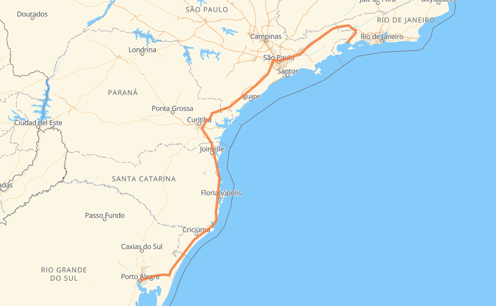
The distance from Porto Alegre to Angra dos Reis is 1,542 kilometers by road including 1,471 kilometers on motorways. Road takes approximately 16 hours and 30 minutes and goes through Piraquara, Taboão da Serra, Jacareí and Guaratinguetá.
| Shortest distance by air | 1,041 km ✈️ |
| Car route length | 1,542 km 🚗 |
| Driving time | 16 h 30 min |
| Fuel amount | 123.3 L |
| Fuel cost | 241.7 CAD |
| Point | Distance | Time | Fuel | |
| Porto Alegre | 0 km | 00 min | 0.0 L | |
|
BR-101 213 km, 2 h 08 min
|
||||
| Glorinha | 213 km | 2 h 08 min | 16.9 L | |
|
BR-101 22 km, 12 min
|
||||
| Sanga da Areia | 235 km | 2 h 20 min | 18.7 L | |
|
BR-101 28 km, 15 min
|
||||
| Morro Albino | 263 km | 2 h 36 min | 20.8 L | |
|
BR-101 17 km, 09 min
|
||||
| Esperança | 280 km | 2 h 45 min | 22.1 L | |
|
BR-101 460 km, 4 h 45 min
|
||||
| Piraquara | 740 km | 7 h 31 min | 58.6 L | |
|
BR-116 381 km, 4 h 05 min
|
||||
| Taboão da Serra | 1,121 km | 11 h 36 min | 89.7 L | |
|
SP-230 SP-070 114 km, 1 h 10 min
|
||||
| Jacareí | 1,235 km | 12 h 46 min | 98.6 L | |
|
SP-070 SP-060 103 km, 1 h 00 min
|
||||
| Guaratinguetá | 1,339 km | 13 h 47 min | 106.9 L | |
|
SP-060 BR-116 221 km, 2 h 42 min
|
||||
| Angra dos Reis | 1,559 km | 16 h 30 min | 124.5 L | |
Hotels of Angra dos Reis
Frequently Asked Questions
How much does it cost to drive from Porto Alegre to Angra dos Reis?
Fuel cost: 241.7 CAD
This fuel cost is calculated as: (Route length 1,542 km / 100 km) * (Fuel consumption 8 L/100 km) * (Fuel price 1.96 CAD / L)
You can adjust fuel consumption and fuel price here.
How long is a car ride from Porto Alegre to Angra dos Reis?
Driving time: 16 h 30 min
This time is calculated for driving at the maximum permitted speed, taking into account traffic rules restrictions.
- 773 km with a maximum speed 110 km/h = 7 h 1 min
- 439 km with a maximum speed 100 km/h = 4 h 23 min
- 32 km with a maximum speed 90 km/h = 21 min
- 164 km with a maximum speed 80 km/h = 2 h 2 min
- 11 km with a maximum speed 70 km/h = 9 min
- 113 km with a maximum speed 60 km/h = 1 h 52 min
- 9 km with a maximum speed 50 km/h = 10 min
- 19 km with a maximum speed 40 km/h = 28 min
The calculated driving time does not take into account intermediate stops and traffic jams.
How far is Porto Alegre to Angra dos Reis by land?
The distance between Porto Alegre and Angra dos Reis is 1,542 km by road including 1,471 km on motorways.
Precise satellite coordinates of highways were used for this calculation. The start and finish points are the centers of Porto Alegre and Angra dos Reis respectively.
How far is Porto Alegre to Angra dos Reis by plane?
The shortest distance (air line, as the crow flies) between Porto Alegre and Angra dos Reis is 1,041 km.
This distance is calculated using the Haversine formula as a great-circle distance between two points on the surface of a sphere. The start and finish points are the centers of Porto Alegre and Angra dos Reis respectively. Actual distance between airports may be different.
How many hours is Porto Alegre from Angra dos Reis by plane?
Boeing 737 airliner needs 1 h 18 min to cover the distance of 1,041 km at a cruising speed of 800 km/h.
Small plane "Cessna 172" needs 4 h 43 min to flight this distance at average speed of 220 km/h.
This time is approximate and do not take into account takeoff and landing times, airport location and other real world factors.
How long is a helicopter ride from Porto Alegre to Angra dos Reis?
Fast helicopter "Eurocopter AS350" or "Hughes OH-6 Cayuse" need 4 h 20 min to cover the distance of 1,041 km at a cruising speed of 240 km/h.
Popular "Robinson R44" needs 4 h 57 min to flight this distance at average speed of 210 km/h.
This time is approximate and do not take into account takeoff and landing times, aerodrome location and other real world factors.
What city is halfway between Porto Alegre and Angra dos Reis?
The halfway point between Porto Alegre and Angra dos Reis is Piraquara. It is located about 30 km from the exact midpoint by road.
The distance from Piraquara to Porto Alegre is 740 km and driving will take about 7 h 30 min. The road between Piraquara and Angra dos Reis has length 801 km and will take approximately 8 h 59 min.
The other cities located close to halfway point:
Where is Porto Alegre in relation to Angra dos Reis?
Porto Alegre is located 1,041 km south-west of Angra dos Reis.
Porto Alegre has geographic coordinates: latitude -30.0325, longitude -51.23038.
Angra dos Reis has geographic coordinates: latitude -23.0064, longitude -44.31633.
Which highway goes from Porto Alegre to Angra dos Reis?
The route from Porto Alegre to Angra dos Reis follows BR-116, BR-101, SP-230, SP-060, SP-070.
Other minor sections pass along the road:
- BR-290: 97 km
- BR-376: 74 km
- BR-494: 56 km
- RJ-155: 56 km
- BR-478: 48 km
- SP-015: 22 km
- BR-459: 14 km
- SP-021: 13 km
- BR-383: 11 km
- BR-285: 9 km
- BR-277: 9 km
- VRD-001: 9 km
- BR-050: 7 km
- SP-280: 4 km
- BR-374: 4 km
- SPI 117/070: 3 km
- KM-272: 3 km
- SPM-280 E: 2 km
- RJ-139: 2 km
- SPI-016/021: 2 km