Distance between Poconé and Carapebus
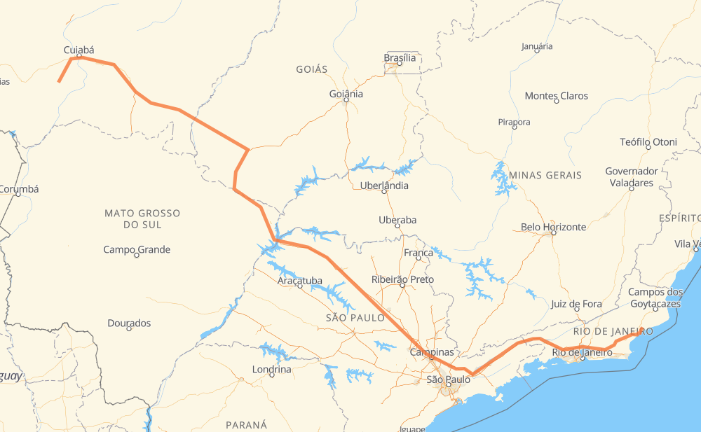
The distance from Poconé to Carapebus is 2,286 kilometers by road including 1,088 kilometers on motorways. Road takes approximately 24 hours and 34 minutes and goes through Rio Claro, Itatiba, Atibaia, Jacareí, Guaratinguetá and Magé.
| Shortest distance by air | 1,702 km ✈️ |
| Car route length | 2,286 km 🚗 |
| Driving time | 24 h 34 min |
| Fuel amount | 182.9 L |
| Fuel cost | 360.3 CAD |
| Point | Distance | Time | Fuel | |
| Poconé | 0 km | 00 min | 0.0 L | |
|
MT-060 53 km, 39 min
|
||||
| Nossa Senhora do Livramento | 53 km | 39 min | 3.0 L | |
|
MT-060 33 km, 23 min
|
||||
| Novo Mundo | 85 km | 1 h 03 min | 6.2 L | |
|
BR-070 BR-163 162 km, 1 h 49 min
|
||||
| Jaciara | 247 km | 2 h 52 min | 19.4 L | |
|
BR-163 BR-364 1,260 km, 13 h 22 min
|
||||
| Rio Claro | 1,508 km | 16 h 14 min | 120.2 L | |
|
SP-310 SP-330 113 km, 1 h 07 min
|
||||
| Itatiba | 1,621 km | 17 h 22 min | 129.2 L | |
|
SP-065 26 km, 14 min
|
||||
| Atibaia | 1,647 km | 17 h 37 min | 130.7 L | |
|
SP-065 80 km, 46 min
|
||||
| Jacareí | 1,727 km | 18 h 23 min | 137.9 L | |
|
SP-060 BR-116 99 km, 58 min
|
||||
| Guaratinguetá | 1,826 km | 19 h 21 min | 145.9 L | |
|
SP-060 BR-116 271 km, 2 h 58 min
|
||||
| Magé | 2,097 km | 22 h 20 min | 167.3 L | |
|
BR-493 BR-101 191 km, 2 h 13 min
|
||||
| -22.18700, -41.66338 | 2,288 km | 24 h 33 min | 183.0 L | |
Frequently Asked Questions
How much does it cost to drive from Poconé to Carapebus?
Fuel cost: 360.3 CAD
This fuel cost is calculated as: (Route length 2,286 km / 100 km) * (Fuel consumption 8 L/100 km) * (Fuel price 1.97 CAD / L)
You can adjust fuel consumption and fuel price here.
How long is a car ride from Poconé to Carapebus?
Driving time: 24 h 34 min
This time is calculated for driving at the maximum permitted speed, taking into account traffic rules restrictions.
- 726 km with a maximum speed 110 km/h = 6 h 35 min
- 223 km with a maximum speed 100 km/h = 2 h 13 min
- 1,029 km with a maximum speed 90 km/h = 11 h 25 min
- 236 km with a maximum speed 80 km/h = 2 h 57 min
- 31 km with a maximum speed 70 km/h = 26 min
- 18 km with a maximum speed 60 km/h = 18 min
- 1 km with a maximum speed 50 km/h = 1 min
- 24 km with a maximum speed 40 km/h = 35 min
The calculated driving time does not take into account intermediate stops and traffic jams.
How far is Poconé to Carapebus by land?
The distance between Poconé and Carapebus is 2,286 km by road including 1,088 km on motorways.
Precise satellite coordinates of highways were used for this calculation. The start and finish points are the centers of Poconé and Carapebus respectively.
How far is Poconé to Carapebus by plane?
The shortest distance (air line, as the crow flies) between Poconé and Carapebus is 1,702 km.
This distance is calculated using the Haversine formula as a great-circle distance between two points on the surface of a sphere. The start and finish points are the centers of Poconé and Carapebus respectively. Actual distance between airports may be different.
How many hours is Poconé from Carapebus by plane?
Boeing 737 airliner needs 2 h 7 min to cover the distance of 1,702 km at a cruising speed of 800 km/h.
Small plane "Cessna 172" needs 7 h 44 min to flight this distance at average speed of 220 km/h.
This time is approximate and do not take into account takeoff and landing times, airport location and other real world factors.
How long is a helicopter ride from Poconé to Carapebus?
Fast helicopter "Eurocopter AS350" or "Hughes OH-6 Cayuse" need 7 h 5 min to cover the distance of 1,702 km at a cruising speed of 240 km/h.
Popular "Robinson R44" needs 8 h 6 min to flight this distance at average speed of 210 km/h.
This time is approximate and do not take into account takeoff and landing times, aerodrome location and other real world factors.
What city is halfway between Poconé and Carapebus?
The halfway point between Poconé and Carapebus is Conjunto Habitacional Antônio Marin. It is located about 10 km from the exact midpoint by road.
The distance from Conjunto Habitacional Antônio Marin to Poconé is 1,133 km and driving will take about 12 h 37 min. The road between Conjunto Habitacional Antônio Marin and Carapebus has length 1,153 km and will take approximately 11 h 56 min.
The other cities located close to halfway point:
Where is Poconé in relation to Carapebus?
Poconé is located 1,702 km north-west of Carapebus.
Poconé has geographic coordinates: latitude -16.26341, longitude -56.62297.
Carapebus has geographic coordinates: latitude -22.187, longitude -41.66338.
Which highway goes from Poconé to Carapebus?
The route from Poconé to Carapebus follows BR-364, BR-116, SP-310, BR-163, SP-320, SP-060, GO-184, BR-158, SP-065, BR-101.
Other minor sections pass along the road:
- BR-070: 93 km
- BR-060: 81 km
- MT-060: 76 km
- BR-493: 71 km
- BR-267: 59 km
- SP-330: 49 km
- BR-050: 49 km
- GO-302: 27 km
- RJ-109: 19 km
- MT-407: 16 km
- RJ-178: 14 km
- BR-459: 14 km
- RJ-168: 14 km
- BR-383: 11 km
- MT-100: 7 km
- KM-272: 3 km
- BR-436: 2 km