Distance between Pimenta Bueno and São Francisco de Itabapoana
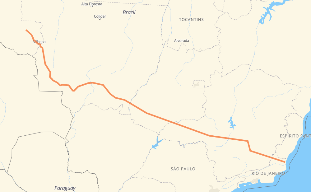
The distance from Pimenta Bueno to São Francisco de Itabapoana is 3,009 kilometers by road including 376 kilometers on motorways. Road takes approximately 35 hours and goes through Betim, Conselheiro Lafaiete, Muriaé, Vilhena, Novo Mundo, Jaciara and Vila Goulart.
| Shortest distance by air | 2,398 km ✈️ |
| Car route length | 3,009 km 🚗 |
| Driving time | 35 h |
| Fuel amount | 240.7 L |
| Fuel cost | 471.9 CAD |
| Point | Distance | Time | Fuel | |
| Pimenta Bueno | 0 km | 00 min | 0.0 L | |
|
BR-364 179 km, 2 h 11 min
|
||||
| Vilhena | 179 km | 2 h 11 min | 13.7 L | |
|
BR-364 BR-174 742 km, 8 h 44 min
|
||||
| Novo Mundo | 921 km | 10 h 56 min | 73.0 L | |
|
BR-070 BR-163 162 km, 1 h 49 min
|
||||
| Jaciara | 1,083 km | 12 h 45 min | 86.3 L | |
|
BR-163 76 km, 53 min
|
||||
| Vila Goulart | 1,159 km | 13 h 39 min | 92.6 L | |
|
BR-364 707 km, 7 h 58 min
|
||||
| Centralina | 1,866 km | 21 h 37 min | 148.5 L | |
|
BR-153 61 km, 33 min
|
||||
| Monte Alegre de Minas | 1,928 km | 22 h 11 min | 152.1 L | |
|
BR-365 BR-262 568 km, 6 h 27 min
|
||||
| Betim | 2,495 km | 28 h 39 min | 199.1 L | |
|
BR-262 BR-040 125 km, 1 h 29 min
|
||||
| Conselheiro Lafaiete | 2,621 km | 30 h 09 min | 208.3 L | |
|
BR-482 208 km, 2 h 37 min
|
||||
| Muriaé | 2,828 km | 32 h 46 min | 224.7 L | |
|
BR-356 186 km, 2 h 13 min
|
||||
| -21.47434, -41.11184 | 3,014 km | 35 h 00 min | 241.1 L | |
Frequently Asked Questions
How much does it cost to drive from Pimenta Bueno to São Francisco de Itabapoana?
Fuel cost: 471.9 CAD
This fuel cost is calculated as: (Route length 3,009 km / 100 km) * (Fuel consumption 8 L/100 km) * (Fuel price 1.96 CAD / L)
You can adjust fuel consumption and fuel price here.
How long is a car ride from Pimenta Bueno to São Francisco de Itabapoana?
Driving time: 35 h
This time is calculated for driving at the maximum permitted speed, taking into account traffic rules restrictions.
- 275 km with a maximum speed 110 km/h = 2 h 30 min
- 62 km with a maximum speed 100 km/h = 37 min
- 1,458 km with a maximum speed 90 km/h = 16 h 11 min
- 1,133 km with a maximum speed 80 km/h = 14 h 9 min
- 9 km with a maximum speed 70 km/h = 7 min
- 65 km with a maximum speed 60 km/h = 1 h 5 min
- 2 km with a maximum speed 50 km/h = 2 min
- 6 km with a maximum speed 40 km/h = 9 min
- 3 km with a maximum speed 30 km/h = 6 min
The calculated driving time does not take into account intermediate stops and traffic jams.
How far is Pimenta Bueno to São Francisco de Itabapoana by land?
The distance between Pimenta Bueno and São Francisco de Itabapoana is 3,009 km by road including 376 km on motorways.
Precise satellite coordinates of highways were used for this calculation. The start and finish points are the centers of Pimenta Bueno and São Francisco de Itabapoana respectively.
How far is Pimenta Bueno to São Francisco de Itabapoana by plane?
The shortest distance (air line, as the crow flies) between Pimenta Bueno and São Francisco de Itabapoana is 2,398 km.
This distance is calculated using the Haversine formula as a great-circle distance between two points on the surface of a sphere. The start and finish points are the centers of Pimenta Bueno and São Francisco de Itabapoana respectively. Actual distance between airports may be different.
How many hours is Pimenta Bueno from São Francisco de Itabapoana by plane?
Boeing 737 airliner needs 2 h 59 min to cover the distance of 2,398 km at a cruising speed of 800 km/h.
Small plane "Cessna 172" needs 10 h 54 min to flight this distance at average speed of 220 km/h.
This time is approximate and do not take into account takeoff and landing times, airport location and other real world factors.
How long is a helicopter ride from Pimenta Bueno to São Francisco de Itabapoana?
Fast helicopter "Eurocopter AS350" or "Hughes OH-6 Cayuse" need 9 h 59 min to cover the distance of 2,398 km at a cruising speed of 240 km/h.
Popular "Robinson R44" needs 11 h 25 min to flight this distance at average speed of 210 km/h.
This time is approximate and do not take into account takeoff and landing times, aerodrome location and other real world factors.
What city is halfway between Pimenta Bueno and São Francisco de Itabapoana?
The halfway point between Pimenta Bueno and São Francisco de Itabapoana is Lagoa do Bauzinho. It is located about 192 km from the exact midpoint by road.
The distance from Lagoa do Bauzinho to Pimenta Bueno is 1,696 km and driving will take about 19 h 37 min. The road between Lagoa do Bauzinho and São Francisco de Itabapoana has length 1,313 km and will take approximately 15 h 23 min.
The other cities located close to halfway point:
Where is Pimenta Bueno in relation to São Francisco de Itabapoana?
Pimenta Bueno is located 2,398 km north-west of São Francisco de Itabapoana.
Pimenta Bueno has geographic coordinates: latitude -11.67679, longitude -61.18639.
São Francisco de Itabapoana has geographic coordinates: latitude -21.47434, longitude -41.11184.
Which highway goes from Pimenta Bueno to São Francisco de Itabapoana?
The route from Pimenta Bueno to São Francisco de Itabapoana follows BR-364, BR-174, BR-452, BR-262, BR-070, BR-356, BR-163, BR-482, MGC-482.
Other minor sections pass along the road:
- BR-060: 96 km
- BR-040: 92 km
- BR-365: 91 km
- BR-153: 57 km
- RJ-224: 31 km
- MGC-356: 28 km
- BR-381: 23 km
- MT-407: 16 km
- MGT-356: 16 km
- BR-120: 15 km
- BR-354: 12 km
- MT-100: 7 km
- BR-158: 5 km
- CA-51: 5 km
- CAM-112: 5 km
- BR-050: 5 km