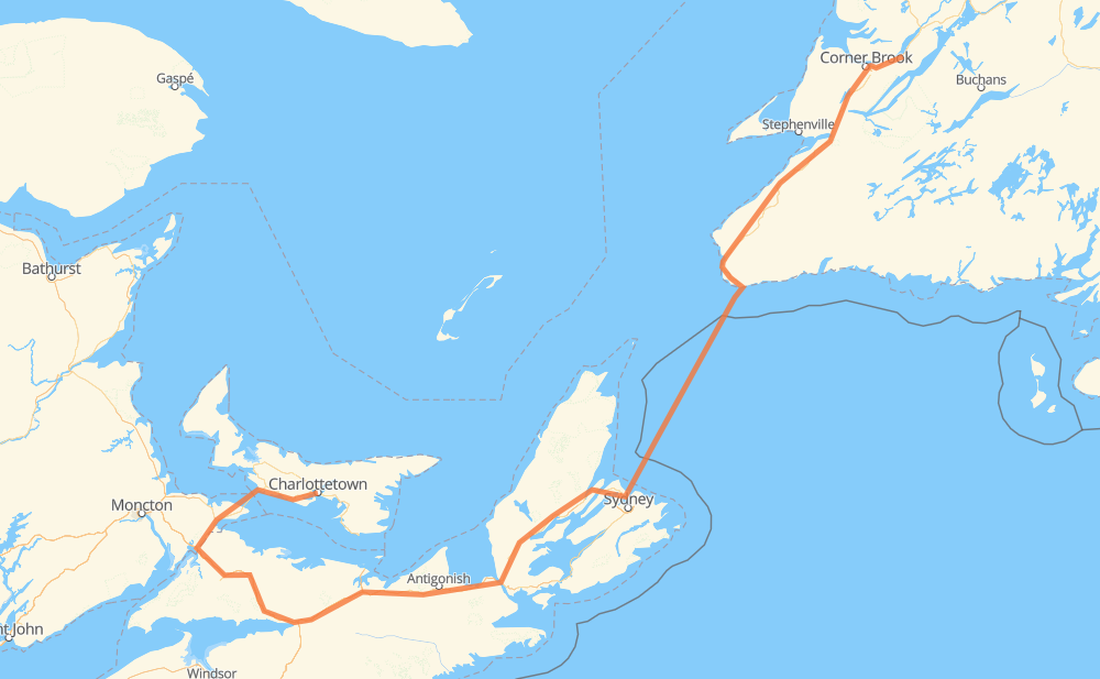
Distance between Pasadena NL and Charlottetown PE
The distance from Pasadena to Charlottetown is 961 kilometers by road including 294 kilometers on motorways. Road takes approximately 17 hours and 14 minutes and goes through Corner Brook, Codroy Valley, Port Aux Basques, Baddeck, Wagmatcook First Nation, Oxford and Amherst.
| Shortest distance by air | 517 km ✈️ |
| Car route length | 961 km 🚗 |
| Driving time | 17 h 14 min |
| Fuel amount | 76.9 L |
| Fuel cost | 150.6 CAD |
| Point | Distance | Time | Fuel | |
| Pasadena | 0 km | 00 min | 0.0 L | |
|
1 35 km, 22 min
|
||||
| Corner Brook | 35 km | 22 min | 1.6 L | |
|
1 178 km, 1 h 57 min
|
||||
| Codroy Valley | 213 km | 2 h 20 min | 15.5 L | |
|
1 28 km, 18 min
|
||||
| Port Aux Basques | 241 km | 2 h 38 min | 19.0 L | |
|
1 NS 105 239 km, 9 h 33 min
|
||||
| Baddeck | 480 km | 12 h 12 min | 37.8 L | |
|
NS 105 18 km, 12 min
|
||||
| Wagmatcook First Nation | 498 km | 12 h 24 min | 39.4 L | |
|
NS 105 TCH 300 km, 3 h 00 min
|
||||
| Oxford | 798 km | 15 h 25 min | 63.7 L | |
|
NS 104 37 km, 20 min
|
||||
| Amherst | 834 km | 15 h 45 min | 66.5 L | |
|
NS 104 16 71 km, 48 min
|
||||
| Borden | 905 km | 16 h 33 min | 72.0 L | |
|
1 55 km, 40 min
|
||||
| Charlottetown | 961 km | 17 h 13 min | 76.3 L | |
Hotels of Charlottetown
Frequently Asked Questions
How much does it cost to drive from Pasadena to Charlottetown?
Fuel cost: 150.6 CAD
This fuel cost is calculated as: (Route length 961 km / 100 km) * (Fuel consumption 8 L/100 km) * (Fuel price 1.96 CAD / L)
You can adjust fuel consumption and fuel price here.
How long is a car ride from Pasadena to Charlottetown?
Driving time: 17 h 14 min
This time is calculated for driving at the maximum permitted speed, taking into account traffic rules restrictions.
- 172 km with a maximum speed 110 km/h = 1 h 33 min
- 108 km with a maximum speed 100 km/h = 1 h 5 min
- 442 km with a maximum speed 90 km/h = 4 h 54 min
- 47 km with a maximum speed 80 km/h = 35 min
- 6 km with a maximum speed 70 km/h = 5 min
- 6 km with a maximum speed 60 km/h = 5 min
- 1 km with a maximum speed 50 km/h = 1 min
- 177 km with a maximum speed 20 km/h = 8 h 52 min
The calculated driving time does not take into account intermediate stops and traffic jams.
How far is Pasadena to Charlottetown by land?
The distance between Pasadena and Charlottetown is 961 km by road including 294 km on motorways.
Precise satellite coordinates of highways were used for this calculation. The start and finish points are the centers of Pasadena and Charlottetown respectively.
How far is Pasadena to Charlottetown by plane?
The shortest distance (air line, as the crow flies) between Pasadena and Charlottetown is 517 km.
This distance is calculated using the Haversine formula as a great-circle distance between two points on the surface of a sphere. The start and finish points are the centers of Pasadena and Charlottetown respectively. Actual distance between airports may be different.
How many hours is Pasadena from Charlottetown by plane?
Boeing 737 airliner needs 38 min to cover the distance of 517 km at a cruising speed of 800 km/h.
Small plane "Cessna 172" needs 2 h 21 min to flight this distance at average speed of 220 km/h.
This time is approximate and do not take into account takeoff and landing times, airport location and other real world factors.
How long is a helicopter ride from Pasadena to Charlottetown?
Fast helicopter "Eurocopter AS350" or "Hughes OH-6 Cayuse" need 2 h 9 min to cover the distance of 517 km at a cruising speed of 240 km/h.
Popular "Robinson R44" needs 2 h 27 min to flight this distance at average speed of 210 km/h.
This time is approximate and do not take into account takeoff and landing times, aerodrome location and other real world factors.
What city is halfway between Pasadena and Charlottetown?
The halfway point between Pasadena and Charlottetown is Baddeck.
The distance from Baddeck to Pasadena is 480 km and driving will take about 12 h 12 min. The road between Baddeck and Charlottetown has length 481 km and will take approximately 5 h 1 min.
The other cities located close to halfway point:
Where is Pasadena in relation to Charlottetown?
Pasadena is located 517 km north-east of Charlottetown.
Pasadena has geographic coordinates: latitude 49.01392, longitude -57.59865.
Charlottetown has geographic coordinates: latitude 46.23495, longitude -63.13294.
Which highway goes from Pasadena to Charlottetown?
The route from Pasadena to Charlottetown follows TCH, 1, NS 104, NS 105.
Other minor sections pass along the road:
- 16: 51 km
- Trans Canada Highway: 13 km
- NS 4: 4 km
- 236: 4 km
- 2: 2 km