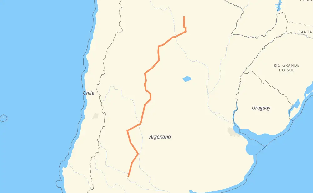
Distance between Monte Quemado and Catriel
The distance from Monte Quemado to Catriel is 1,758 kilometers by road. Road takes approximately 20 hours and 9 minutes and goes through Santiago del Estero, San Luis, Campo Gallo, La Banda, Frías, Recreo and Esquiú.
| Shortest distance by air | 1,422 km ✈️ |
| Car route length | 1,758 km 🚗 |
| Driving time | 20 h 9 min |
| Fuel amount | 140.6 L |
| Fuel cost | 275.6 CAD |
| Point | Distance | Time | Fuel | |
| Monte Quemado | 0 km | 00 min | 0.0 L | |
|
RP92 113 km, 1 h 25 min
|
||||
| Donadeu | 113 km | 1 h 25 min | 9.0 L | |
|
RP92 RP5 210 km, 2 h 26 min
|
||||
| La Banda | 323 km | 3 h 52 min | 25.5 L | |
|
RP5 11 km, 07 min
|
||||
| Santiago del Estero | 334 km | 4 h 00 min | 26.4 L | |
|
RN64 122 km, 1 h 21 min
|
||||
| Frías | 456 km | 5 h 21 min | 34.3 L | |
|
RN157 122 km, 1 h 22 min
|
||||
| Recreo | 578 km | 6 h 43 min | 43.9 L | |
|
RP20 RN79 162 km, 1 h 50 min
|
||||
| Chamical | 740 km | 8 h 33 min | 59.0 L | |
|
RN79 386 km, 4 h 23 min
|
||||
| San Luis | 1,127 km | 12 h 56 min | 90.1 L | |
|
RN7 RN146 261 km, 3 h 02 min
|
||||
| General Alvear | 1,388 km | 15 h 59 min | 110.7 L | |
|
RN143 RN151 370 km, 4 h 09 min
|
||||
| Catriel | 1,758 km | 20 h 09 min | 140.4 L | |
Hotels of Catriel
Frequently Asked Questions
How much does it cost to drive from Monte Quemado to Catriel?
Fuel cost: 275.6 CAD
This fuel cost is calculated as: (Route length 1,758 km / 100 km) * (Fuel consumption 8 L/100 km) * (Fuel price 1.96 CAD / L)
You can adjust fuel consumption and fuel price here.
How long is a car ride from Monte Quemado to Catriel?
Driving time: 20 h 9 min
This time is calculated for driving at the maximum permitted speed, taking into account traffic rules restrictions.
- 1,391 km with a maximum speed 90 km/h = 15 h 27 min
- 343 km with a maximum speed 80 km/h = 4 h 17 min
- 20 km with a maximum speed 60 km/h = 20 min
- 2 km with a maximum speed 50 km/h = 2 min
- 1 km with a maximum speed 40 km/h = 1 min
The calculated driving time does not take into account intermediate stops and traffic jams.
How far is Monte Quemado to Catriel by land?
The distance between Monte Quemado and Catriel is 1,758 km by road.
Precise satellite coordinates of highways were used for this calculation. The start and finish points are the centers of Monte Quemado and Catriel respectively.
How far is Monte Quemado to Catriel by plane?
The shortest distance (air line, as the crow flies) between Monte Quemado and Catriel is 1,422 km.
This distance is calculated using the Haversine formula as a great-circle distance between two points on the surface of a sphere. The start and finish points are the centers of Monte Quemado and Catriel respectively. Actual distance between airports may be different.
How many hours is Monte Quemado from Catriel by plane?
Boeing 737 airliner needs 1 h 46 min to cover the distance of 1,422 km at a cruising speed of 800 km/h.
Small plane "Cessna 172" needs 6 h 27 min to flight this distance at average speed of 220 km/h.
This time is approximate and do not take into account takeoff and landing times, airport location and other real world factors.
How long is a helicopter ride from Monte Quemado to Catriel?
Fast helicopter "Eurocopter AS350" or "Hughes OH-6 Cayuse" need 5 h 55 min to cover the distance of 1,422 km at a cruising speed of 240 km/h.
Popular "Robinson R44" needs 6 h 46 min to flight this distance at average speed of 210 km/h.
This time is approximate and do not take into account takeoff and landing times, aerodrome location and other real world factors.
What city is halfway between Monte Quemado and Catriel?
The halfway point between Monte Quemado and Catriel is Bajo Hondo. It is located about 17 km from the exact midpoint by road.
The distance from Bajo Hondo to Monte Quemado is 896 km and driving will take about 10 h 18 min. The road between Bajo Hondo and Catriel has length 862 km and will take approximately 9 h 50 min.
The other cities located close to halfway point:
Where is Monte Quemado in relation to Catriel?
Monte Quemado is located 1,422 km north-east of Catriel.
Monte Quemado has geographic coordinates: latitude -25.80349, longitude -62.83036.
Catriel has geographic coordinates: latitude -37.87941, longitude -67.7932.
Which highway goes from Monte Quemado to Catriel?
The route from Monte Quemado to Catriel follows RN79, RN146, RN143, RN151, RP5, RP92, RN157.
Other minor sections pass along the road:
- RN64: 93 km
- RP20: 56 km
- RP171: 37 km
- RN20: 19 km
- RNV146: 10 km
- RN60: 5 km
- RN38: 4 km
- RN7: 2 km
- RN16: 1 km