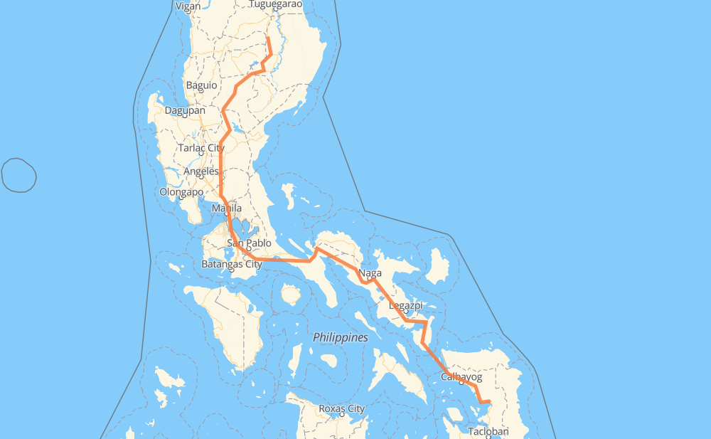
The distance from Mallig to Buray (Paranas) is 1,170 kilometers by road including 78 kilometers on motorways. Road takes approximately 16 hours and 20 minutes and goes through Muñoz, Gapan, San Pedro, Biñan, Santa Rosa, Cabuyao and Calamba.
How much does it cost to drive from Mallig to Buray (Paranas)?
Fuel cost:
183.5 CAD
This fuel cost is calculated as: (Route length 1,170 km / 100 km) * (Fuel consumption 8 L/100 km) * (Fuel price 1.96 CAD / L)
You can adjust fuel consumption and fuel price here.
How long is a car ride from Mallig to Buray (Paranas)?
Driving time:
16 h 20 min
This time is calculated for driving at the maximum permitted speed, taking into account traffic rules restrictions.
70 km with a maximum speed 100 km/h = 41 min
111 km with a maximum speed 90 km/h = 1 h 14 min
776 km with a maximum speed 80 km/h = 9 h 42 min
40 km with a maximum speed 70 km/h = 34 min
66 km with a maximum speed 60 km/h = 1 h 5 min
56 km with a maximum speed 50 km/h = 1 h 7 min
25 km with a maximum speed 40 km/h = 37 min
1 km with a maximum speed 30 km/h = 1 min
25 km with a maximum speed 20 km/h = 1 h 15 min
The calculated driving time does not take into account intermediate stops and traffic jams.
How far is Mallig to Buray (Paranas) by land?
The distance between Mallig and Buray (Paranas) is 1,170 km by road including 78 km on motorways.
Precise satellite coordinates of highways were used for this calculation. The start and finish points are the centers of Mallig and Buray (Paranas) respectively.
How far is Mallig to Buray (Paranas) by plane?
The shortest distance (air line, as the crow flies) between Mallig and Buray (Paranas) is 709 km.
This distance is calculated using the Haversine formula as a great-circle distance between two points on the surface of a sphere. The start and finish points are the centers of Mallig and Buray (Paranas) respectively. Actual distance between airports may be different.
How many hours is Mallig from Buray (Paranas) by plane?
Boeing 737 airliner needs 53 min to cover the distance of 709 km at a cruising speed of 800 km/h.
Small plane "Cessna 172" needs 3 h 13 min to flight this distance at average speed of 220 km/h.
This time is approximate and do not take into account takeoff and landing times, airport location and other real world factors.
How long is a helicopter ride from Mallig to Buray (Paranas)?
Fast helicopter "Eurocopter AS350" or "Hughes OH-6 Cayuse" need 2 h 57 min to cover the distance of 709 km at a cruising speed of 240 km/h.
Popular "Robinson R44" needs 3 h 22 min to flight this distance at average speed of 210 km/h.
This time is approximate and do not take into account takeoff and landing times, aerodrome location and other real world factors.
What city is halfway between Mallig and Buray (Paranas)?
The halfway point between Mallig and Buray (Paranas) is Gumaca. It is located about 1 km from the exact midpoint by road.
The distance from Gumaca to Mallig is 584 km and driving will take about 7 h 39 min. The road between Gumaca and Buray (Paranas) has length 587 km and will take approximately 8 h 41 min.
The other cities located close to halfway point:
Plaridel is in 571 km from Mallig and 599 km from Buray (Paranas)
Lopez is in 603 km from Mallig and 567 km from Buray (Paranas)
Atimonan is in 561 km from Mallig and 610 km from Buray (Paranas)
Where is Mallig in relation to Buray (Paranas)?
Mallig is located 709 km north-west of Buray (Paranas).
Mallig has geographic coordinates: latitude 17.21145, longitude 121.61126.
Buray (Paranas) has geographic coordinates: latitude 11.76892, longitude 125.03913.
Which highway goes from Mallig to Buray (Paranas)?
The route from Mallig to Buray (Paranas) follows AH26, 1.