Distance between Magog QC and Lily Lake BC
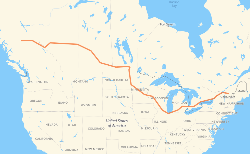
The distance from Magog to Lily Lake is 5,110 kilometers by road including 2,826 kilometers on motorways. Road takes approximately 53 hours and 44 minutes and goes through Montreal, Cornwall, Brockville, Kingston, Belleville, Oshawa and Ajax.
| Shortest distance by air | 3,806 km ✈️ |
| Car route length | 5,110 km 🚗 |
| Driving time | 53 h 44 min |
| Fuel amount | 408.8 L |
| Fuel cost | 801.2 CAD |
| Point | Distance | Time | Fuel | |
| Magog | 0 km | 00 min | 0.0 L | |
|
112 10 125 km, 1 h 18 min
|
||||
| Montreal | 125 km | 1 h 18 min | 9.3 L | |
|
20 103 km, 1 h 05 min
|
||||
| Cornwall | 228 km | 2 h 24 min | 17.9 L | |
|
401 92 km, 55 min
|
||||
| Brockville | 320 km | 3 h 19 min | 25.1 L | |
|
401 79 km, 47 min
|
||||
| Kingston | 399 km | 4 h 06 min | 30.4 L | |
|
401 77 km, 45 min
|
||||
| Belleville | 475 km | 4 h 52 min | 37.1 L | |
|
401 126 km, 1 h 15 min
|
||||
| Oshawa | 601 km | 6 h 07 min | 47.7 L | |
|
401 15 km, 08 min
|
||||
| Ajax | 615 km | 6 h 16 min | 49.0 L | |
|
401 32 km, 19 min
|
||||
| Toronto | 647 km | 6 h 35 min | 50.1 L | |
|
401 31 km, 18 min
|
||||
| Mississauga | 678 km | 6 h 53 min | 53.5 L | |
|
401 66 km, 39 min
|
||||
| Kitchener | 744 km | 7 h 33 min | 59.2 L | |
|
401 42 km, 25 min
|
||||
| Woodstock | 786 km | 7 h 58 min | 62.5 L | |
|
401 402 140 km, 1 h 19 min
|
||||
| Sarnia | 926 km | 9 h 18 min | 73.4 L | |
|
402 I 69 122 km, 1 h 12 min
|
||||
| Flint | 1,048 km | 10 h 31 min | 83.5 L | |
|
I 69 99 km, 53 min
|
||||
| Lansing | 1,147 km | 11 h 25 min | 91.5 L | |
|
I 69 102 km, 55 min
|
||||
| Kalamazoo | 1,248 km | 12 h 20 min | 99.7 L | |
|
I 94 I 90 409 km, 3 h 53 min
|
||||
| Janesville | 1,658 km | 16 h 14 min | 132.3 L | |
|
I 39 56 km, 30 min
|
||||
| Madison | 1,714 km | 16 h 44 min | 136.4 L | |
|
I 39 I 94 282 km, 2 h 34 min
|
||||
| Eau Claire | 1,996 km | 19 h 19 min | 158.8 L | |
|
I 94 526 km, 4 h 52 min
|
||||
| Fargo | 2,522 km | 24 h 12 min | 201.0 L | |
|
I 29 102 km, 1 h 10 min
|
||||
| Grand Forks | 2,624 km | 25 h 22 min | 207.9 L | |
|
I 29 243 km, 2 h 47 min
|
||||
| Winnipeg | 2,867 km | 28 h 09 min | 228.4 L | |
|
PTH 100 PTH 1 88 km, 59 min
|
||||
| Portage la Prairie | 2,955 km | 29 h 09 min | 235.8 L | |
|
PTH 1 123 km, 1 h 22 min
|
||||
| Brandon | 3,078 km | 30 h 31 min | 245.9 L | |
|
PTH 1 1 362 km, 4 h 07 min
|
||||
| Regina | 3,439 km | 34 h 38 min | 274.8 L | |
|
46 11 253 km, 2 h 49 min
|
||||
| Saskatoon | 3,692 km | 37 h 27 min | 294.8 L | |
|
11 16 162 km, 1 h 50 min
|
||||
| North Battleford | 3,854 km | 39 h 18 min | 306.2 L | |
|
16 109 km, 1 h 14 min
|
||||
| Lloydminster | 3,963 km | 40 h 32 min | 314.8 L | |
|
16 254 km, 2 h 50 min
|
||||
| Edmonton | 4,217 km | 43 h 23 min | 336.4 L | |
|
16 27 km, 17 min
|
||||
| Spruce Grove | 4,245 km | 43 h 40 min | 339.0 L | |
|
16 709 km, 8 h 01 min
|
||||
| Prince George | 4,954 km | 51 h 42 min | 395.2 L | |
|
16 159 km, 2 h 03 min
|
||||
| Lily Lake | 5,113 km | 53 h 45 min | 408.6 L | |
Frequently Asked Questions
How much does it cost to drive from Magog to Lily Lake?
Fuel cost: 801.2 CAD
This fuel cost is calculated as: (Route length 5,110 km / 100 km) * (Fuel consumption 8 L/100 km) * (Fuel price 1.96 CAD / L)
You can adjust fuel consumption and fuel price here.
How long is a car ride from Magog to Lily Lake?
Driving time: 53 h 44 min
This time is calculated for driving at the maximum permitted speed, taking into account traffic rules restrictions.
- 1,497 km with a maximum speed 110 km/h = 13 h 36 min
- 30 km with a maximum speed 105 km/h = 17 min
- 992 km with a maximum speed 100 km/h = 9 h 55 min
- 50 km with a maximum speed 97 km/h = 31 min
- 2,025 km with a maximum speed 90 km/h = 22 h 30 min
- 30 km with a maximum speed 89 km/h = 20 min
- 2 km with a maximum speed 80 km/h = 1 min
- 366 km with a maximum speed 80 km/h = 4 h 34 min
- 3 km with a maximum speed 72 km/h = 2 min
- 56 km with a maximum speed 70 km/h = 48 min
- 13 km with a maximum speed 60 km/h = 13 min
- 44 km with a maximum speed 50 km/h = 53 min
The calculated driving time does not take into account intermediate stops and traffic jams.
How far is Magog to Lily Lake by land?
The distance between Magog and Lily Lake is 5,110 km by road including 2,826 km on motorways.
Precise satellite coordinates of highways were used for this calculation. The start and finish points are the centers of Magog and Lily Lake respectively.
How far is Magog to Lily Lake by plane?
The shortest distance (air line, as the crow flies) between Magog and Lily Lake is 3,806 km.
This distance is calculated using the Haversine formula as a great-circle distance between two points on the surface of a sphere. The start and finish points are the centers of Magog and Lily Lake respectively. Actual distance between airports may be different.
How many hours is Magog from Lily Lake by plane?
Boeing 737 airliner needs 4 h 45 min to cover the distance of 3,806 km at a cruising speed of 800 km/h.
Small plane "Cessna 172" needs 17 h 18 min to flight this distance at average speed of 220 km/h.
This time is approximate and do not take into account takeoff and landing times, airport location and other real world factors.
How long is a helicopter ride from Magog to Lily Lake?
Fast helicopter "Eurocopter AS350" or "Hughes OH-6 Cayuse" need 15 h 51 min to cover the distance of 3,806 km at a cruising speed of 240 km/h.
Popular "Robinson R44" needs 18 h 7 min to flight this distance at average speed of 210 km/h.
This time is approximate and do not take into account takeoff and landing times, aerodrome location and other real world factors.
What city is halfway between Magog and Lily Lake?
The halfway point between Magog and Lily Lake is Brooktree Park. It is located about 7 km from the exact midpoint by road.
The distance from Brooktree Park to Magog is 2,548 km and driving will take about 24 h 28 min. The road between Brooktree Park and Lily Lake has length 2,562 km and will take approximately 29 h 16 min.
The other cities located close to halfway point:
Where is Magog in relation to Lily Lake?
Magog is located 3,806 km east of Lily Lake.
Magog has geographic coordinates: latitude 45.26546, longitude -72.14791.
Lily Lake has geographic coordinates: latitude 53.88333, longitude -124.56667.
Which highway goes from Magog to Lily Lake?
The route from Magog to Lily Lake follows 16, I 94, 401, I 90, PTH 1, I 69, 11, I 29, 1, US 81, I 39, 10, 402.
Other minor sections pass along the road:
- PTH 75: 94 km
- 20: 78 km
- I 694: 46 km
- US 51: 30 km
- 46: 22 km
- US 41: 22 km
- PTH 100: 19 km
- 2: 18 km
- US 59: 17 km
- 15: 9 km
- US 12: 9 km
- 11A: 9 km
- 47: 8 km
- 22: 8 km
- I 96: 8 km
- PTH 83: 7 km
- 40: 7 km
- MN 95: 7 km
- 112: 6 km
- PR 254: 5 km
- MN 210: 5 km
- US 31: 5 km
- US 10: 5 km
- 674: 5 km
- US 52: 4 km
- PR 241: 4 km
- WI 35: 4 km
- PR 250: 4 km
- 6: 3 km
- 21: 3 km
- US 20: 3 km
- WI 11: 3 km
- Route 42: 3 km
- PR 427: 2 km
- PR 334: 2 km
- 201: 2 km
- 12: 2 km
- PTH 10: 2 km
- 8: 1 km
- 675: 1 km
- 4: 1 km