Distance between Los Angeles CA and Comfort TX
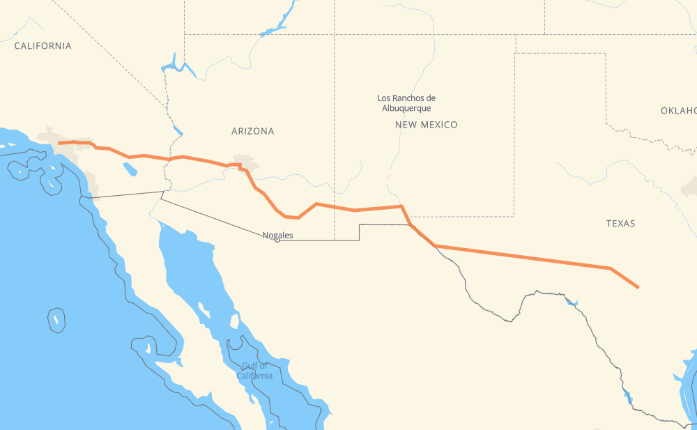
The distance from Los Angeles to Comfort is 2,102 kilometers by road including 2,098 kilometers on motorways. Road takes approximately 20 hours and 7 minutes and goes through Alhambra, San Gabriel, Rosemead, El Monte, West Covina, Pomona and Ontario.
| Shortest distance by air | 1,877 km ✈️ |
| Car route length | 2,102 km 🚗 |
| Driving time | 20 h 7 min |
| Fuel amount | 168.2 L |
| Fuel cost | 329.6 CAD |
| Point | Distance | Time | Fuel | |
| Los Angeles | 0 km | 00 min | 0.0 L | |
|
I 10S 11 km, 08 min
|
||||
| Alhambra | 11 km | 08 min | 0.6 L | |
|
I 10S 3 km, 02 min
|
||||
| San Gabriel | 14 km | 10 min | 1.1 L | |
|
I 10S 2 km, 01 min
|
||||
| Rosemead | 16 km | 11 min | 1.2 L | |
|
I 10S 4 km, 02 min
|
||||
| El Monte | 20 km | 14 min | 1.3 L | |
|
I 10 13 km, 07 min
|
||||
| West Covina | 33 km | 21 min | 2.2 L | |
|
I 10 12 km, 06 min
|
||||
| Pomona | 45 km | 28 min | 3.1 L | |
|
I 10 17 km, 09 min
|
||||
| Ontario | 62 km | 38 min | 4.3 L | |
|
I 10 15 km, 08 min
|
||||
| Fontana | 76 km | 46 min | 5.6 L | |
|
I 10 7 km, 04 min
|
||||
| Rialto | 84 km | 51 min | 6.6 L | |
|
I 10 8 km, 04 min
|
||||
| San Bernardino | 92 km | 55 min | 7.3 L | |
|
I 10 11 km, 06 min
|
||||
| Redlands | 103 km | 1 h 02 min | 7.7 L | |
|
I 10 10 km, 05 min
|
||||
| Calimesa | 113 km | 1 h 07 min | 8.9 L | |
|
I 10 49 km, 26 min
|
||||
| Palm Springs | 161 km | 1 h 34 min | 12.4 L | |
|
I 10 36 km, 19 min
|
||||
| Indio | 197 km | 1 h 53 min | 14.9 L | |
|
I 10 383 km, 3 h 29 min
|
||||
| Tolleson | 580 km | 5 h 23 min | 46.3 L | |
|
I 10 22 km, 13 min
|
||||
| Phoenix | 603 km | 5 h 36 min | 46.5 L | |
|
AZ 202 Loop I 10 187 km, 1 h 46 min
|
||||
| Tucson | 790 km | 7 h 23 min | 61.3 L | |
|
I 10 501 km, 5 h 02 min
|
||||
| El Paso | 1,291 km | 12 h 25 min | 102.8 L | |
|
Loop 375 I 10 811 km, 7 h 40 min
|
||||
| Comfort | 2,102 km | 20 h 06 min | 167.7 L | |
Hotels of Comfort
Frequently Asked Questions
How much does it cost to drive from Los Angeles to Comfort?
Fuel cost: 329.6 CAD
This fuel cost is calculated as: (Route length 2,102 km / 100 km) * (Fuel consumption 8 L/100 km) * (Fuel price 1.96 CAD / L)
You can adjust fuel consumption and fuel price here.
How long is a car ride from Los Angeles to Comfort?
Driving time: 20 h 7 min
This time is calculated for driving at the maximum permitted speed, taking into account traffic rules restrictions.
- 1,395 km with a maximum speed 110 km/h = 12 h 40 min
- 219 km with a maximum speed 105 km/h = 2 h 5 min
- 281 km with a maximum speed 100 km/h = 2 h 48 min
- 22 km with a maximum speed 97 km/h = 13 min
- 2 km with a maximum speed 90 km/h = 1 min
- 3 km with a maximum speed 89 km/h = 2 min
- 179 km with a maximum speed 80 km/h = 2 h 14 min
The calculated driving time does not take into account intermediate stops and traffic jams.
How far is Los Angeles to Comfort by land?
The distance between Los Angeles and Comfort is 2,102 km by road including 2,098 km on motorways.
Precise satellite coordinates of highways were used for this calculation. The start and finish points are the centers of Los Angeles and Comfort respectively.
How far is Los Angeles to Comfort by plane?
The shortest distance (air line, as the crow flies) between Los Angeles and Comfort is 1,877 km.
This distance is calculated using the Haversine formula as a great-circle distance between two points on the surface of a sphere. The start and finish points are the centers of Los Angeles and Comfort respectively. Actual distance between airports may be different.
How many hours is Los Angeles from Comfort by plane?
Boeing 737 airliner needs 2 h 20 min to cover the distance of 1,877 km at a cruising speed of 800 km/h.
Small plane "Cessna 172" needs 8 h 31 min to flight this distance at average speed of 220 km/h.
This time is approximate and do not take into account takeoff and landing times, airport location and other real world factors.
How long is a helicopter ride from Los Angeles to Comfort?
Fast helicopter "Eurocopter AS350" or "Hughes OH-6 Cayuse" need 7 h 49 min to cover the distance of 1,877 km at a cruising speed of 240 km/h.
Popular "Robinson R44" needs 8 h 56 min to flight this distance at average speed of 210 km/h.
This time is approximate and do not take into account takeoff and landing times, aerodrome location and other real world factors.
What city is halfway between Los Angeles and Comfort?
The halfway point between Los Angeles and Comfort is Lordsburg. It is located about 20 km from the exact midpoint by road.
The distance from Lordsburg to Los Angeles is 1,031 km and driving will take about 9 h 43 min. The road between Lordsburg and Comfort has length 1,071 km and will take approximately 10 h 23 min.
The other cities located close to halfway point:
Where is Los Angeles in relation to Comfort?
Los Angeles is located 1,877 km west of Comfort.
Los Angeles has geographic coordinates: latitude 34.05494, longitude -118.24448.
Comfort has geographic coordinates: latitude 29.96772, longitude -98.90503.
Which highway goes from Los Angeles to Comfort?
The route from Los Angeles to Comfort follows I 10, US 70, US 180.
Other minor sections pass along the road:
- US 67: 38 km
- AZ 202 Loop: 35 km
- Loop 375: 33 km
- US 191: 32 km
- US 95: 31 km
- US 85: 22 km
- US 385: 18 km
- I 10S: 17 km
- US 83: 9 km
- TX 17: 3 km
- US 87 Business: 1 km