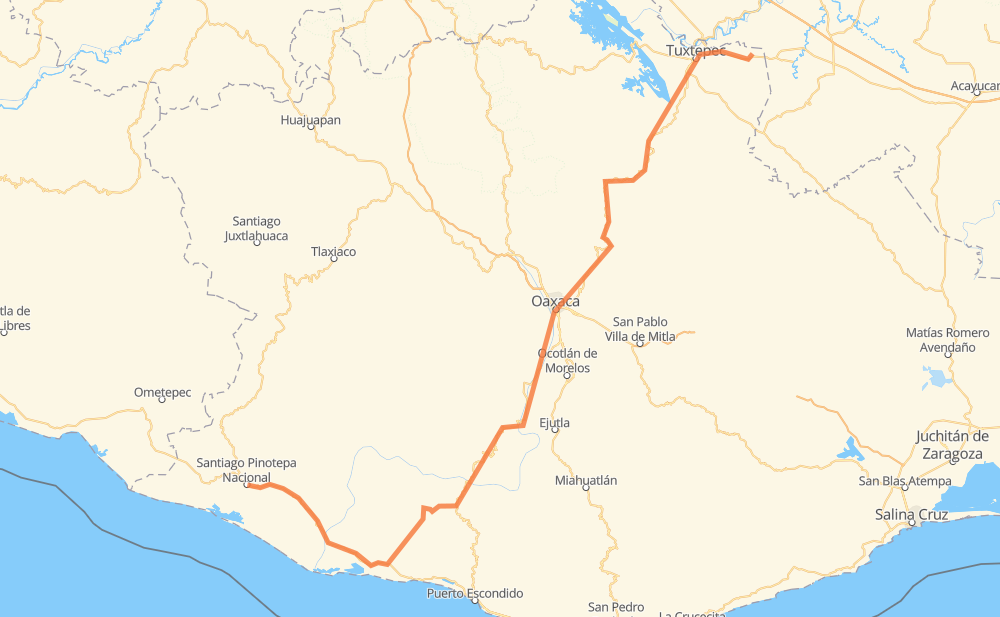
Distance between Loma Bonita and Santiago Pinotepa Nacional
The distance from Loma Bonita to Santiago Pinotepa Nacional is 578 kilometers by road. Road takes approximately 7 hours and 28 minutes and goes through Oaxaca, San Juan Bautista Tuxtepec, Santa Cruz Xoxocotlán, Villa de Zaachila and Zimatlán de Álvarez.
| Shortest distance by air | 303 km ✈️ |
| Car route length | 578 km 🚗 |
| Driving time | 7 h 28 min |
| Fuel amount | 46.2 L |
| Fuel cost | 90.6 CAD |
| Point | Distance | Time | Fuel | |
| Loma Bonita | 0 km | 00 min | 0.0 L | |
|
MEX 145 17 km, 14 min
|
||||
| Benemérito Juárez | 17 km | 14 min | 1.0 L | |
|
MEX 145 11 km, 08 min
|
||||
| Agua Fría Papaloapan | 28 km | 22 min | 1.8 L | |
|
7 km, 05 min
|
||||
| San Juan Bautista Tuxtepec | 36 km | 28 min | 2.8 L | |
|
MEX 175 10 km, 07 min
|
||||
| Arroyo Choápam | 45 km | 35 min | 3.1 L | |
|
MEX 175 206 km, 2 h 34 min
|
||||
| Oaxaca | 251 km | 3 h 10 min | 19.8 L | |
|
MEX 190 4 km, 03 min
|
||||
| Santa Cruz Xoxocotlán | 255 km | 3 h 13 min | 20.4 L | |
|
9 km, 08 min
|
||||
| Villa de Zaachila | 265 km | 3 h 22 min | 20.9 L | |
|
11 km, 07 min
|
||||
| Zimatlán de Álvarez | 276 km | 3 h 30 min | 21.9 L | |
|
MEX 131 324 km, 3 h 58 min
|
||||
| Santiago Pinotepa Nacional | 599 km | 7 h 28 min | 47.5 L | |
Frequently Asked Questions
How much does it cost to drive from Loma Bonita to Santiago Pinotepa Nacional?
Fuel cost: 90.6 CAD
This fuel cost is calculated as: (Route length 578 km / 100 km) * (Fuel consumption 8 L/100 km) * (Fuel price 1.96 CAD / L)
You can adjust fuel consumption and fuel price here.
How long is a car ride from Loma Bonita to Santiago Pinotepa Nacional?
Driving time: 7 h 28 min
This time is calculated for driving at the maximum permitted speed, taking into account traffic rules restrictions.
- 134 km with a maximum speed 90 km/h = 1 h 29 min
- 441 km with a maximum speed 80 km/h = 5 h 30 min
- 11 km with a maximum speed 60 km/h = 11 min
- 8 km with a maximum speed 50 km/h = 9 min
- 5 km with a maximum speed 40 km/h = 7 min
The calculated driving time does not take into account intermediate stops and traffic jams.
How far is Loma Bonita to Santiago Pinotepa Nacional by land?
The distance between Loma Bonita and Santiago Pinotepa Nacional is 578 km by road.
Precise satellite coordinates of highways were used for this calculation. The start and finish points are the centers of Loma Bonita and Santiago Pinotepa Nacional respectively.
How far is Loma Bonita to Santiago Pinotepa Nacional by plane?
The shortest distance (air line, as the crow flies) between Loma Bonita and Santiago Pinotepa Nacional is 303 km.
This distance is calculated using the Haversine formula as a great-circle distance between two points on the surface of a sphere. The start and finish points are the centers of Loma Bonita and Santiago Pinotepa Nacional respectively. Actual distance between airports may be different.
How many hours is Loma Bonita from Santiago Pinotepa Nacional by plane?
Boeing 737 airliner needs 22 min to cover the distance of 303 km at a cruising speed of 800 km/h.
Small plane "Cessna 172" needs 1 h 22 min to flight this distance at average speed of 220 km/h.
This time is approximate and do not take into account takeoff and landing times, airport location and other real world factors.
How long is a helicopter ride from Loma Bonita to Santiago Pinotepa Nacional?
Fast helicopter "Eurocopter AS350" or "Hughes OH-6 Cayuse" need 1 h 15 min to cover the distance of 303 km at a cruising speed of 240 km/h.
Popular "Robinson R44" needs 1 h 26 min to flight this distance at average speed of 210 km/h.
This time is approximate and do not take into account takeoff and landing times, aerodrome location and other real world factors.
What city is halfway between Loma Bonita and Santiago Pinotepa Nacional?
The halfway point between Loma Bonita and Santiago Pinotepa Nacional is Valdeflores. It is located about 2 km from the exact midpoint by road.
The distance from Valdeflores to Loma Bonita is 287 km and driving will take about 3 h 38 min. The road between Valdeflores and Santiago Pinotepa Nacional has length 291 km and will take approximately 3 h 49 min.
The other cities located close to halfway point:
Where is Loma Bonita in relation to Santiago Pinotepa Nacional?
Loma Bonita is located 303 km north-east of Santiago Pinotepa Nacional.
Loma Bonita has geographic coordinates: latitude 18.10797, longitude -95.879.
Santiago Pinotepa Nacional has geographic coordinates: latitude 16.33805, longitude -98.05028.
Which highway goes from Loma Bonita to Santiago Pinotepa Nacional?
The route from Loma Bonita to Santiago Pinotepa Nacional follows MEX 175, MEX 131.
Other minor sections pass along the road:
- MEX 200: 89 km
- MEX 145: 20 km
- MEX 190: 2 km