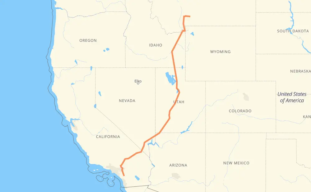
The distance from Livingston to Temecula is 1,816 kilometers by road including 1,547 kilometers on motorways. Road takes approximately 17 hours and 42 minutes and goes through Bozeman, Idaho Falls, Pocatello, Ogden, Salt Lake City, Provo and St. George.
How much does it cost to drive from Livingston to Temecula?
Fuel cost:
284.7 CAD
This fuel cost is calculated as: (Route length 1,816 km / 100 km) * (Fuel consumption 8 L/100 km) * (Fuel price 1.96 CAD / L)
You can adjust fuel consumption and fuel price here.
How long is a car ride from Livingston to Temecula?
Driving time:
17 h 42 min
This time is calculated for driving at the maximum permitted speed, taking into account traffic rules restrictions.
1,184 km with a maximum speed 110 km/h = 10 h 45 min
121 km with a maximum speed 105 km/h = 1 h 9 min
123 km with a maximum speed 100 km/h = 1 h 13 min
7 km with a maximum speed 97 km/h = 4 min
172 km with a maximum speed 90 km/h = 1 h 54 min
71 km with a maximum speed 89 km/h = 48 min
124 km with a maximum speed 80 km/h = 1 h 33 min
6 km with a maximum speed 72 km/h = 5 min
1 km with a maximum speed 56 km/h = 1 min
4 km with a maximum speed 50 km/h = 4 min
1 km with a maximum speed 40 km/h = 2 min
The calculated driving time does not take into account intermediate stops and traffic jams.
How far is Livingston to Temecula by land?
The distance between Livingston and Temecula is 1,816 km by road including 1,547 km on motorways.
Precise satellite coordinates of highways were used for this calculation. The start and finish points are the centers of Livingston and Temecula respectively.
How far is Livingston to Temecula by plane?
The shortest distance (air line, as the crow flies) between Livingston and Temecula is 1,465 km.
This distance is calculated using the Haversine formula as a great-circle distance between two points on the surface of a sphere. The start and finish points are the centers of Livingston and Temecula respectively. Actual distance between airports may be different.
How many hours is Livingston from Temecula by plane?
Boeing 737 airliner needs 1 h 49 min to cover the distance of 1,465 km at a cruising speed of 800 km/h.
Small plane "Cessna 172" needs 6 h 39 min to flight this distance at average speed of 220 km/h.
This time is approximate and do not take into account takeoff and landing times, airport location and other real world factors.
How long is a helicopter ride from Livingston to Temecula?
Fast helicopter "Eurocopter AS350" or "Hughes OH-6 Cayuse" need 6 h 6 min to cover the distance of 1,465 km at a cruising speed of 240 km/h.
Popular "Robinson R44" needs 6 h 58 min to flight this distance at average speed of 210 km/h.
This time is approximate and do not take into account takeoff and landing times, aerodrome location and other real world factors.
What city is halfway between Livingston and Temecula?
The halfway point between Livingston and Temecula is Holden. It is located about 13 km from the exact midpoint by road.
The distance from Holden to Livingston is 921 km and driving will take about 9 h 26 min. The road between Holden and Temecula has length 894 km and will take approximately 8 h 16 min.
The other cities located close to halfway point:
Meadow is in 938 km from Livingston and 877 km from Temecula
Nephi is in 834 km from Livingston and 982 km from Temecula
Payson is in 797 km from Livingston and 1,019 km from Temecula
Where is Livingston in relation to Temecula?
Livingston is located 1,465 km north-east of Temecula.
Livingston has geographic coordinates: latitude 45.66244, longitude -110.56104.
Temecula has geographic coordinates: latitude 33.49463, longitude -117.14737.
Which highway goes from Livingston to Temecula?
The route from Livingston to Temecula follows I 15, US 20, US 191.