Distance between Leinster and Toodyay
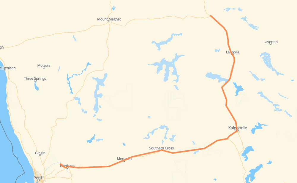
The distance from Leinster to Toodyay is 892 kilometers by road. Road takes approximately 10 hours and 7 minutes and goes through Kalgoorlie, Leonora, Kurrawang, Southern Cross, Moorine Rock, Merredin and Burracoppin.
| Shortest distance by air | 575 km ✈️ |
| Car route length | 892 km 🚗 |
| Driving time | 10 h 7 min |
| Fuel amount | 71.4 L |
| Fuel cost | 141.4 CAD |
| Point | Distance | Time | Fuel | |
| Leinster | 0 km | 00 min | 0.0 L | |
|
138 km, 1 h 36 min
|
||||
| Leonora | 138 km | 1 h 36 min | 10.3 L | |
|
231 km, 2 h 35 min
|
||||
| Kalgoorlie | 369 km | 4 h 11 min | 29.2 L | |
|
94 24 km, 16 min
|
||||
| Kurrawang | 393 km | 4 h 27 min | 30.3 L | |
|
94 196 km, 2 h 11 min
|
||||
| Southern Cross | 589 km | 6 h 39 min | 45.0 L | |
|
94 29 km, 19 min
|
||||
| Moorine Rock | 618 km | 6 h 58 min | 49.2 L | |
|
94 70 km, 47 min
|
||||
| Merredin | 688 km | 7 h 46 min | 53.5 L | |
|
94 33 km, 22 min
|
||||
| Hines Hill | 721 km | 8 h 09 min | 56.5 L | |
|
94 24 km, 16 min
|
||||
| Doodlakine | 745 km | 8 h 25 min | 59.0 L | |
|
94 147 km, 1 h 42 min
|
||||
| Toodyay | 892 km | 10 h 07 min | 70.3 L | |
Frequently Asked Questions
How much does it cost to drive from Leinster to Toodyay?
Fuel cost: 141.4 CAD
This fuel cost is calculated as: (Route length 892 km / 100 km) * (Fuel consumption 8 L/100 km) * (Fuel price 1.98 CAD / L)
You can adjust fuel consumption and fuel price here.
How long is a car ride from Leinster to Toodyay?
Driving time: 10 h 7 min
This time is calculated for driving at the maximum permitted speed, taking into account traffic rules restrictions.
- 785 km with a maximum speed 90 km/h = 8 h 43 min
- 99 km with a maximum speed 80 km/h = 1 h 14 min
- 8 km with a maximum speed 50 km/h = 9 min
The calculated driving time does not take into account intermediate stops and traffic jams.
How far is Leinster to Toodyay by land?
The distance between Leinster and Toodyay is 892 km by road.
Precise satellite coordinates of highways were used for this calculation. The start and finish points are the centers of Leinster and Toodyay respectively.
How far is Leinster to Toodyay by plane?
The shortest distance (air line, as the crow flies) between Leinster and Toodyay is 575 km.
This distance is calculated using the Haversine formula as a great-circle distance between two points on the surface of a sphere. The start and finish points are the centers of Leinster and Toodyay respectively. Actual distance between airports may be different.
How many hours is Leinster from Toodyay by plane?
Boeing 737 airliner needs 43 min to cover the distance of 575 km at a cruising speed of 800 km/h.
Small plane "Cessna 172" needs 2 h 36 min to flight this distance at average speed of 220 km/h.
This time is approximate and do not take into account takeoff and landing times, airport location and other real world factors.
How long is a helicopter ride from Leinster to Toodyay?
Fast helicopter "Eurocopter AS350" or "Hughes OH-6 Cayuse" need 2 h 23 min to cover the distance of 575 km at a cruising speed of 240 km/h.
Popular "Robinson R44" needs 2 h 44 min to flight this distance at average speed of 210 km/h.
This time is approximate and do not take into account takeoff and landing times, aerodrome location and other real world factors.
What city is halfway between Leinster and Toodyay?
The halfway point between Leinster and Toodyay is Kurrawang. It is located about 54 km from the exact midpoint by road.
The distance from Kurrawang to Leinster is 393 km and driving will take about 4 h 27 min. The road between Kurrawang and Toodyay has length 500 km and will take approximately 5 h 40 min.
The other cities located close to halfway point:
Where is Leinster in relation to Toodyay?
Leinster is located 575 km north-east of Toodyay.
Leinster has geographic coordinates: latitude -27.91713, longitude 120.70007.
Toodyay has geographic coordinates: latitude -31.55117, longitude 116.46717.
Which highway goes from Leinster to Toodyay?
The route from Leinster to Toodyay follows 94.
Other minor sections pass along the road:
- 120: 24 km
- 50: 3 km