Distance between Kaij and Meluri
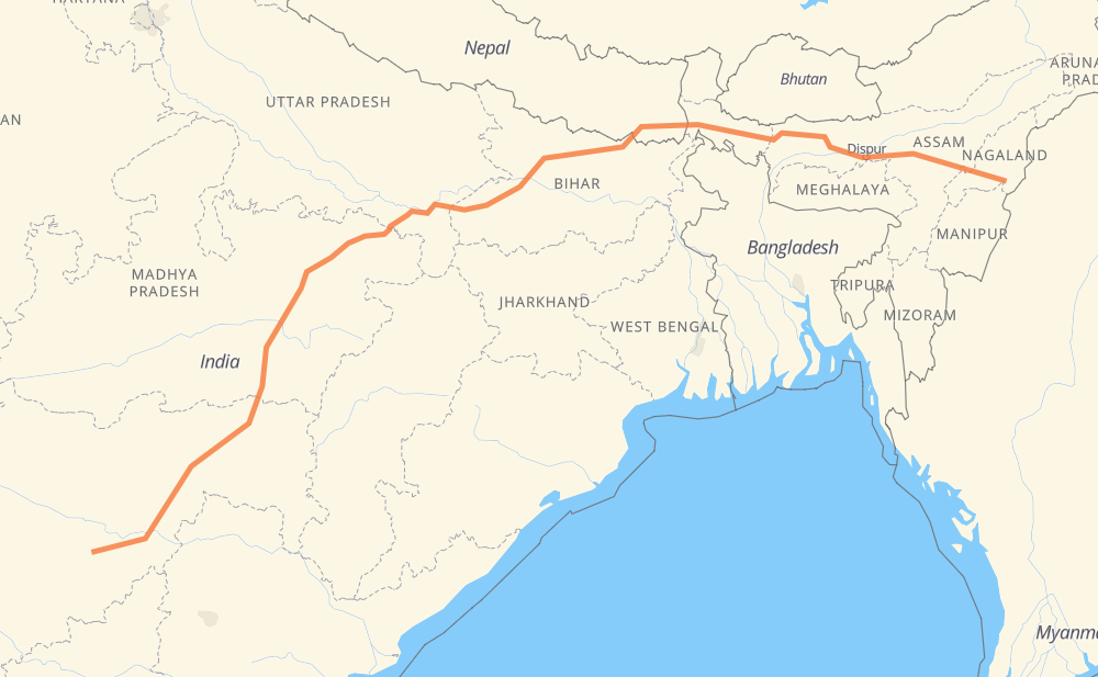
The distance from Kaij to Meluri is 2,770 kilometers by road. Road takes approximately 32 hours and 55 minutes and goes through Nanded-Waghala, Yavatmal, Jabalpur, Rewa, Varanasi, Arrah and Muzaffarpur.
| Shortest distance by air | 2,060 km ✈️ |
| Car route length | 2,770 km 🚗 |
| Driving time | 32 h 55 min |
| Fuel amount | 221.6 L |
| Fuel cost | 434.3 CAD |
| Point | Distance | Time | Fuel | |
| Kaij | 0 km | 00 min | 0.0 L | |
|
NH548D 36 km, 26 min
|
||||
| Ambajogai | 36 km | 26 min | 2.4 L | |
|
NH548D NH361F 132 km, 1 h 34 min
|
||||
| Nanded-Waghala | 168 km | 2 h 01 min | 12.6 L | |
|
NH361 189 km, 2 h 14 min
|
||||
| Yavatmal | 357 km | 4 h 16 min | 27.9 L | |
|
NH361 NH44 423 km, 4 h 58 min
|
||||
| Jabalpur | 780 km | 9 h 14 min | 61.9 L | |
|
NH45 NH30 224 km, 2 h 38 min
|
||||
| Rewa | 1,004 km | 11 h 52 min | 79.8 L | |
|
NH39 NH135 406 km, 4 h 44 min
|
||||
| Arrah | 1,410 km | 16 h 37 min | 112.4 L | |
|
NH922 NH722 103 km, 1 h 13 min
|
||||
| Muzaffarpur | 1,514 km | 17 h 50 min | 120.7 L | |
|
NH722 NH27 63 km, 44 min
|
||||
| Darbhanga | 1,576 km | 18 h 35 min | 125.6 L | |
|
NH27 1,207 km, 14 h 19 min
|
||||
| Meluri | 2,784 km | 32 h 55 min | 220.4 L | |
Frequently Asked Questions
How much does it cost to drive from Kaij to Meluri?
Fuel cost: 434.3 CAD
This fuel cost is calculated as: (Route length 2,770 km / 100 km) * (Fuel consumption 8 L/100 km) * (Fuel price 1.96 CAD / L)
You can adjust fuel consumption and fuel price here.
How long is a car ride from Kaij to Meluri?
Driving time: 32 h 55 min
This time is calculated for driving at the maximum permitted speed, taking into account traffic rules restrictions.
- 1,437 km with a maximum speed 90 km/h = 15 h 58 min
- 1,335 km with a maximum speed 80 km/h = 16 h 41 min
- 4 km with a maximum speed 50 km/h = 4 min
- 7 km with a maximum speed 40 km/h = 10 min
The calculated driving time does not take into account intermediate stops and traffic jams.
How far is Kaij to Meluri by land?
The distance between Kaij and Meluri is 2,770 km by road.
Precise satellite coordinates of highways were used for this calculation. The start and finish points are the centers of Kaij and Meluri respectively.
How far is Kaij to Meluri by plane?
The shortest distance (air line, as the crow flies) between Kaij and Meluri is 2,060 km.
This distance is calculated using the Haversine formula as a great-circle distance between two points on the surface of a sphere. The start and finish points are the centers of Kaij and Meluri respectively. Actual distance between airports may be different.
How many hours is Kaij from Meluri by plane?
Boeing 737 airliner needs 2 h 34 min to cover the distance of 2,060 km at a cruising speed of 800 km/h.
Small plane "Cessna 172" needs 9 h 21 min to flight this distance at average speed of 220 km/h.
This time is approximate and do not take into account takeoff and landing times, airport location and other real world factors.
How long is a helicopter ride from Kaij to Meluri?
Fast helicopter "Eurocopter AS350" or "Hughes OH-6 Cayuse" need 8 h 35 min to cover the distance of 2,060 km at a cruising speed of 240 km/h.
Popular "Robinson R44" needs 9 h 48 min to flight this distance at average speed of 210 km/h.
This time is approximate and do not take into account takeoff and landing times, aerodrome location and other real world factors.
What city is halfway between Kaij and Meluri?
The halfway point between Kaij and Meluri is Arrah. It is located about 25 km from the exact midpoint by road.
The distance from Arrah to Kaij is 1,410 km and driving will take about 16 h 36 min. The road between Arrah and Meluri has length 1,360 km and will take approximately 16 h 18 min.
The other cities located close to halfway point:
Where is Kaij in relation to Meluri?
Kaij is located 2,060 km south-west of Meluri.
Kaij has geographic coordinates: latitude 18.71412, longitude 76.06516.
Meluri has geographic coordinates: latitude 25.68445, longitude 94.62848.
Which highway goes from Kaij to Meluri?
The route from Kaij to Meluri follows NH27, NH361, NH29, NH30, NH44, H01, NH135, NH319.
Other minor sections pass along the road:
- NH427: 91 km
- NH34: 70 km
- NH361F: 68 km
- NH19: 63 km
- NH722: 63 km
- NH35: 60 km
- NH202: 43 km
- NH548D: 43 km
- NH161: 27 km
- SH17: 27 km
- NH131: 27 km
- 161A: 26 km
- NH17: 19 km
- NH548B: 19 km
- MDR: 18 km
- NH327: 17 km
- SH19: 15 km
- 27: 14 km
- NH39: 14 km
- NH922: 13 km
- 548B: 9 km
- NH22: 6 km
- 34: 6 km
- 353I: 5 km
- 43: 4 km
- 347A: 4 km
- 753: 4 km
- 361F: 3 km
- NH752K: 3 km
- NH61: 3 km
- 752I: 3 km
- 161: 3 km
- 361: 1 km