Distance between Joaquín V. González and Punta Mejillón
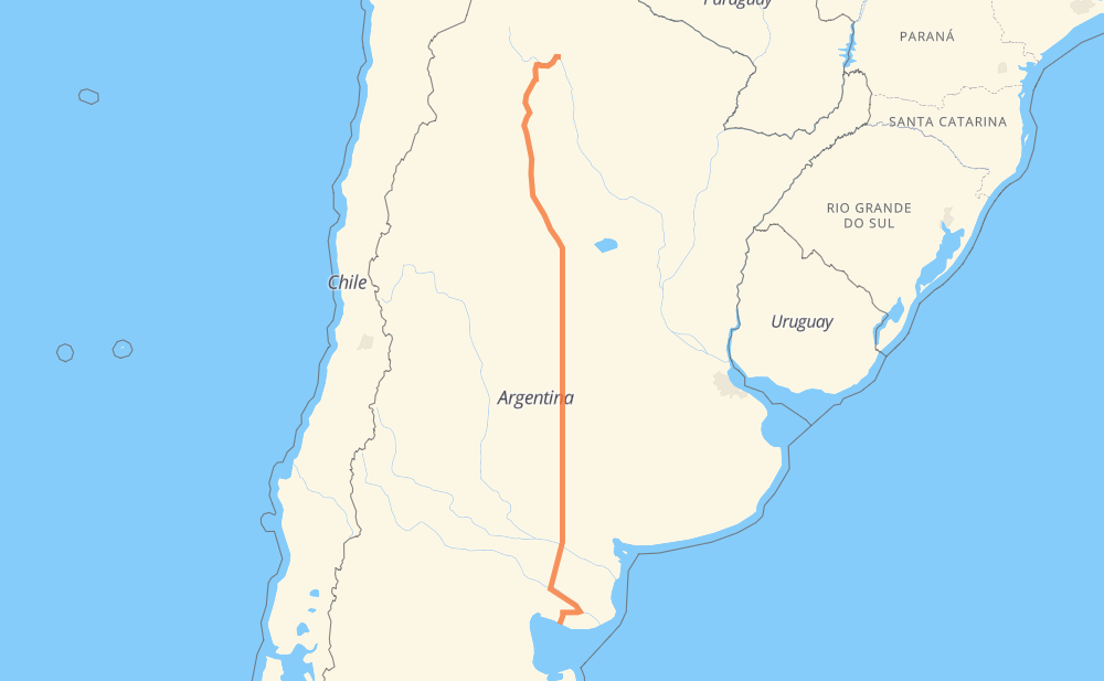
The distance from Joaquín V. González to Punta Mejillón is 2,084 kilometers by road including 57 kilometers on motorways. Road takes approximately 23 hours and 50 minutes and goes through San Miguel de Tucumán, Córdoba, Río Cuarto and Santa Rosa.
| Shortest distance by air | 1,768 km ✈️ |
| Car route length | 2,084 km 🚗 |
| Driving time | 23 h 50 min |
| Fuel amount | 166.7 L |
| Fuel cost | 326.7 CAD |
| Point | Distance | Time | Fuel | |
| Joaquín V. González | 0 km | 00 min | 0.0 L | |
|
RN16 120 km, 1 h 27 min
|
||||
| Metán | 120 km | 1 h 27 min | 9.5 L | |
|
RN9 35 km, 25 min
|
||||
| Rosario de la Frontera | 155 km | 1 h 52 min | 12.3 L | |
|
RN9 75 km, 50 min
|
||||
| Benjamín Paz | 230 km | 2 h 43 min | 18.1 L | |
|
RN9 53 km, 35 min
|
||||
| San Miguel de Tucumán | 283 km | 3 h 19 min | 21.4 L | |
|
RN9 RN157 196 km, 2 h 09 min
|
||||
| Frías | 479 km | 5 h 29 min | 36.2 L | |
|
RN157 RN60 367 km, 4 h 10 min
|
||||
| Córdoba | 846 km | 9 h 39 min | 65.8 L | |
|
RN2V9 RN36 222 km, 2 h 29 min
|
||||
| Río Cuarto | 1,067 km | 12 h 08 min | 84.6 L | |
|
RNA005 RN35 395 km, 4 h 34 min
|
||||
| Santa Rosa | 1,462 km | 16 h 42 min | 116.6 L | |
|
RN35 RN154 621 km, 7 h 07 min
|
||||
| Punta Mejillón | 2,084 km | 23 h 50 min | 166.3 L | |
Frequently Asked Questions
How much does it cost to drive from Joaquín V. González to Punta Mejillón?
Fuel cost: 326.7 CAD
This fuel cost is calculated as: (Route length 2,084 km / 100 km) * (Fuel consumption 8 L/100 km) * (Fuel price 1.96 CAD / L)
You can adjust fuel consumption and fuel price here.
How long is a car ride from Joaquín V. González to Punta Mejillón?
Driving time: 23 h 50 min
This time is calculated for driving at the maximum permitted speed, taking into account traffic rules restrictions.
- 41 km with a maximum speed 110 km/h = 22 min
- 1,672 km with a maximum speed 90 km/h = 18 h 34 min
- 325 km with a maximum speed 80 km/h = 4 h 3 min
- 35 km with a maximum speed 60 km/h = 34 min
- 7 km with a maximum speed 50 km/h = 8 min
- 4 km with a maximum speed 40 km/h = 5 min
The calculated driving time does not take into account intermediate stops and traffic jams.
How far is Joaquín V. González to Punta Mejillón by land?
The distance between Joaquín V. González and Punta Mejillón is 2,084 km by road including 57 km on motorways.
Precise satellite coordinates of highways were used for this calculation. The start and finish points are the centers of Joaquín V. González and Punta Mejillón respectively.
How far is Joaquín V. González to Punta Mejillón by plane?
The shortest distance (air line, as the crow flies) between Joaquín V. González and Punta Mejillón is 1,768 km.
This distance is calculated using the Haversine formula as a great-circle distance between two points on the surface of a sphere. The start and finish points are the centers of Joaquín V. González and Punta Mejillón respectively. Actual distance between airports may be different.
How many hours is Joaquín V. González from Punta Mejillón by plane?
Boeing 737 airliner needs 2 h 12 min to cover the distance of 1,768 km at a cruising speed of 800 km/h.
Small plane "Cessna 172" needs 8 h 2 min to flight this distance at average speed of 220 km/h.
This time is approximate and do not take into account takeoff and landing times, airport location and other real world factors.
How long is a helicopter ride from Joaquín V. González to Punta Mejillón?
Fast helicopter "Eurocopter AS350" or "Hughes OH-6 Cayuse" need 7 h 22 min to cover the distance of 1,768 km at a cruising speed of 240 km/h.
Popular "Robinson R44" needs 8 h 25 min to flight this distance at average speed of 210 km/h.
This time is approximate and do not take into account takeoff and landing times, aerodrome location and other real world factors.
What city is halfway between Joaquín V. González and Punta Mejillón?
The halfway point between Joaquín V. González and Punta Mejillón is Coronel Baigorria. It is located about 13 km from the exact midpoint by road.
The distance from Coronel Baigorria to Joaquín V. González is 1,029 km and driving will take about 11 h 41 min. The road between Coronel Baigorria and Punta Mejillón has length 1,055 km and will take approximately 12 h 9 min.
The other cities located close to halfway point:
Where is Joaquín V. González in relation to Punta Mejillón?
Joaquín V. González is located 1,768 km north of Punta Mejillón.
Joaquín V. González has geographic coordinates: latitude -25.1143, longitude -64.12467.
Punta Mejillón has geographic coordinates: latitude -41.01263, longitude -64.16246.
Which highway goes from Joaquín V. González to Punta Mejillón?
The route from Joaquín V. González to Punta Mejillón follows RN35, RN157, RN9, RN36, RN60, RN154, RN251, RN250, RN16.
Other minor sections pass along the road:
- RN34: 50 km
- RN3: 49 km
- RP52: 33 km
- RN22: 32 km
- RN2V9: 14 km
- RNA005: 11 km
- RN8: 8 km
- RNA019: 8 km
- RN38: 6 km
- RP1: 4 km
- RPU304: 2 km
- RPS428: 1 km