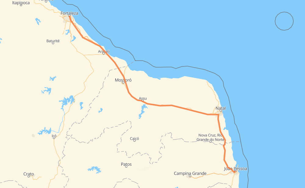
Distance between João Pessoa and Fortaleza
The distance from João Pessoa to Fortaleza is 665 kilometers by road including 127 kilometers on motorways. Road takes approximately 8 hours and 17 minutes and goes through Distrito Mecânico, Varadouro, Imaculada, Cajupiranga, Guajerú, Messejana and Parque Iracema.
| Shortest distance by air | 552 km ✈️ |
| Car route length | 665 km 🚗 |
| Driving time | 8 h 17 min |
| Fuel amount | 53.2 L |
| Fuel cost | 104.3 CAD |
| Point | Distance | Time | Fuel | |
| João Pessoa | 0 km | 00 min | 0.0 L | |
|
1 km, 00 min
|
||||
| Distrito Mecânico | 1 km | 00 min | 0.1 L | |
|
1 km, 00 min
|
||||
| Varadouro | 2 km | 01 min | 0.1 L | |
|
PB-004 6 km, 04 min
|
||||
| Imaculada | 8 km | 05 min | 0.5 L | |
|
BR-101 147 km, 1 h 39 min
|
||||
| Cajupiranga | 154 km | 1 h 45 min | 11.9 L | |
|
BR-101 BR-304 497 km, 6 h 10 min
|
||||
| Guajerú | 652 km | 7 h 55 min | 52.0 L | |
|
CE-040 3 km, 03 min
|
||||
| Messejana | 655 km | 7 h 58 min | 52.3 L | |
|
6 km, 05 min
|
||||
| Jardim das Oliveiras | 660 km | 8 h 03 min | 52.4 L | |
|
BR-116 12 km, 11 min
|
||||
| José Bonifácio | 672 km | 8 h 15 min | 53.7 L | |
|
2 km, 01 min
|
||||
| Fortaleza | 674 km | 8 h 17 min | 53.8 L | |
Hotels of Fortaleza
Frequently Asked Questions
How much does it cost to drive from João Pessoa to Fortaleza?
Fuel cost: 104.3 CAD
This fuel cost is calculated as: (Route length 665 km / 100 km) * (Fuel consumption 8 L/100 km) * (Fuel price 1.96 CAD / L)
You can adjust fuel consumption and fuel price here.
How long is a car ride from João Pessoa to Fortaleza?
Driving time: 8 h 17 min
This time is calculated for driving at the maximum permitted speed, taking into account traffic rules restrictions.
- 23 km with a maximum speed 100 km/h = 13 min
- 219 km with a maximum speed 90 km/h = 2 h 26 min
- 386 km with a maximum speed 80 km/h = 4 h 49 min
- 40 km with a maximum speed 60 km/h = 40 min
- 6 km with a maximum speed 50 km/h = 6 min
- 1 km with a maximum speed 40 km/h = 1 min
The calculated driving time does not take into account intermediate stops and traffic jams.
How far is João Pessoa to Fortaleza by land?
The distance between João Pessoa and Fortaleza is 665 km by road including 127 km on motorways.
Precise satellite coordinates of highways were used for this calculation. The start and finish points are the centers of João Pessoa and Fortaleza respectively.
How far is João Pessoa to Fortaleza by plane?
The shortest distance (air line, as the crow flies) between João Pessoa and Fortaleza is 552 km.
This distance is calculated using the Haversine formula as a great-circle distance between two points on the surface of a sphere. The start and finish points are the centers of João Pessoa and Fortaleza respectively. Actual distance between airports may be different.
How many hours is João Pessoa from Fortaleza by plane?
Boeing 737 airliner needs 41 min to cover the distance of 552 km at a cruising speed of 800 km/h.
Small plane "Cessna 172" needs 2 h 30 min to flight this distance at average speed of 220 km/h.
This time is approximate and do not take into account takeoff and landing times, airport location and other real world factors.
How long is a helicopter ride from João Pessoa to Fortaleza?
Fast helicopter "Eurocopter AS350" or "Hughes OH-6 Cayuse" need 2 h 18 min to cover the distance of 552 km at a cruising speed of 240 km/h.
Popular "Robinson R44" needs 2 h 37 min to flight this distance at average speed of 210 km/h.
This time is approximate and do not take into account takeoff and landing times, aerodrome location and other real world factors.
What city is halfway between João Pessoa and Fortaleza?
The halfway point between João Pessoa and Fortaleza is Cachoeira do Sapo. It is located about 89 km from the exact midpoint by road.
The distance from Cachoeira do Sapo to João Pessoa is 244 km and driving will take about 2 h 51 min. The road between Cachoeira do Sapo and Fortaleza has length 422 km and will take approximately 5 h 26 min.
The other cities located close to halfway point:
Where is João Pessoa in relation to Fortaleza?
João Pessoa is located 552 km south-east of Fortaleza.
João Pessoa has geographic coordinates: latitude -7.1216, longitude -34.88203.
Fortaleza has geographic coordinates: latitude -3.73045, longitude -38.5218.
Which highway goes from João Pessoa to Fortaleza?
The route from João Pessoa to Fortaleza follows BR-304, BR-101, CE-040.
Other minor sections pass along the road:
- BR-116: 13 km
- BR-230: 4 km