Distance between Jackson TN and San Nicolás de los Garza
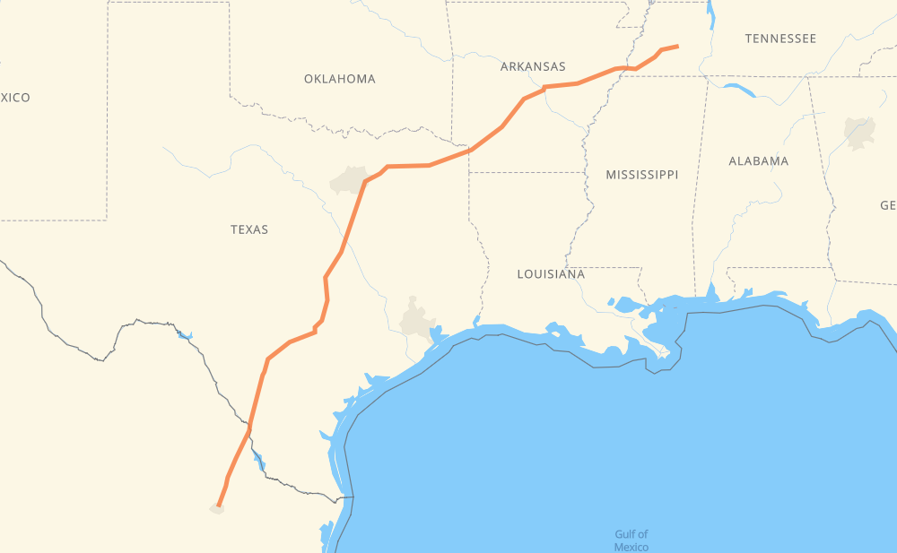
The distance from Jackson to San Nicolás de los Garza is 1,794 kilometers by road including 1,733 kilometers on motorways. Road takes approximately 17 hours and 39 minutes and goes through Memphis, Little Rock, Dallas, Garland, Mesquite, Waco and Austin.
| Shortest distance by air | 1,549 km ✈️ |
| Car route length | 1,794 km 🚗 |
| Driving time | 17 h 39 min |
| Fuel amount | 143.5 L |
| Fuel cost | 281.3 CAD |
| Toll roads cost | 273 MXN |
| Point | Distance | Time | Fuel | |
| Jackson | 0 km | 00 min | 0.0 L | |
|
US 45 Bypass I 40 123 km, 1 h 11 min
|
||||
| Memphis | 123 km | 1 h 11 min | 8.7 L | |
|
I 40 240 km, 2 h 18 min
|
||||
| Little Rock | 364 km | 3 h 30 min | 27.7 L | |
|
I 30 470 km, 4 h 52 min
|
||||
| Dallas | 834 km | 8 h 22 min | 66.5 L | |
|
I 30 6 km, 04 min
|
||||
| Garland | 840 km | 8 h 26 min | 66.9 L | |
|
I 30 10 km, 06 min
|
||||
| Mesquite | 850 km | 8 h 32 min | 67.5 L | |
|
I 635 22 km, 12 min
|
||||
| Dallas | 871 km | 8 h 45 min | 68.9 L | |
|
I 20 I 35E 146 km, 1 h 25 min
|
||||
| Waco | 1,017 km | 10 h 10 min | 80.8 L | |
|
I 35 163 km, 1 h 31 min
|
||||
| Austin | 1,181 km | 11 h 42 min | 93.4 L | |
|
TX 45 Toll TX 130 Toll 150 km, 1 h 22 min
|
||||
| San Antonio | 1,331 km | 13 h 05 min | 106.1 L | |
|
I 10 I 35 236 km, 2 h 09 min
|
||||
| Laredo | 1,567 km | 15 h 14 min | 124.1 L | |
|
US 83 16 km, 09 min
|
||||
| Nuevo Laredo | 1,582 km | 15 h 24 min | 126.5 L | |
|
MEX 85 MEX 85D 221 km, 2 h 14 min
|
||||
| San Nicolás de los Garza | 1,803 km | 17 h 39 min | 143.9 L | |
Hotels of San Nicolás de los Garza
Frequently Asked Questions
How many toll booths are there from Jackson to San Nicolás de los Garza?
There are 1 tollbooth between Jackson and San Nicolás de los Garza: Sabinas.
How much does the toll booths cost from Jackson to San Nicolás de los Garza?
Toll roads cost: Sabinas (273 MXN) = 273 MXN
How much does it cost to drive from Jackson to San Nicolás de los Garza?
Fuel cost: 281.3 CAD
This fuel cost is calculated as: (Route length 1,794 km / 100 km) * (Fuel consumption 8 L/100 km) * (Fuel price 1.96 CAD / L)
You can adjust fuel consumption and fuel price here.
Toll roads cost: 273 MXN
How long is a car ride from Jackson to San Nicolás de los Garza?
Driving time: 17 h 39 min
This time is calculated for driving at the maximum permitted speed, taking into account traffic rules restrictions.
- 1,195 km with a maximum speed 110 km/h = 10 h 51 min
- 103 km with a maximum speed 105 km/h = 59 min
- 184 km with a maximum speed 100 km/h = 1 h 50 min
- 17 km with a maximum speed 97 km/h = 10 min
- 24 km with a maximum speed 90 km/h = 15 min
- 17 km with a maximum speed 89 km/h = 11 min
- 255 km with a maximum speed 80 km/h = 3 h 11 min
- 3 km with a maximum speed 64 km/h = 2 min
- 2 km with a maximum speed 60 km/h = 2 min
- 2 km with a maximum speed 50 km/h = 2 min
The calculated driving time does not take into account intermediate stops and traffic jams.
How far is Jackson to San Nicolás de los Garza by land?
The distance between Jackson and San Nicolás de los Garza is 1,794 km by road including 1,733 km on motorways.
Precise satellite coordinates of highways were used for this calculation. The start and finish points are the centers of Jackson and San Nicolás de los Garza respectively.
How far is Jackson to San Nicolás de los Garza by plane?
The shortest distance (air line, as the crow flies) between Jackson and San Nicolás de los Garza is 1,549 km.
This distance is calculated using the Haversine formula as a great-circle distance between two points on the surface of a sphere. The start and finish points are the centers of Jackson and San Nicolás de los Garza respectively. Actual distance between airports may be different.
How many hours is Jackson from San Nicolás de los Garza by plane?
Boeing 737 airliner needs 1 h 56 min to cover the distance of 1,549 km at a cruising speed of 800 km/h.
Small plane "Cessna 172" needs 7 h 2 min to flight this distance at average speed of 220 km/h.
This time is approximate and do not take into account takeoff and landing times, airport location and other real world factors.
How long is a helicopter ride from Jackson to San Nicolás de los Garza?
Fast helicopter "Eurocopter AS350" or "Hughes OH-6 Cayuse" need 6 h 27 min to cover the distance of 1,549 km at a cruising speed of 240 km/h.
Popular "Robinson R44" needs 7 h 22 min to flight this distance at average speed of 210 km/h.
This time is approximate and do not take into account takeoff and landing times, aerodrome location and other real world factors.
What city is halfway between Jackson and San Nicolás de los Garza?
The halfway point between Jackson and San Nicolás de los Garza is Waxahachie. It is located about 9 km from the exact midpoint by road.
The distance from Waxahachie to Jackson is 906 km and driving will take about 9 h 6 min. The road between Waxahachie and San Nicolás de los Garza has length 888 km and will take approximately 8 h 32 min.
The other cities located close to halfway point:
Where is Jackson in relation to San Nicolás de los Garza?
Jackson is located 1,549 km north-east of San Nicolás de los Garza.
Jackson has geographic coordinates: latitude 35.61444, longitude -88.81774.
San Nicolás de los Garza has geographic coordinates: latitude 25.75551, longitude -100.28957.
Which highway goes from Jackson to San Nicolás de los Garza?
The route from Jackson to San Nicolás de los Garza follows I 30, I 35, I 40, US 67, TX 130 Toll, MEX 85D.
Other minor sections pass along the road:
- MEX 85: 99 km
- I 35E: 77 km
- I 10: 66 km
- US 77: 57 km
- TX 130: 53 km
- US 90: 49 km
- TX 45 Toll: 46 km
- US 70: 34 km
- US 83: 28 km
- MEX 2: 24 km
- I 20: 19 km
- I 440: 16 km
- I 635: 13 km
- US-70: 11 km
- I-30: 11 km
- US 45 Bypass: 8 km
- US 190: 7 km
- US-67: 7 km
- US 87: 6 km
- US 59: 4 km
- I 55: 4 km
- US 270: 2 km
- US 412: 1 km
- I 35-A Business: 1 km