Distance between Jackson's Arm NL and Mattawa ON
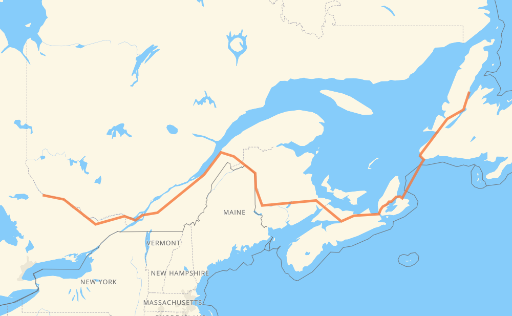
The distance from Jackson's Arm to Mattawa is 2,498 kilometers by road including 1,557 kilometers on motorways. Road takes approximately 32 hours and 26 minutes and goes through Corner Brook, Moncton, Fredericton, Lévis, Drummondville, Longueuil and Montreal.
| Shortest distance by air | 1,670 km ✈️ |
| Car route length | 2,498 km 🚗 |
| Driving time | 32 h 26 min |
| Fuel amount | 199.8 L |
| Fuel cost | 391.6 CAD |
| Point | Distance | Time | Fuel | |
| Jackson's Arm | 0 km | 00 min | 0.0 L | |
|
420 1 169 km, 1 h 52 min
|
||||
| Corner Brook | 169 km | 1 h 52 min | 12.3 L | |
|
1 TCH 860 km, 15 h 57 min
|
||||
| Moncton | 1,030 km | 17 h 49 min | 81.6 L | |
|
2 170 km, 1 h 32 min
|
||||
| Fredericton | 1,199 km | 19 h 21 min | 95.6 L | |
|
2 550 km, 5 h 17 min
|
||||
| Lévis | 1,749 km | 24 h 38 min | 138.8 L | |
|
20 160 km, 1 h 35 min
|
||||
| Drummondville | 1,909 km | 26 h 14 min | 152.2 L | |
|
20 87 km, 52 min
|
||||
| Longueuil | 1,996 km | 27 h 07 min | 159.6 L | |
|
25 16 km, 12 min
|
||||
| Montreal | 2,012 km | 27 h 19 min | 159.8 L | |
|
40 417 205 km, 2 h 00 min
|
||||
| Ottawa | 2,217 km | 29 h 20 min | 173.5 L | |
|
417 17 128 km, 1 h 22 min
|
||||
| Pembroke | 2,345 km | 30 h 43 min | 187.3 L | |
|
17 153 km, 1 h 43 min
|
||||
| Mattawa | 2,498 km | 32 h 26 min | 197.1 L | |
Hotels of Mattawa
Frequently Asked Questions
How much does it cost to drive from Jackson's Arm to Mattawa?
Fuel cost: 391.6 CAD
This fuel cost is calculated as: (Route length 2,498 km / 100 km) * (Fuel consumption 8 L/100 km) * (Fuel price 1.96 CAD / L)
You can adjust fuel consumption and fuel price here.
How long is a car ride from Jackson's Arm to Mattawa?
Driving time: 32 h 26 min
This time is calculated for driving at the maximum permitted speed, taking into account traffic rules restrictions.
- 779 km with a maximum speed 110 km/h = 7 h 5 min
- 741 km with a maximum speed 100 km/h = 7 h 24 min
- 726 km with a maximum speed 90 km/h = 8 h 4 min
- 37 km with a maximum speed 80 km/h = 27 min
- 30 km with a maximum speed 70 km/h = 25 min
- 3 km with a maximum speed 60 km/h = 2 min
- 4 km with a maximum speed 50 km/h = 4 min
- 177 km with a maximum speed 20 km/h = 8 h 52 min
The calculated driving time does not take into account intermediate stops and traffic jams.
How far is Jackson's Arm to Mattawa by land?
The distance between Jackson's Arm and Mattawa is 2,498 km by road including 1,557 km on motorways.
Precise satellite coordinates of highways were used for this calculation. The start and finish points are the centers of Jackson's Arm and Mattawa respectively.
How far is Jackson's Arm to Mattawa by plane?
The shortest distance (air line, as the crow flies) between Jackson's Arm and Mattawa is 1,670 km.
This distance is calculated using the Haversine formula as a great-circle distance between two points on the surface of a sphere. The start and finish points are the centers of Jackson's Arm and Mattawa respectively. Actual distance between airports may be different.
How many hours is Jackson's Arm from Mattawa by plane?
Boeing 737 airliner needs 2 h 5 min to cover the distance of 1,670 km at a cruising speed of 800 km/h.
Small plane "Cessna 172" needs 7 h 35 min to flight this distance at average speed of 220 km/h.
This time is approximate and do not take into account takeoff and landing times, airport location and other real world factors.
How long is a helicopter ride from Jackson's Arm to Mattawa?
Fast helicopter "Eurocopter AS350" or "Hughes OH-6 Cayuse" need 6 h 57 min to cover the distance of 1,670 km at a cruising speed of 240 km/h.
Popular "Robinson R44" needs 7 h 57 min to flight this distance at average speed of 210 km/h.
This time is approximate and do not take into account takeoff and landing times, aerodrome location and other real world factors.
What city is halfway between Jackson's Arm and Mattawa?
The halfway point between Jackson's Arm and Mattawa is Meductic. It is located about 27 km from the exact midpoint by road.
The distance from Meductic to Jackson's Arm is 1,276 km and driving will take about 20 h 2 min. The road between Meductic and Mattawa has length 1,222 km and will take approximately 12 h 24 min.
The other cities located close to halfway point:
Where is Jackson's Arm in relation to Mattawa?
Jackson's Arm is located 1,670 km east of Mattawa.
Jackson's Arm has geographic coordinates: latitude 49.86688, longitude -56.77719.
Mattawa has geographic coordinates: latitude 46.3173, longitude -78.70331.
Which highway goes from Jackson's Arm to Mattawa?
The route from Jackson's Arm to Mattawa follows TCH, 2, 20, 1, NS 104, 17, 417, NS 105.
Other minor sections pass along the road:
- 40: 80 km
- 420: 67 km
- 85: 62 km
- 185: 38 km
- 55: 35 km
- 7: 11 km
- 25: 8 km
- 105: 6 km
- 116: 5 km
- NS 4: 4 km
- NB 2: 2 km
- 15: 2 km
- 232: 2 km