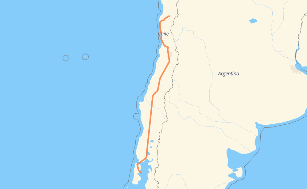
The distance from Hurtado to Traiguén is 1,699 kilometers by road including 1,450 kilometers on motorways. Road takes approximately 16 hours and 45 minutes and goes through Ovalle, Colina, San Bernardo, Rancagua, San Fernando, Curicó and Talca.
How much does it cost to drive from Hurtado to Traiguén?
Fuel cost:
266.4 CAD
This fuel cost is calculated as: (Route length 1,699 km / 100 km) * (Fuel consumption 8 L/100 km) * (Fuel price 1.96 CAD / L)
You can adjust fuel consumption and fuel price here.
How long is a car ride from Hurtado to Traiguén?
Driving time:
16 h 45 min
This time is calculated for driving at the maximum permitted speed, taking into account traffic rules restrictions.
1,253 km with a maximum speed 110 km/h = 11 h 23 min
158 km with a maximum speed 100 km/h = 1 h 34 min
49 km with a maximum speed 90 km/h = 32 min
219 km with a maximum speed 80 km/h = 2 h 44 min
5 km with a maximum speed 70 km/h = 4 min
3 km with a maximum speed 60 km/h = 2 min
6 km with a maximum speed 50 km/h = 7 min
5 km with a maximum speed 20 km/h = 15 min
The calculated driving time does not take into account intermediate stops and traffic jams.
How far is Hurtado to Traiguén by land?
The distance between Hurtado and Traiguén is 1,699 km by road including 1,450 km on motorways.
Precise satellite coordinates of highways were used for this calculation. The start and finish points are the centers of Hurtado and Traiguén respectively.
How far is Hurtado to Traiguén by plane?
The shortest distance (air line, as the crow flies) between Hurtado and Traiguén is 1,387 km.
This distance is calculated using the Haversine formula as a great-circle distance between two points on the surface of a sphere. The start and finish points are the centers of Hurtado and Traiguén respectively. Actual distance between airports may be different.
How many hours is Hurtado from Traiguén by plane?
Boeing 737 airliner needs 1 h 44 min to cover the distance of 1,387 km at a cruising speed of 800 km/h.
Small plane "Cessna 172" needs 6 h 18 min to flight this distance at average speed of 220 km/h.
This time is approximate and do not take into account takeoff and landing times, airport location and other real world factors.
How long is a helicopter ride from Hurtado to Traiguén?
Fast helicopter "Eurocopter AS350" or "Hughes OH-6 Cayuse" need 5 h 46 min to cover the distance of 1,387 km at a cruising speed of 240 km/h.
Popular "Robinson R44" needs 6 h 36 min to flight this distance at average speed of 210 km/h.
This time is approximate and do not take into account takeoff and landing times, aerodrome location and other real world factors.
What city is halfway between Hurtado and Traiguén?
The halfway point between Hurtado and Traiguén is San Carlos. It is located about 11 km from the exact midpoint by road.
The distance from San Carlos to Hurtado is 861 km and driving will take about 8 h 21 min. The road between San Carlos and Traiguén has length 838 km and will take approximately 8 h 23 min.
The other cities located close to halfway point:
San Gregorio is in 835 km from Hurtado and 864 km from Traiguén
Parral is in 825 km from Hurtado and 874 km from Traiguén
Chillán is in 880 km from Hurtado and 819 km from Traiguén
Where is Hurtado in relation to Traiguén?
Hurtado is located 1,387 km north of Traiguén.
Hurtado has geographic coordinates: latitude -30.27846, longitude -70.67675.
Traiguén has geographic coordinates: latitude -42.55865, longitude -73.41349.