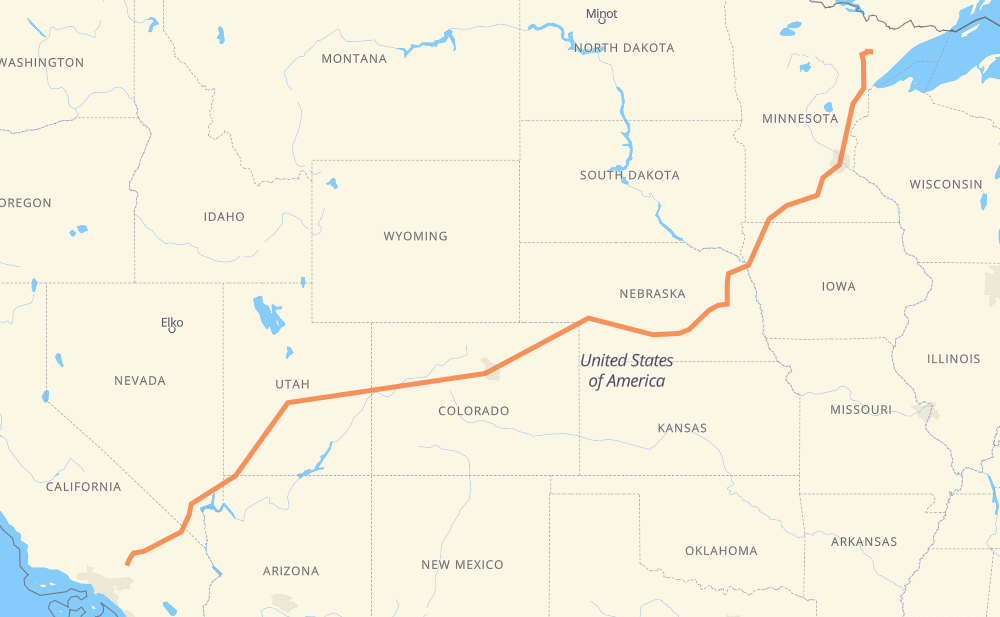
The distance from Hoyt Lakes to Victorville is 3,222 kilometers by road including 2,494 kilometers on motorways. Road takes approximately 31 hours and 40 minutes and goes through Minneapolis, Sioux City, Columbus, Grand Island, North Platte, Denver and Vail.
How much does it cost to drive from Hoyt Lakes to Victorville?
Fuel cost:
507.7 CAD
This fuel cost is calculated as: (Route length 3,222 km / 100 km) * (Fuel consumption 8 L/100 km) * (Fuel price 1.97 CAD / L)
You can adjust fuel consumption and fuel price here.
How long is a car ride from Hoyt Lakes to Victorville?
Driving time:
31 h 40 min
This time is calculated for driving at the maximum permitted speed, taking into account traffic rules restrictions.
1,917 km with a maximum speed 110 km/h = 17 h 25 min
285 km with a maximum speed 105 km/h = 2 h 43 min
112 km with a maximum speed 100 km/h = 1 h 7 min
37 km with a maximum speed 97 km/h = 23 min
621 km with a maximum speed 90 km/h = 6 h 54 min
91 km with a maximum speed 89 km/h = 1 h 1 min
19 km with a maximum speed 80 km/h = 14 min
109 km with a maximum speed 80 km/h = 1 h 22 min
15 km with a maximum speed 72 km/h = 12 min
3 km with a maximum speed 64 km/h = 3 min
3 km with a maximum speed 56 km/h = 3 min
2 km with a maximum speed 50 km/h = 1 min
5 km with a maximum speed 48 km/h = 6 min
The calculated driving time does not take into account intermediate stops and traffic jams.
How far is Hoyt Lakes to Victorville by land?
The distance between Hoyt Lakes and Victorville is 3,222 km by road including 2,494 km on motorways.
Precise satellite coordinates of highways were used for this calculation. The start and finish points are the centers of Hoyt Lakes and Victorville respectively.
How far is Hoyt Lakes to Victorville by plane?
The shortest distance (air line, as the crow flies) between Hoyt Lakes and Victorville is 2,539 km.
This distance is calculated using the Haversine formula as a great-circle distance between two points on the surface of a sphere. The start and finish points are the centers of Hoyt Lakes and Victorville respectively. Actual distance between airports may be different.
How many hours is Hoyt Lakes from Victorville by plane?
Boeing 737 airliner needs 3 h 10 min to cover the distance of 2,539 km at a cruising speed of 800 km/h.
Small plane "Cessna 172" needs 11 h 32 min to flight this distance at average speed of 220 km/h.
This time is approximate and do not take into account takeoff and landing times, airport location and other real world factors.
How long is a helicopter ride from Hoyt Lakes to Victorville?
Fast helicopter "Eurocopter AS350" or "Hughes OH-6 Cayuse" need 10 h 34 min to cover the distance of 2,539 km at a cruising speed of 240 km/h.
Popular "Robinson R44" needs 12 h 5 min to flight this distance at average speed of 210 km/h.
This time is approximate and do not take into account takeoff and landing times, aerodrome location and other real world factors.
What city is halfway between Hoyt Lakes and Victorville?
The halfway point between Hoyt Lakes and Victorville is Log Lane Village. It is located about 13 km from the exact midpoint by road.
The distance from Log Lane Village to Hoyt Lakes is 1,598 km and driving will take about 16 h 20 min. The road between Log Lane Village and Victorville has length 1,624 km and will take approximately 15 h 19 min.
The other cities located close to halfway point:
Fort Morgan is in 1,593 km from Hoyt Lakes and 1,629 km from Victorville
Brush is in 1,581 km from Hoyt Lakes and 1,641 km from Victorville
Keenesburg is in 1,655 km from Hoyt Lakes and 1,566 km from Victorville
Where is Hoyt Lakes in relation to Victorville?
Hoyt Lakes is located 2,539 km north-east of Victorville.
Hoyt Lakes has geographic coordinates: latitude 47.51965, longitude -92.13851.
Victorville has geographic coordinates: latitude 34.53611, longitude -117.29116.
Which highway goes from Hoyt Lakes to Victorville?
The route from Hoyt Lakes to Victorville follows I 70, I 15, US 6, I 80, I 76, US 50, I 35, MN 60, US 30, US 169.