Distance between Hespeler ON and Big Spring TX
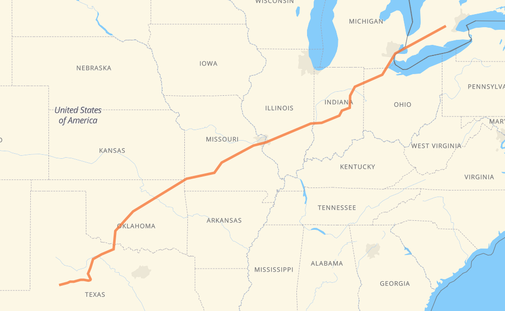
The distance from Hespeler to Big Spring is 2,549 kilometers by road including 2,247 kilometers on motorways. Road takes approximately 25 hours and 18 minutes and goes through Kitchener, Woodstock, Detroit, Toledo, Indianapolis, St. Louis and Lebanon.
| Shortest distance by air | 2,227 km ✈️ |
| Car route length | 2,549 km 🚗 |
| Driving time | 25 h 18 min |
| Fuel amount | 204 L |
| Fuel cost | 401.8 CAD |
| Point | Distance | Time | Fuel | |
| Hespeler | 0 km | 00 min | 0.0 L | |
|
24 401 10 km, 07 min
|
||||
| Kitchener | 10 km | 07 min | 0.5 L | |
|
401 42 km, 25 min
|
||||
| Woodstock | 52 km | 32 min | 3.8 L | |
|
401 238 km, 2 h 25 min
|
||||
| Detroit | 291 km | 2 h 58 min | 22.8 L | |
|
I 75 84 km, 48 min
|
||||
| Toledo | 375 km | 3 h 47 min | 29.2 L | |
|
SR 25 I 69 353 km, 3 h 41 min
|
||||
| Indianapolis | 728 km | 7 h 28 min | 58.0 L | |
|
I 70 394 km, 3 h 42 min
|
||||
| St. Louis | 1,123 km | 11 h 10 min | 89.3 L | |
|
I 44 269 km, 2 h 29 min
|
||||
| Lebanon | 1,391 km | 13 h 40 min | 108.4 L | |
|
I 44 68 km, 37 min
|
||||
| Springfield | 1,459 km | 14 h 17 min | 116.3 L | |
|
I 44 450 km, 4 h 09 min
|
||||
| Oklahoma City | 1,909 km | 18 h 26 min | 150.1 L | |
|
I 44 146 km, 1 h 21 min
|
||||
| Lawton | 2,055 km | 19 h 48 min | 164.1 L | |
|
I 44 US 277 326 km, 3 h 42 min
|
||||
| Abilene | 2,381 km | 23 h 30 min | 189.9 L | |
|
I 20 168 km, 1 h 47 min
|
||||
| Big Spring | 2,549 km | 25 h 18 min | 203.1 L | |
Hotels of Big Spring
Frequently Asked Questions
How much does it cost to drive from Hespeler to Big Spring?
Fuel cost: 401.8 CAD
This fuel cost is calculated as: (Route length 2,549 km / 100 km) * (Fuel consumption 8 L/100 km) * (Fuel price 1.97 CAD / L)
You can adjust fuel consumption and fuel price here.
How long is a car ride from Hespeler to Big Spring?
Driving time: 25 h 18 min
This time is calculated for driving at the maximum permitted speed, taking into account traffic rules restrictions.
- 1,332 km with a maximum speed 110 km/h = 12 h 6 min
- 113 km with a maximum speed 105 km/h = 1 h 4 min
- 529 km with a maximum speed 100 km/h = 5 h 17 min
- 112 km with a maximum speed 97 km/h = 1 h 9 min
- 97 km with a maximum speed 90 km/h = 1 h 4 min
- 29 km with a maximum speed 89 km/h = 19 min
- 28 km with a maximum speed 80 km/h = 21 min
- 301 km with a maximum speed 80 km/h = 3 h 45 min
- 4 km with a maximum speed 60 km/h = 4 min
- 2 km with a maximum speed 50 km/h = 2 min
The calculated driving time does not take into account intermediate stops and traffic jams.
How far is Hespeler to Big Spring by land?
The distance between Hespeler and Big Spring is 2,549 km by road including 2,247 km on motorways.
Precise satellite coordinates of highways were used for this calculation. The start and finish points are the centers of Hespeler and Big Spring respectively.
How far is Hespeler to Big Spring by plane?
The shortest distance (air line, as the crow flies) between Hespeler and Big Spring is 2,227 km.
This distance is calculated using the Haversine formula as a great-circle distance between two points on the surface of a sphere. The start and finish points are the centers of Hespeler and Big Spring respectively. Actual distance between airports may be different.
How many hours is Hespeler from Big Spring by plane?
Boeing 737 airliner needs 2 h 47 min to cover the distance of 2,227 km at a cruising speed of 800 km/h.
Small plane "Cessna 172" needs 10 h 7 min to flight this distance at average speed of 220 km/h.
This time is approximate and do not take into account takeoff and landing times, airport location and other real world factors.
How long is a helicopter ride from Hespeler to Big Spring?
Fast helicopter "Eurocopter AS350" or "Hughes OH-6 Cayuse" need 9 h 16 min to cover the distance of 2,227 km at a cruising speed of 240 km/h.
Popular "Robinson R44" needs 10 h 36 min to flight this distance at average speed of 210 km/h.
This time is approximate and do not take into account takeoff and landing times, aerodrome location and other real world factors.
What city is halfway between Hespeler and Big Spring?
The halfway point between Hespeler and Big Spring is Rolla. It is located about 8 km from the exact midpoint by road.
The distance from Rolla to Hespeler is 1,267 km and driving will take about 12 h 30 min. The road between Rolla and Big Spring has length 1,283 km and will take approximately 12 h 47 min.
The other cities located close to halfway point:
Where is Hespeler in relation to Big Spring?
Hespeler is located 2,227 km north-east of Big Spring.
Hespeler has geographic coordinates: latitude 43.43148, longitude -80.31186.
Big Spring has geographic coordinates: latitude 32.2504, longitude -101.47874.
Which highway goes from Hespeler to Big Spring?
The route from Hespeler to Big Spring follows I 44, I 70, US 277, 401, I 20, I 69, US 24.
Other minor sections pass along the road:
- I 75: 83 km
- US 82: 72 km
- US 84: 64 km
- US 281: 60 km
- US 40: 53 km
- US 50: 49 km
- OK 66: 47 km
- US 83: 36 km
- I 469: 33 km
- I 55: 32 km
- US 35: 22 km
- US 62: 22 km
- US 183: 18 km
- US 283: 18 km
- US 33: 18 km
- SR 25: 17 km
- SR 67: 17 km
- OK 3: 12 km
- I 49: 10 km
- US 71: 10 km
- I 57: 9 km
- US 412: 7 km
- SR 37: 7 km
- I 35: 7 km
- 3: 7 km
- US 6: 7 km
- SR 38: 5 km
- SR 9: 5 km
- US 287: 5 km
- OK 37: 4 km
- TX 70: 4 km
- MO 43: 4 km
- I 20-G Business: 3 km
- 4: 3 km
- I 65: 3 km
- IL 3: 2 km
- I 64: 2 km
- TX 208: 2 km
- US 30: 2 km
- I 280: 1 km