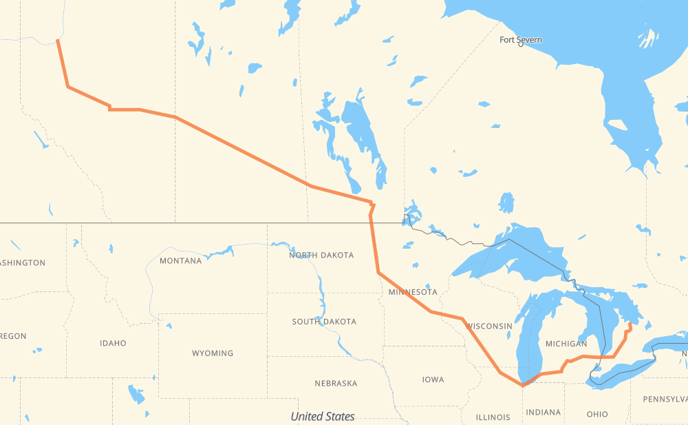
Distance between Grimshaw AB and Meaford ON
The distance from Grimshaw to Meaford is 4,041 kilometers by road including 1,976 kilometers on motorways. Road takes approximately 42 hours and 53 minutes and goes through Spruce Grove, Edmonton, Lloydminster, North Battleford, Saskatoon, Yorkton and Portage la Prairie.
| Shortest distance by air | 2,877 km ✈️ |
| Car route length | 4,041 km 🚗 |
| Driving time | 42 h 53 min |
| Fuel amount | 323.3 L |
| Fuel cost | 617.5 CAD |
| Point | Distance | Time | Fuel | |
| Grimshaw | 0 km | 00 min | 0.0 L | |
|
2 43 478 km, 5 h 21 min
|
||||
| Spruce Grove | 478 km | 5 h 21 min | 37.7 L | |
|
16 28 km, 17 min
|
||||
| Edmonton | 506 km | 5 h 39 min | 39.5 L | |
|
16 246 km, 2 h 45 min
|
||||
| Lloydminster | 752 km | 8 h 24 min | 57.3 L | |
|
16 117 km, 1 h 20 min
|
||||
| North Battleford | 869 km | 9 h 44 min | 67.3 L | |
|
16 162 km, 1 h 51 min
|
||||
| Saskatoon | 1,031 km | 11 h 35 min | 81.8 L | |
|
16 325 km, 3 h 37 min
|
||||
| Yorkton | 1,355 km | 15 h 13 min | 108.0 L | |
|
16 PTH 16 369 km, 4 h 14 min
|
||||
| Portage la Prairie | 1,725 km | 19 h 27 min | 137.4 L | |
|
PTH 1 85 km, 58 min
|
||||
| Winnipeg | 1,810 km | 20 h 25 min | 143.6 L | |
|
PTH 100 I 29 228 km, 2 h 34 min
|
||||
| Grand Forks | 2,038 km | 23 h 00 min | 162.4 L | |
|
I 29 119 km, 1 h 17 min
|
||||
| Fargo | 2,157 km | 24 h 17 min | 171.8 L | |
|
I 29 I 94 526 km, 5 h 02 min
|
||||
| Eau Claire | 2,683 km | 29 h 20 min | 213.7 L | |
|
I 94 282 km, 2 h 34 min
|
||||
| Madison | 2,965 km | 31 h 54 min | 236.5 L | |
|
I 39 56 km, 30 min
|
||||
| Janesville | 3,021 km | 32 h 25 min | 241.3 L | |
|
I 39 I 90 173 km, 1 h 39 min
|
||||
| Chicago | 3,194 km | 34 h 04 min | 253.7 L | |
|
I 90 I 94 231 km, 2 h 12 min
|
||||
| Kalamazoo | 3,426 km | 36 h 17 min | 273.9 L | |
|
I 94 I 69 104 km, 56 min
|
||||
| Lansing | 3,529 km | 37 h 13 min | 282.3 L | |
|
I 69 99 km, 54 min
|
||||
| Flint | 3,629 km | 38 h 08 min | 289.9 L | |
|
I 69 122 km, 1 h 14 min
|
||||
| Sarnia | 3,751 km | 39 h 22 min | 299.4 L | |
|
402 23 290 km, 3 h 29 min
|
||||
| Meaford | 4,041 km | 42 h 52 min | 323.0 L | |
Hotels of Meaford
Frequently Asked Questions
How much does it cost to drive from Grimshaw to Meaford?
Fuel cost: 617.5 CAD
This fuel cost is calculated as: (Route length 4,041 km / 100 km) * (Fuel consumption 8 L/100 km) * (Fuel price 1.91 CAD / L)
You can adjust fuel consumption and fuel price here.
How long is a car ride from Grimshaw to Meaford?
Driving time: 42 h 53 min
This time is calculated for driving at the maximum permitted speed, taking into account traffic rules restrictions.
- 1,326 km with a maximum speed 110 km/h = 12 h 3 min
- 28 km with a maximum speed 105 km/h = 15 min
- 346 km with a maximum speed 100 km/h = 3 h 27 min
- 33 km with a maximum speed 97 km/h = 20 min
- 1,699 km with a maximum speed 90 km/h = 18 h 52 min
- 40 km with a maximum speed 89 km/h = 27 min
- 492 km with a maximum speed 80 km/h = 6 h 9 min
- 13 km with a maximum speed 72 km/h = 10 min
- 28 km with a maximum speed 70 km/h = 23 min
- 12 km with a maximum speed 60 km/h = 12 min
- 1 km with a maximum speed 56 km/h = 1 min
- 21 km with a maximum speed 50 km/h = 25 min
- 2 km with a maximum speed 40 km/h = 2 min
The calculated driving time does not take into account intermediate stops and traffic jams.
How far is Grimshaw to Meaford by land?
The distance between Grimshaw and Meaford is 4,041 km by road including 1,976 km on motorways.
Precise satellite coordinates of highways were used for this calculation. The start and finish points are the centers of Grimshaw and Meaford respectively.
How far is Grimshaw to Meaford by plane?
The shortest distance (air line, as the crow flies) between Grimshaw and Meaford is 2,877 km.
This distance is calculated using the Haversine formula as a great-circle distance between two points on the surface of a sphere. The start and finish points are the centers of Grimshaw and Meaford respectively. Actual distance between airports may be different.
How many hours is Grimshaw from Meaford by plane?
Boeing 737 airliner needs 3 h 35 min to cover the distance of 2,877 km at a cruising speed of 800 km/h.
Small plane "Cessna 172" needs 13 h 4 min to flight this distance at average speed of 220 km/h.
This time is approximate and do not take into account takeoff and landing times, airport location and other real world factors.
How long is a helicopter ride from Grimshaw to Meaford?
Fast helicopter "Eurocopter AS350" or "Hughes OH-6 Cayuse" need 11 h 59 min to cover the distance of 2,877 km at a cruising speed of 240 km/h.
Popular "Robinson R44" needs 13 h 42 min to flight this distance at average speed of 210 km/h.
This time is approximate and do not take into account takeoff and landing times, aerodrome location and other real world factors.
What city is halfway between Grimshaw and Meaford?
Where is Grimshaw in relation to Meaford?
Grimshaw is located 2,877 km north-west of Meaford.
Grimshaw has geographic coordinates: latitude 56.18792, longitude -117.60828.
Meaford has geographic coordinates: latitude 44.60866, longitude -80.59146.
Which highway goes from Grimshaw to Meaford?
The route from Grimshaw to Meaford follows I 94, 16, I 90, 43, PTH 16, I 69, I 29, US 81, I 39.
Other minor sections pass along the road:
- 23: 96 km
- 2: 94 km
- PTH 75: 93 km
- PTH 1: 85 km
- 49: 76 km
- 402: 63 km
- I 694: 46 km
- PTH 83: 37 km
- US 51: 32 km
- 6: 27 km
- PTH 100: 23 km
- CR 7: 23 km
- 4: 21 km
- US 59: 17 km
- 7: 16 km
- 19: 15 km
- 89: 14 km
- 11: 13 km
- CR 13: 12 km
- 20: 10 km
- CR 4: 9 km
- 32: 8 km
- I 96: 7 km
- US 10: 7 km
- MN 95: 6 km
- PTH 10: 6 km
- US 12: 6 km
- 81: 5 km
- MN 210: 5 km
- US 52: 5 km
- US 31: 5 km
- 674: 5 km
- 40: 5 km
- WI 35: 4 km
- PR 264: 3 km
- 9: 3 km
- 21: 3 km
- WI 11: 3 km
- Route 42: 2 km
- 757: 2 km
- 12: 2 km
- 10: 2 km
- PR 250: 2 km
- 26: 1 km
- PTH 5: 1 km
- 675: 1 km
- CR 86: 1 km