Distance between Grand Falls-Windsor NL and Mississauga ON
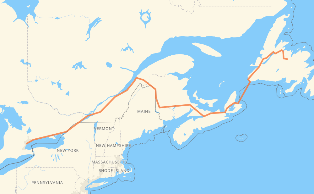
The distance from Grand Falls-Windsor to Mississauga is 2,673 kilometers by road including 1,854 kilometers on motorways. Road takes approximately 34 hours and 6 minutes and goes through Corner Brook, Moncton, Fredericton, Lévis, Drummondville, Longueuil and Montreal.
| Shortest distance by air | 1,929 km ✈️ |
| Car route length | 2,673 km 🚗 |
| Driving time | 34 h 6 min |
| Fuel amount | 213.8 L |
| Fuel cost | 406.3 CAD |
| Point | Distance | Time | Fuel | |
| Grand Falls-Windsor | 0 km | 00 min | 0.0 L | |
|
1 268 km, 2 h 56 min
|
||||
| Corner Brook | 268 km | 2 h 56 min | 20.2 L | |
|
1 TCH 860 km, 15 h 57 min
|
||||
| Moncton | 1,128 km | 18 h 53 min | 89.5 L | |
|
2 170 km, 1 h 32 min
|
||||
| Fredericton | 1,298 km | 20 h 25 min | 103.4 L | |
|
2 550 km, 5 h 17 min
|
||||
| Lévis | 1,847 km | 25 h 43 min | 146.7 L | |
|
20 160 km, 1 h 35 min
|
||||
| Drummondville | 2,007 km | 27 h 19 min | 160.1 L | |
|
20 87 km, 52 min
|
||||
| Longueuil | 2,094 km | 28 h 11 min | 167.5 L | |
|
25 16 km, 12 min
|
||||
| Montreal | 2,110 km | 28 h 24 min | 167.6 L | |
|
40 401 109 km, 1 h 09 min
|
||||
| Cornwall | 2,219 km | 29 h 33 min | 177.2 L | |
|
401 92 km, 55 min
|
||||
| Brockville | 2,311 km | 30 h 28 min | 184.3 L | |
|
401 79 km, 47 min
|
||||
| Kingston | 2,390 km | 31 h 15 min | 189.7 L | |
|
401 77 km, 45 min
|
||||
| Belleville | 2,466 km | 32 h 01 min | 196.4 L | |
|
401 126 km, 1 h 15 min
|
||||
| Oshawa | 2,592 km | 33 h 16 min | 207.0 L | |
|
401 15 km, 08 min
|
||||
| Ajax | 2,607 km | 33 h 25 min | 208.3 L | |
|
401 32 km, 19 min
|
||||
| Toronto | 2,639 km | 33 h 44 min | 209.4 L | |
|
401 34 km, 21 min
|
||||
| Mississauga | 2,673 km | 34 h 06 min | 212.8 L | |
Hotels of Mississauga
Frequently Asked Questions
How much does it cost to drive from Grand Falls-Windsor to Mississauga?
Fuel cost: 406.3 CAD
This fuel cost is calculated as: (Route length 2,673 km / 100 km) * (Fuel consumption 8 L/100 km) * (Fuel price 1.9 CAD / L)
You can adjust fuel consumption and fuel price here.
How long is a car ride from Grand Falls-Windsor to Mississauga?
Driving time: 34 h 6 min
This time is calculated for driving at the maximum permitted speed, taking into account traffic rules restrictions.
- 678 km with a maximum speed 110 km/h = 6 h 9 min
- 1,143 km with a maximum speed 100 km/h = 11 h 25 min
- 623 km with a maximum speed 90 km/h = 6 h 55 min
- 19 km with a maximum speed 80 km/h = 14 min
- 29 km with a maximum speed 70 km/h = 24 min
- 3 km with a maximum speed 65 km/h = 2 min
- 2 km with a maximum speed 50 km/h = 2 min
- 177 km with a maximum speed 20 km/h = 8 h 52 min
The calculated driving time does not take into account intermediate stops and traffic jams.
How far is Grand Falls-Windsor to Mississauga by land?
The distance between Grand Falls-Windsor and Mississauga is 2,673 km by road including 1,854 km on motorways.
Precise satellite coordinates of highways were used for this calculation. The start and finish points are the centers of Grand Falls-Windsor and Mississauga respectively.
How far is Grand Falls-Windsor to Mississauga by plane?
The shortest distance (air line, as the crow flies) between Grand Falls-Windsor and Mississauga is 1,929 km.
This distance is calculated using the Haversine formula as a great-circle distance between two points on the surface of a sphere. The start and finish points are the centers of Grand Falls-Windsor and Mississauga respectively. Actual distance between airports may be different.
How many hours is Grand Falls-Windsor from Mississauga by plane?
Boeing 737 airliner needs 2 h 24 min to cover the distance of 1,929 km at a cruising speed of 800 km/h.
Small plane "Cessna 172" needs 8 h 46 min to flight this distance at average speed of 220 km/h.
This time is approximate and do not take into account takeoff and landing times, airport location and other real world factors.
How long is a helicopter ride from Grand Falls-Windsor to Mississauga?
Fast helicopter "Eurocopter AS350" or "Hughes OH-6 Cayuse" need 8 h 2 min to cover the distance of 1,929 km at a cruising speed of 240 km/h.
Popular "Robinson R44" needs 9 h 11 min to flight this distance at average speed of 210 km/h.
This time is approximate and do not take into account takeoff and landing times, aerodrome location and other real world factors.
What city is halfway between Grand Falls-Windsor and Mississauga?
The halfway point between Grand Falls-Windsor and Mississauga is Meductic. It is located about 38 km from the exact midpoint by road.
The distance from Meductic to Grand Falls-Windsor is 1,374 km and driving will take about 21 h 7 min. The road between Meductic and Mississauga has length 1,299 km and will take approximately 12 h 59 min.
The other cities located close to halfway point:
Where is Grand Falls-Windsor in relation to Mississauga?
Grand Falls-Windsor is located 1,929 km east of Mississauga.
Grand Falls-Windsor has geographic coordinates: latitude 48.94415, longitude -55.65262.
Mississauga has geographic coordinates: latitude 43.59034, longitude -79.64573.
Which highway goes from Grand Falls-Windsor to Mississauga?
The route from Grand Falls-Windsor to Mississauga follows TCH, 2, 401, 1, 20, NS 104, NS 105.
Other minor sections pass along the road:
- 85: 62 km
- 40: 47 km
- 185: 38 km
- 55: 35 km
- 7: 11 km
- 25: 8 km
- 105: 6 km
- 403: 6 km
- 116: 5 km
- NS 4: 4 km
- NB 2: 2 km
- 15: 2 km
- 30: 2 km
- 201: 2 km
- 232: 2 km