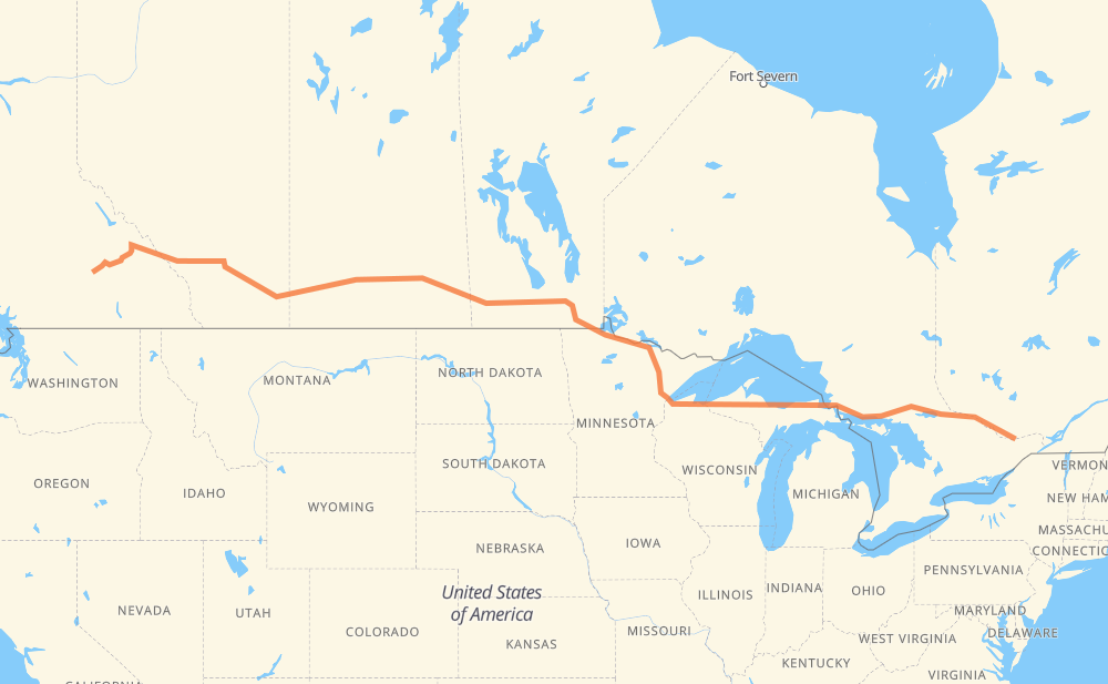
The distance from Gatineau to Salmon Arm is 3,929 kilometers by road including 432 kilometers on motorways. Road takes approximately 44 hours and 39 minutes and goes through Ottawa, Pembroke, North Bay, Sault Ste. Marie, Marquette, Duluth and International Falls.
How much does it cost to drive from Gatineau to Salmon Arm?
Fuel cost:
616.1 CAD
This fuel cost is calculated as: (Route length 3,929 km / 100 km) * (Fuel consumption 8 L/100 km) * (Fuel price 1.96 CAD / L)
You can adjust fuel consumption and fuel price here.
How long is a car ride from Gatineau to Salmon Arm?
Driving time:
44 h 39 min
This time is calculated for driving at the maximum permitted speed, taking into account traffic rules restrictions.
119 km with a maximum speed 110 km/h = 1 h 4 min
12 km with a maximum speed 105 km/h = 6 min
151 km with a maximum speed 100 km/h = 1 h 30 min
2,835 km with a maximum speed 90 km/h = 31 h 30 min
224 km with a maximum speed 89 km/h = 2 h 31 min
5 km with a maximum speed 80 km/h = 4 min
435 km with a maximum speed 80 km/h = 5 h 26 min
18 km with a maximum speed 72 km/h = 15 min
50 km with a maximum speed 70 km/h = 43 min
5 km with a maximum speed 64 km/h = 4 min
31 km with a maximum speed 60 km/h = 31 min
9 km with a maximum speed 56 km/h = 9 min
25 km with a maximum speed 50 km/h = 30 min
6 km with a maximum speed 48 km/h = 7 min
1 km with a maximum speed 40 km/h = 1 min
1 km with a maximum speed 20 km/h = 1 min
The calculated driving time does not take into account intermediate stops and traffic jams.
How far is Gatineau to Salmon Arm by land?
The distance between Gatineau and Salmon Arm is 3,929 km by road including 432 km on motorways.
Precise satellite coordinates of highways were used for this calculation. The start and finish points are the centers of Gatineau and Salmon Arm respectively.
How far is Gatineau to Salmon Arm by plane?
The shortest distance (air line, as the crow flies) between Gatineau and Salmon Arm is 3,241 km.
This distance is calculated using the Haversine formula as a great-circle distance between two points on the surface of a sphere. The start and finish points are the centers of Gatineau and Salmon Arm respectively. Actual distance between airports may be different.
How many hours is Gatineau from Salmon Arm by plane?
Boeing 737 airliner needs 4 h 3 min to cover the distance of 3,241 km at a cruising speed of 800 km/h.
Small plane "Cessna 172" needs 14 h 43 min to flight this distance at average speed of 220 km/h.
This time is approximate and do not take into account takeoff and landing times, airport location and other real world factors.
How long is a helicopter ride from Gatineau to Salmon Arm?
Fast helicopter "Eurocopter AS350" or "Hughes OH-6 Cayuse" need 13 h 30 min to cover the distance of 3,241 km at a cruising speed of 240 km/h.
Popular "Robinson R44" needs 15 h 26 min to flight this distance at average speed of 210 km/h.
This time is approximate and do not take into account takeoff and landing times, aerodrome location and other real world factors.
What city is halfway between Gatineau and Salmon Arm?
The halfway point between Gatineau and Salmon Arm is Zhoda. It is located about 32 km from the exact midpoint by road.
The distance from Zhoda to Gatineau is 1,996 km and driving will take about 23 h 4 min. The road between Zhoda and Salmon Arm has length 1,933 km and will take approximately 21 h 35 min.
The other cities located close to halfway point:
Sprague is in 1,920 km from Gatineau and 2,009 km from Salmon Arm
Steinbach is in 2,027 km from Gatineau and 1,902 km from Salmon Arm
Longworth is in 1,898 km from Gatineau and 2,031 km from Salmon Arm
Where is Gatineau in relation to Salmon Arm?
Gatineau is located 3,241 km east of Salmon Arm.
Gatineau has geographic coordinates: latitude 45.45724, longitude -75.72327.
Salmon Arm has geographic coordinates: latitude 50.70168, longitude -119.2868.
Which highway goes from Gatineau to Salmon Arm?
The route from Gatineau to Salmon Arm follows 1, 17, M 28, PTH 1, US 53, US 2, PTH 12.