Distance between Gatineau QC and Banff AB
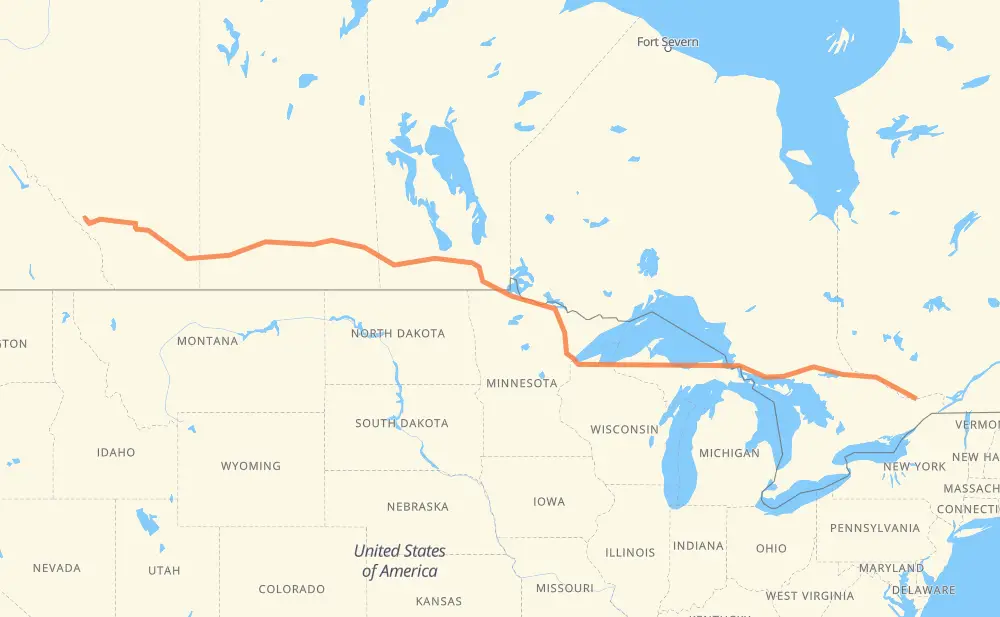
The distance from Gatineau to Banff is 3,546 kilometers by road including 352 kilometers on motorways. Road takes approximately 40 hours and 19 minutes and goes through Ottawa, Pembroke, North Bay, Sault Ste. Marie, Marquette, Duluth and International Falls.
| Shortest distance by air | 2,976 km ✈️ |
| Car route length | 3,546 km 🚗 |
| Driving time | 40 h 19 min |
| Fuel amount | 283.7 L |
| Fuel cost | 556.1 CAD |
| Point | Distance | Time | Fuel | |
| Gatineau | 0 km | 00 min | 0.0 L | |
|
36 km, 26 min
|
||||
| Ottawa | 36 km | 26 min | 0.4 L | |
|
417 17 111 km, 1 h 13 min
|
||||
| Pembroke | 147 km | 1 h 39 min | 11.5 L | |
|
17 205 km, 2 h 20 min
|
||||
| North Bay | 353 km | 4 h 00 min | 27.2 L | |
|
17 442 km, 5 h 04 min
|
||||
| Sault Ste. Marie | 795 km | 9 h 05 min | 63.1 L | |
|
17 M 28 267 km, 3 h 08 min
|
||||
| Marquette | 1,062 km | 12 h 13 min | 84.6 L | |
|
US 41 M 28 409 km, 4 h 51 min
|
||||
| Duluth | 1,471 km | 17 h 05 min | 116.9 L | |
|
US 53 262 km, 2 h 59 min
|
||||
| International Falls | 1,733 km | 20 h 05 min | 138.1 L | |
|
US 53 PTH 12 294 km, 3 h 22 min
|
||||
| Steinbach | 2,027 km | 23 h 27 min | 161.4 L | |
|
PTH 12 PTH 1 72 km, 48 min
|
||||
| Winnipeg | 2,099 km | 24 h 15 min | 166.7 L | |
|
PTH 100 PTH 1 91 km, 1 h 01 min
|
||||
| Portage la Prairie | 2,191 km | 25 h 16 min | 174.7 L | |
|
PTH 1 123 km, 1 h 22 min
|
||||
| Brandon | 2,314 km | 26 h 38 min | 184.8 L | |
|
PTH 1 1 361 km, 4 h 05 min
|
||||
| Regina | 2,675 km | 30 h 44 min | 213.5 L | |
|
6 1 104 km, 1 h 07 min
|
||||
| Moose Jaw | 2,779 km | 31 h 51 min | 219.4 L | |
|
1 139 km, 1 h 32 min
|
||||
| Swift Current | 2,918 km | 33 h 24 min | 233.0 L | |
|
1 221 km, 2 h 27 min
|
||||
| Medicine Hat | 3,139 km | 35 h 52 min | 250.6 L | |
|
1 106 km, 1 h 10 min
|
||||
| Brooks | 3,246 km | 37 h 03 min | 259.2 L | |
|
1 163 km, 1 h 49 min
|
||||
| Chestermere | 3,409 km | 38 h 52 min | 272.0 L | |
|
1 148 km, 1 h 34 min
|
||||
| Banff | 3,556 km | 40 h 26 min | 284.0 L | |
Hotels of Banff
Frequently Asked Questions
How much does it cost to drive from Gatineau to Banff?
Fuel cost: 556.1 CAD
This fuel cost is calculated as: (Route length 3,546 km / 100 km) * (Fuel consumption 8 L/100 km) * (Fuel price 1.96 CAD / L)
You can adjust fuel consumption and fuel price here.
How long is a car ride from Gatineau to Banff?
Driving time: 40 h 19 min
This time is calculated for driving at the maximum permitted speed, taking into account traffic rules restrictions.
- 119 km with a maximum speed 110 km/h = 1 h 4 min
- 12 km with a maximum speed 105 km/h = 6 min
- 143 km with a maximum speed 100 km/h = 1 h 25 min
- 2,485 km with a maximum speed 90 km/h = 27 h 36 min
- 224 km with a maximum speed 89 km/h = 2 h 31 min
- 5 km with a maximum speed 80 km/h = 4 min
- 432 km with a maximum speed 80 km/h = 5 h 24 min
- 18 km with a maximum speed 72 km/h = 15 min
- 38 km with a maximum speed 70 km/h = 32 min
- 5 km with a maximum speed 64 km/h = 4 min
- 24 km with a maximum speed 60 km/h = 23 min
- 9 km with a maximum speed 56 km/h = 9 min
- 24 km with a maximum speed 50 km/h = 29 min
- 6 km with a maximum speed 48 km/h = 7 min
- 1 km with a maximum speed 40 km/h = 1 min
- 1 km with a maximum speed 20 km/h = 1 min
The calculated driving time does not take into account intermediate stops and traffic jams.
How far is Gatineau to Banff by land?
The distance between Gatineau and Banff is 3,546 km by road including 352 km on motorways.
Precise satellite coordinates of highways were used for this calculation. The start and finish points are the centers of Gatineau and Banff respectively.
How far is Gatineau to Banff by plane?
The shortest distance (air line, as the crow flies) between Gatineau and Banff is 2,976 km.
This distance is calculated using the Haversine formula as a great-circle distance between two points on the surface of a sphere. The start and finish points are the centers of Gatineau and Banff respectively. Actual distance between airports may be different.
How many hours is Gatineau from Banff by plane?
Boeing 737 airliner needs 3 h 43 min to cover the distance of 2,976 km at a cruising speed of 800 km/h.
Small plane "Cessna 172" needs 13 h 31 min to flight this distance at average speed of 220 km/h.
This time is approximate and do not take into account takeoff and landing times, airport location and other real world factors.
How long is a helicopter ride from Gatineau to Banff?
Fast helicopter "Eurocopter AS350" or "Hughes OH-6 Cayuse" need 12 h 24 min to cover the distance of 2,976 km at a cruising speed of 240 km/h.
Popular "Robinson R44" needs 14 h 10 min to flight this distance at average speed of 210 km/h.
This time is approximate and do not take into account takeoff and landing times, aerodrome location and other real world factors.
What city is halfway between Gatineau and Banff?
The halfway point between Gatineau and Banff is Emo. It is located about 1 km from the exact midpoint by road.
The distance from Emo to Gatineau is 1,772 km and driving will take about 20 h 31 min. The road between Emo and Banff has length 1,774 km and will take approximately 19 h 48 min.
The other cities located close to halfway point:
Where is Gatineau in relation to Banff?
Gatineau is located 2,976 km east of Banff.
Gatineau has geographic coordinates: latitude 45.45724, longitude -75.72327.
Banff has geographic coordinates: latitude 51.17778, longitude -115.56825.
Which highway goes from Gatineau to Banff?
The route from Gatineau to Banff follows 1, 17, M 28, PTH 1, US 53, US 2, PTH 12.
Other minor sections pass along the road:
- 11: 96 km
- US 41: 95 km
- 417: 71 km
- MN 11: 60 km
- 71: 40 km
- PTH 100: 35 km
- 19: 26 km
- 41: 16 km
- 64: 16 km
- M 94: 15 km
- I 75: 15 km
- MN 194: 10 km
- MN 313: 9 km
- 47: 8 km
- US 53-MN 1: 7 km
- 6: 7 km
- PTH 83: 7 km
- US 141: 7 km
- M 64: 7 km
- MN 37: 6 km
- WI 13: 6 km
- PR 254: 5 km
- PR 241: 4 km
- MN 1: 4 km
- I 535: 4 km
- PR 250: 4 km
- PR 311: 3 km
- PR 427: 2 km
- PR 206: 2 km
- 611: 2 km
- PR 334: 2 km
- PTH 10: 2 km
- 8: 1 km
- MN 72: 1 km