Distance between Fleece ND and Beaverlodge AB
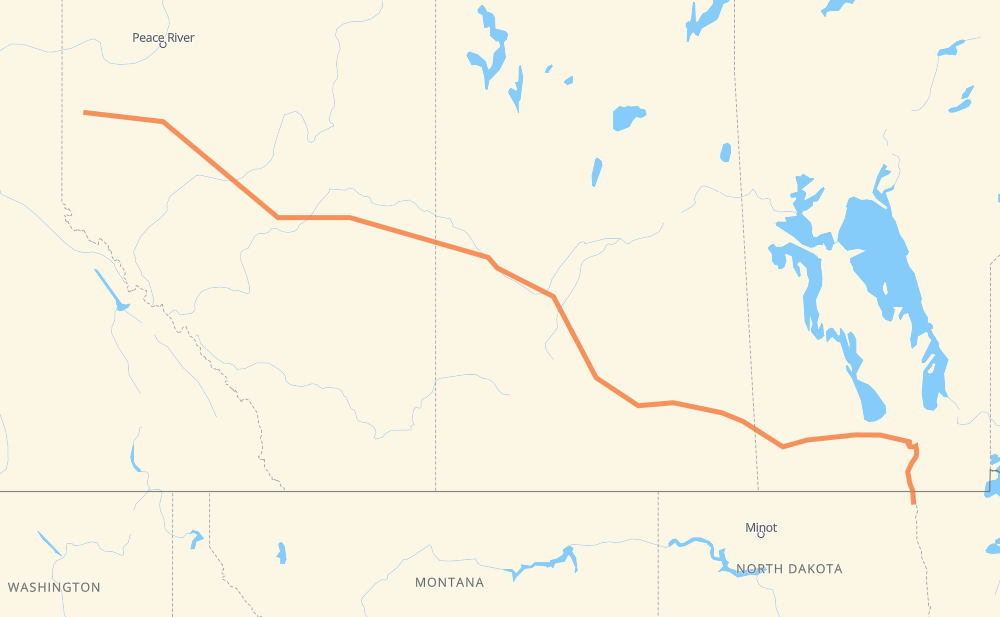
The distance from Fleece to Beaverlodge is 1,972 kilometers by road including 121 kilometers on motorways. Road takes approximately 22 hours and 13 minutes and goes through Winnipeg, Portage la Prairie, Brandon, Regina, Saskatoon, North Battleford and Lloydminster.
| Shortest distance by air | 1,673 km ✈️ |
| Car route length | 1,972 km 🚗 |
| Driving time | 22 h 13 min |
| Fuel amount | 157.7 L |
| Fuel cost | 301.3 CAD |
| Point | Distance | Time | Fuel | |
| Fleece | 0 km | 00 min | 0.0 L | |
|
I 29 PTH 75 129 km, 1 h 30 min
|
||||
| Winnipeg | 129 km | 1 h 30 min | 9.4 L | |
|
PTH 100 PTH 1 88 km, 59 min
|
||||
| Portage la Prairie | 217 km | 2 h 29 min | 16.8 L | |
|
PTH 1 123 km, 1 h 22 min
|
||||
| Brandon | 340 km | 3 h 51 min | 26.9 L | |
|
PTH 1 1 362 km, 4 h 07 min
|
||||
| Regina | 702 km | 7 h 59 min | 55.8 L | |
|
46 11 253 km, 2 h 49 min
|
||||
| Saskatoon | 955 km | 10 h 48 min | 75.7 L | |
|
11 16 162 km, 1 h 50 min
|
||||
| North Battleford | 1,117 km | 12 h 39 min | 87.1 L | |
|
16 109 km, 1 h 14 min
|
||||
| Lloydminster | 1,226 km | 13 h 53 min | 95.8 L | |
|
16 254 km, 2 h 50 min
|
||||
| Edmonton | 1,480 km | 16 h 44 min | 117.4 L | |
|
16 27 km, 17 min
|
||||
| Spruce Grove | 1,507 km | 17 h 01 min | 120.0 L | |
|
16 43 465 km, 5 h 11 min
|
||||
| Beaverlodge | 1,972 km | 22 h 12 min | 157.3 L | |
Hotels of Beaverlodge
Frequently Asked Questions
How much does it cost to drive from Fleece to Beaverlodge?
Fuel cost: 301.3 CAD
This fuel cost is calculated as: (Route length 1,972 km / 100 km) * (Fuel consumption 8 L/100 km) * (Fuel price 1.91 CAD / L)
You can adjust fuel consumption and fuel price here.
How long is a car ride from Fleece to Beaverlodge?
Driving time: 22 h 13 min
This time is calculated for driving at the maximum permitted speed, taking into account traffic rules restrictions.
- 36 km with a maximum speed 110 km/h = 19 min
- 27 km with a maximum speed 100 km/h = 16 min
- 1,709 km with a maximum speed 90 km/h = 18 h 59 min
- 164 km with a maximum speed 80 km/h = 2 h 2 min
- 21 km with a maximum speed 70 km/h = 17 min
- 5 km with a maximum speed 60 km/h = 5 min
- 10 km with a maximum speed 50 km/h = 11 min
The calculated driving time does not take into account intermediate stops and traffic jams.
How far is Fleece to Beaverlodge by land?
The distance between Fleece and Beaverlodge is 1,972 km by road including 121 km on motorways.
Precise satellite coordinates of highways were used for this calculation. The start and finish points are the centers of Fleece and Beaverlodge respectively.
How far is Fleece to Beaverlodge by plane?
The shortest distance (air line, as the crow flies) between Fleece and Beaverlodge is 1,673 km.
This distance is calculated using the Haversine formula as a great-circle distance between two points on the surface of a sphere. The start and finish points are the centers of Fleece and Beaverlodge respectively. Actual distance between airports may be different.
How many hours is Fleece from Beaverlodge by plane?
Boeing 737 airliner needs 2 h 5 min to cover the distance of 1,673 km at a cruising speed of 800 km/h.
Small plane "Cessna 172" needs 7 h 36 min to flight this distance at average speed of 220 km/h.
This time is approximate and do not take into account takeoff and landing times, airport location and other real world factors.
How long is a helicopter ride from Fleece to Beaverlodge?
Fast helicopter "Eurocopter AS350" or "Hughes OH-6 Cayuse" need 6 h 58 min to cover the distance of 1,673 km at a cruising speed of 240 km/h.
Popular "Robinson R44" needs 7 h 58 min to flight this distance at average speed of 210 km/h.
This time is approximate and do not take into account takeoff and landing times, aerodrome location and other real world factors.
What city is halfway between Fleece and Beaverlodge?
The halfway point between Fleece and Beaverlodge is Langham. It is located about 10 km from the exact midpoint by road.
The distance from Langham to Fleece is 996 km and driving will take about 11 h 16 min. The road between Langham and Beaverlodge has length 976 km and will take approximately 10 h 56 min.
The other cities located close to halfway point:
Where is Fleece in relation to Beaverlodge?
Fleece is located 1,673 km south-east of Beaverlodge.
Fleece has geographic coordinates: latitude 48.76026, longitude -97.20674.
Beaverlodge has geographic coordinates: latitude 55.21062, longitude -119.42867.
Which highway goes from Fleece to Beaverlodge?
The route from Fleece to Beaverlodge follows 16, 43, PTH 1, 11, 1.
Other minor sections pass along the road:
- PTH 75: 94 km
- I 29: 27 km
- 46: 22 km
- PTH 100: 19 km
- 2: 18 km
- US 81: 17 km
- 11A: 9 km
- 47: 8 km
- 32: 8 km
- PTH 83: 7 km
- PR 254: 5 km
- 674: 5 km
- 40: 5 km
- PR 241: 4 km
- PR 250: 4 km
- 6: 3 km
- 21: 3 km
- Route 42: 3 km
- 757: 2 km
- PR 427: 2 km
- PR 334: 2 km
- 12: 2 km
- PTH 10: 2 km
- 8: 1 km
- 675: 1 km
- 4: 1 km