Distance between Dores do Indaiá and Itinga
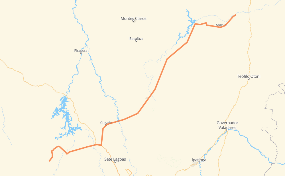
The distance from Dores do Indaiá to Itinga is 678 kilometers by road including 4 kilometers on motorways. Road takes approximately 8 hours and 17 minutes and goes through Martinho Campos, Pompéu, Curvelo, Vila Alexandre Mascarenhas, Gouveia, Diamantina and Berilo.
| Shortest distance by air | 515 km ✈️ |
| Car route length | 678 km 🚗 |
| Driving time | 8 h 17 min |
| Fuel amount | 54.3 L |
| Fuel cost | 106.4 CAD |
| Point | Distance | Time | Fuel | |
| Dores do Indaiá | 0 km | 00 min | 0.0 L | |
|
MG-176 73 km, 51 min
|
||||
| Martinho Campos | 73 km | 51 min | 5.1 L | |
|
MG-164 34 km, 25 min
|
||||
| Pompéu | 107 km | 1 h 16 min | 6.6 L | |
|
MG-420 BR-135 94 km, 1 h 07 min
|
||||
| Curvelo | 201 km | 2 h 24 min | 15.8 L | |
|
AMG-0910 BR-259 45 km, 31 min
|
||||
| Vila Alexandre Mascarenhas | 246 km | 2 h 55 min | 19.7 L | |
|
BR-259 28 km, 21 min
|
||||
| Gouveia | 274 km | 3 h 17 min | 19.7 L | |
|
BR-259 MGC-367 55 km, 44 min
|
||||
| Diamantina | 330 km | 4 h 02 min | 26.0 L | |
|
BR-367 241 km, 2 h 57 min
|
||||
| Berilo | 571 km | 6 h 59 min | 44.4 L | |
|
LMG-677 23 km, 17 min
|
||||
| Virgem da Lapa | 594 km | 7 h 17 min | 46.9 L | |
|
MG-114 BR-367 84 km, 59 min
|
||||
| Itinga | 678 km | 8 h 16 min | 53.7 L | |
Frequently Asked Questions
How much does it cost to drive from Dores do Indaiá to Itinga?
Fuel cost: 106.4 CAD
This fuel cost is calculated as: (Route length 678 km / 100 km) * (Fuel consumption 8 L/100 km) * (Fuel price 1.96 CAD / L)
You can adjust fuel consumption and fuel price here.
How long is a car ride from Dores do Indaiá to Itinga?
Driving time: 8 h 17 min
This time is calculated for driving at the maximum permitted speed, taking into account traffic rules restrictions.
- 231 km with a maximum speed 90 km/h = 2 h 33 min
- 429 km with a maximum speed 80 km/h = 5 h 21 min
- 9 km with a maximum speed 60 km/h = 9 min
- 3 km with a maximum speed 50 km/h = 3 min
- 5 km with a maximum speed 40 km/h = 8 min
The calculated driving time does not take into account intermediate stops and traffic jams.
How far is Dores do Indaiá to Itinga by land?
The distance between Dores do Indaiá and Itinga is 678 km by road including 4 km on motorways.
Precise satellite coordinates of highways were used for this calculation. The start and finish points are the centers of Dores do Indaiá and Itinga respectively.
How far is Dores do Indaiá to Itinga by plane?
The shortest distance (air line, as the crow flies) between Dores do Indaiá and Itinga is 515 km.
This distance is calculated using the Haversine formula as a great-circle distance between two points on the surface of a sphere. The start and finish points are the centers of Dores do Indaiá and Itinga respectively. Actual distance between airports may be different.
How many hours is Dores do Indaiá from Itinga by plane?
Boeing 737 airliner needs 38 min to cover the distance of 515 km at a cruising speed of 800 km/h.
Small plane "Cessna 172" needs 2 h 20 min to flight this distance at average speed of 220 km/h.
This time is approximate and do not take into account takeoff and landing times, airport location and other real world factors.
How long is a helicopter ride from Dores do Indaiá to Itinga?
Fast helicopter "Eurocopter AS350" or "Hughes OH-6 Cayuse" need 2 h 8 min to cover the distance of 515 km at a cruising speed of 240 km/h.
Popular "Robinson R44" needs 2 h 27 min to flight this distance at average speed of 210 km/h.
This time is approximate and do not take into account takeoff and landing times, aerodrome location and other real world factors.
What city is halfway between Dores do Indaiá and Itinga?
The halfway point between Dores do Indaiá and Itinga is Diamantina. It is located about 10 km from the exact midpoint by road.
The distance from Diamantina to Dores do Indaiá is 330 km and driving will take about 4 h 2 min. The road between Diamantina and Itinga has length 349 km and will take approximately 4 h 15 min.
The other cities located close to halfway point:
Where is Dores do Indaiá in relation to Itinga?
Dores do Indaiá is located 515 km south-west of Itinga.
Dores do Indaiá has geographic coordinates: latitude -19.46366, longitude -45.60166.
Itinga has geographic coordinates: latitude -16.60668, longitude -41.77021.
Which highway goes from Dores do Indaiá to Itinga?
The route from Dores do Indaiá to Itinga follows BR-367, MGC-367.
Other minor sections pass along the road:
- BR-259: 98 km
- LMG-677: 95 km
- BR-135: 43 km
- MG-420: 43 km
- MG-176: 43 km
- MG-164: 29 km
- BR-352: 25 km
- BR-451: 25 km
- MGC-451: 25 km
- MG-308: 14 km
- BR-040: 10 km
- MG-114: 8 km
- AMG-0910: 8 km
- MG-060: 5 km