Distance between Danjiang and Phukpa
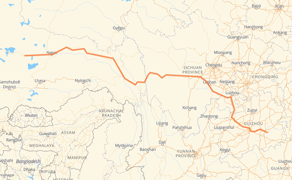
The distance from Danjiang to Phukpa is 2,832 kilometers by road including 978 kilometers on motorways. Road takes approximately 33 hours and 2 minutes and goes through Longshan, Yunyan Qu, Qianxi, Xuyong, Jiang’an, Qianwei and Hongya.
| Shortest distance by air | 1,843 km ✈️ |
| Car route length | 2,832 km 🚗 |
| Driving time | 33 h 2 min |
| Fuel amount | 226.5 L |
| Fuel cost | 444 CAD |
| Point | Distance | Time | Fuel | |
| Danjiang | 0 km | 00 min | 0.0 L | |
|
S63 G60 168 km, 1 h 55 min
|
||||
| Longshan | 168 km | 1 h 55 min | 12.7 L | |
|
G60 G75 G76 G6001 44 km, 29 min
|
||||
| Yunyan Qu | 212 km | 2 h 24 min | 16.5 L | |
|
G75 G76 G6001 G76 92 km, 1 h 02 min
|
||||
| Qianxi | 305 km | 3 h 27 min | 24.1 L | |
|
S82 G76 207 km, 2 h 13 min
|
||||
| Xuyong | 511 km | 5 h 40 min | 40.6 L | |
|
G76 105 km, 1 h 12 min
|
||||
| Jiang’an | 616 km | 6 h 52 min | 49.0 L | |
|
G93 130 km, 1 h 27 min
|
||||
| Qianwei | 746 km | 8 h 19 min | 59.3 L | |
|
G93 107 km, 1 h 12 min
|
||||
| Hongya | 853 km | 9 h 31 min | 68.0 L | |
|
G93 G4218 144 km, 1 h 40 min
|
||||
| Luqiao | 997 km | 11 h 12 min | 79.7 L | |
|
G318 472 km, 5 h 35 min
|
||||
| Batang county | 1,469 km | 16 h 48 min | 117.1 L | |
|
G318 109 km, 1 h 18 min
|
||||
| Mangkang | 1,578 km | 18 h 06 min | 125.9 L | |
|
G318 138 km, 1 h 40 min
|
||||
| 左贡县 | 1,716 km | 19 h 47 min | 137.2 L | |
|
G318 264 km, 3 h 10 min
|
||||
| Samdo | 1,980 km | 22 h 57 min | 158.3 L | |
|
G214 G317 146 km, 1 h 43 min
|
||||
| Dêngqên | 2,126 km | 24 h 41 min | 169.6 L | |
|
G317 215 km, 2 h 31 min
|
||||
| Lhashé | 2,342 km | 27 h 12 min | 186.8 L | |
|
G317 30 km, 20 min
|
||||
| Yakla | 2,371 km | 27 h 33 min | 189.1 L | |
|
G317 221 km, 2 h 36 min
|
||||
| Nagqu | 2,592 km | 30 h 09 min | 206.2 L | |
|
G317 239 km, 2 h 52 min
|
||||
| Phukpa | 2,832 km | 33 h 02 min | 224.8 L | |
Frequently Asked Questions
How much does it cost to drive from Danjiang to Phukpa?
Fuel cost: 444 CAD
This fuel cost is calculated as: (Route length 2,832 km / 100 km) * (Fuel consumption 8 L/100 km) * (Fuel price 1.96 CAD / L)
You can adjust fuel consumption and fuel price here.
How long is a car ride from Danjiang to Phukpa?
Driving time: 33 h 2 min
This time is calculated for driving at the maximum permitted speed, taking into account traffic rules restrictions.
- 504 km with a maximum speed 100 km/h = 5 h 2 min
- 803 km with a maximum speed 90 km/h = 8 h 55 min
- 1,521 km with a maximum speed 80 km/h = 19 h
- 3 km with a maximum speed 50 km/h = 3 min
The calculated driving time does not take into account intermediate stops and traffic jams.
How far is Danjiang to Phukpa by land?
The distance between Danjiang and Phukpa is 2,832 km by road including 978 km on motorways.
Precise satellite coordinates of highways were used for this calculation. The start and finish points are the centers of Danjiang and Phukpa respectively.
How far is Danjiang to Phukpa by plane?
The shortest distance (air line, as the crow flies) between Danjiang and Phukpa is 1,843 km.
This distance is calculated using the Haversine formula as a great-circle distance between two points on the surface of a sphere. The start and finish points are the centers of Danjiang and Phukpa respectively. Actual distance between airports may be different.
How many hours is Danjiang from Phukpa by plane?
Boeing 737 airliner needs 2 h 18 min to cover the distance of 1,843 km at a cruising speed of 800 km/h.
Small plane "Cessna 172" needs 8 h 22 min to flight this distance at average speed of 220 km/h.
This time is approximate and do not take into account takeoff and landing times, airport location and other real world factors.
How long is a helicopter ride from Danjiang to Phukpa?
Fast helicopter "Eurocopter AS350" or "Hughes OH-6 Cayuse" need 7 h 40 min to cover the distance of 1,843 km at a cruising speed of 240 km/h.
Popular "Robinson R44" needs 8 h 46 min to flight this distance at average speed of 210 km/h.
This time is approximate and do not take into account takeoff and landing times, aerodrome location and other real world factors.
What city is halfway between Danjiang and Phukpa?
The halfway point between Danjiang and Phukpa is Lieyi. It is located about 5 km from the exact midpoint by road.
The distance from Lieyi to Danjiang is 1,421 km and driving will take about 16 h 12 min. The road between Lieyi and Phukpa has length 1,410 km and will take approximately 16 h 50 min.
The other cities located close to halfway point:
Where is Danjiang in relation to Phukpa?
Danjiang is located 1,843 km south-east of Phukpa.
Danjiang has geographic coordinates: latitude 26.3869, longitude 108.072.
Phukpa has geographic coordinates: latitude 31.39963, longitude 90.00735.
Which highway goes from Danjiang to Phukpa?
The route from Danjiang to Phukpa follows G317, G318, G93, G76, G60, G75.
Other minor sections pass along the road:
- S82: 94 km
- G214: 89 km
- S303: 82 km
- G4218: 78 km
- G109: 37 km
- S80: 24 km
- S63: 22 km
- G75 G76 G6001: 21 km
- S82, G76: 20 km
- G5: 16 km
- G6001: 9 km
- 256: 8 km
- 317: 6 km
- X138: 2 km
- S308: 1 km